Malo jezero - resort webcam image
Camera image unavailable
Camera image · refreshes every 60 seconds while visible.
Open camera page ↗
Κάθε χρώμα ξεκινά από την τιμή που αναγράφεται. Τα χρώματα ανέμου αντιστοιχούν και στις τρεις μονάδες. Οι τιμές χωρίς υετό παραμένουν ουδέτερες. Τα χρώματα περιγράφουν τις τιμές και δεν αποτελούν επίσημες προειδοποιήσεις.
Προετοιμασία γραφημάτων…
Οι ώρες και οι τιμές αντιστοιχούν στην αναλυτική πρόγνωση. Πατήστε μια τιμή για λεπτομέρειες και μετακινήστε οριζόντια τα γραφήματα για επόμενες ημέρες. Ο υετός είναι το συνολικό ισοδύναμο νερού ανά διάστημα, μαζί με το χιόνι. Η χιονόπτωση αφορά νέο χιόνι ανά διάστημα, όχι το ύψος του χιονιού στο έδαφος.
Σύγκριση GFS και ECMWF. Κάθε μοντέλο διατηρεί τις δικές του ώρες και διάρκεια πρόγνωσης. Ο υετός και το νέο χιόνι αφορούν τα διαστήματα κάθε μοντέλου, τα οποία μπορεί να διαφέρουν.
ECMWF · Εκτέλεση μοντέλου: Αναμενόμενη επόμενη ενημέρωση:
Ημέρα Ώρα (UTC) Θερμ. (°C) Υγρασία (%) Άνεμος (km/h) Άνεμος (κόμβοι) Άνεμος (Bft) Διεύθυνση Υετός (mm) Νέο χιόνι (cm) Πίεση (hPa) Σημείο παγοποίησης (m) Συνθήκες | Τετάρτη, 04/11 06:00 2.6 100 9 5 2B N — — 1024 1497 Overcast 100% cloud  09:00 3.3 98 12 6 2B N 0.55 0 1025 1560 Overcast 100% cloud 12:00 3.9 93 9 5 2B N 0.31 0 1026 1626 Overcast 100% cloud 15:00 3.4 96 9 5 2B N 0.14 0 1026 1663 Overcast 100% cloud 18:00 3.2 97 8 4 2B N 0.05 0 1028 1714 Overcast 100% cloud 21:00 3 97 8 4 2B N 0.07 0 1029 1682 Overcast 99% cloud Πέμπτη, 05/11 00:00 2.8 97 6 3 2B N 0.01 0 1030 1673 Overcast 99% cloud 03:00 2.8 96 6 3 2B N 0.01 0 1030 1688 Overcast 99% cloud 06:00 2.8 96 6 3 1B N 0.02 0 1030 1644 Overcast 100% cloud 09:00 3.7 91 5 3 1B N 0.06 0 1031 1679 Overcast 100% cloud 12:00 4.7 86 4 2 1B N 0 0 1029 1823 Overcast 100% cloud 15:00 4.1 90 4 2 1B N 0.11 0 1029 1812 Overcast 100% cloud 18:00 3.1 96 3 2 1B NE 0 0 1030 1749 Overcast 100% cloud 21:00 3 95 1 1 1B NE 0 0 1029 1655 Overcast 96% cloud Παρασκευή, 06/11 00:00 2.5 92 1 1 1B W 0 0 1028 1921 Cloudy 73% cloud  03:00 1.9 92 2 1 1B N 0 0 1027 1935 Overcast 88% cloud 06:00 1.8 89 2 1 1B N 0 0 1027 1923 Cloudy 73% cloud 09:00 5.1 69 3 2 1B N 0 0 1026 1960 Partly cloudy 34% cloud  12:00 7.1 65 5 3 1B N 0 0 1023 2369 Clear 12% cloud  15:00 4.8 77 5 3 1B NW 0 0 1023 2432 Clear 7% cloud 18:00 2 77 8 4 2B N 0 0 1024 2413 Clear 12% cloud 21:00 0.8 73 8 5 2B N 0 0 1026 2277 Overcast 81% cloud Σάββατο, 07/11 00:00 0.4 72 7 4 2B N 0 0 1026 962 Cloudy 56% cloud 03:00 -0 68 5 3 1B N 0 0 1026 1099 Partly cloudy 31% cloud 06:00 0.1 63 3 2 1B N 0 0 1027 1056 Clear 4% cloud 09:00 4.1 51 3 2 1B NE 0 0 1027 1908 Clear 1% cloud 12:00 6.2 51 2 1 1B NE 0 0 1025 2085 Clear 1% cloud 15:00 3.6 67 1 0 0B E 0 0 1026 2145 Clear 0% cloud 18:00 1 70 2 1 1B SE 0 0 1027 2165 Clear 2% cloud 21:00 0.4 64 4 2 1B SE 0 0 1028 980 Clear 1% cloud Κυριακή, 08/11 00:00 0.3 64 6 3 2B SE 0 0 1028 1010 Clear 0% cloud 03:00 0.5 63 7 4 2B S 0 0 1028 978 Clear 0% cloud 06:00 1.3 61 7 4 2B S 0 0 1029 2313 Clear 0% cloud 09:00 6.6 49 7 4 2B S 0 0 1028 2406 Clear 0% cloud 12:00 8.9 45 5 3 1B S 0 0 1026 2438 Clear 0% cloud 15:00 6 62 4 2 1B S 0 0 1026 2434 Clear 0% cloud 18:00 3.6 69 3 2 1B S 0 0 1027 2475 Clear 8% cloud 21:00 3 74 5 3 1B SW 0 0 1027 2477 Cloudy 77% cloud Δευτέρα, 09/11 00:00 3.5 76 5 3 1B SW 0 0 1027 2478 Overcast 99% cloud 03:00 4.1 81 6 3 2B SW 0.05 0 1026 2457 Overcast 81% cloud 06:00 3.9 87 5 3 1B SW 0.13 0 1026 2446 Cloudy 54% cloud 09:00 8.8 67 6 3 2B SW 0.01 0 1026 2474 Overcast 97% cloud 12:00 10.2 64 6 3 1B SW 0 0 1024 2483 Overcast 98% cloud 15:00 7.5 81 5 3 1B SW 0 0 1024 2561 Overcast 87% cloud 18:00 5.3 88 7 4 2B SW 0 0 1024 2601 Cloudy 61% cloud 21:00 4.6 89 8 4 2B SW 0 0 1024 2569 Cloudy 56% cloud Τρίτη, 10/11 00:00 4.2 89 8 5 2B SW 0 0 1024 2582 Overcast 92% cloud 03:00 4.6 86 8 4 2B SW 0 0 1023 2638 Overcast 99% cloud 06:00 4.7 86 9 5 2B SW 0 0 1023 2730 Overcast 94% cloud |
|---|
Forecast table times: UTC.
Coordinates: 43.2928282°N, 20.8759848°E · Requested elevation: 1078 m. Model terrain: 899 m. Terrain and 1000/925/850/700 hPa profiles are used for height estimates.
These are altitude estimates, not a simulation of local mountain terrain. Precipitation, cloud and sea-level pressure use horizontal interpolation only.
Precipitation includes rain and snow water equivalent: preceding 3 hours through day 6, then 6 hours (see cell tooltip). Snow (cm) estimates fresh snowfall from precipitation and temperature using the GFS conversion; it is not snow depth on the ground. Freezing (m) uses additional 600/500 hPa temperatures when available and estimates the lowest resolved 0°C crossing above sea level. When all sampled levels are warm, the upper profile limit is shown (see tooltip). < marks an entirely cold sampled profile and its lower height limit. No extrapolation is used.
Summer dry ski slope · This snow resort also has an outdoor synthetic slope for seasonal use. Check the operator for opening dates.
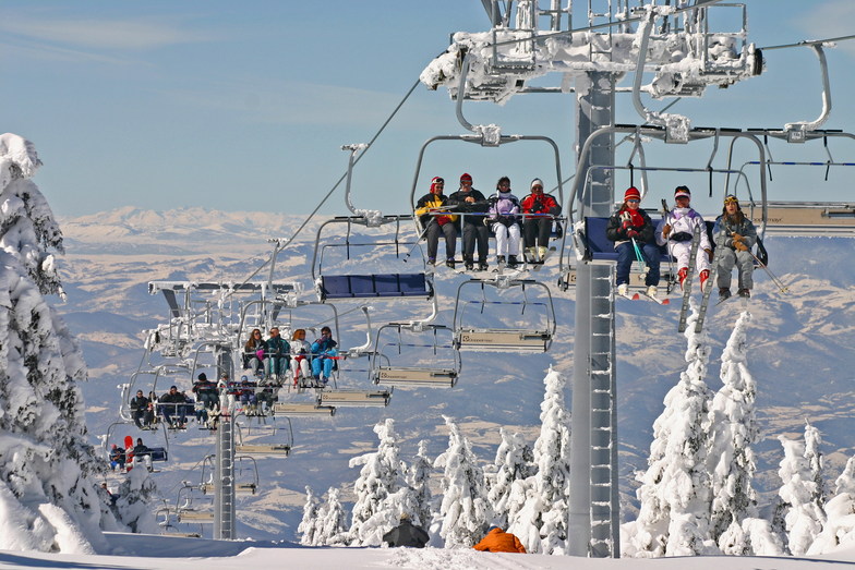
Kopaonik is a downhill ski area in Mitrovica, Serbia. Mapped terrain includes beginner, easy, intermediate, advanced routes. Its mapped lift network extends from approximately 1078 to 1975 metres above sea level. Cross-country skiing is also mapped within the area.
Data: OpenSkiData / OpenSkiMap, OpenStreetMap contributors (ODbL), Skimap.org, Who's On First, Mapterhorn.
Camera image · refreshes every 60 seconds while visible.
Open camera page ↗Camera image · refreshes every 60 seconds while visible.
Open camera page ↗Προετοιμασία γραφημάτων…
Οι ώρες και οι τιμές αντιστοιχούν στην αναλυτική πρόγνωση. Πατήστε μια τιμή για λεπτομέρειες και μετακινήστε οριζόντια τα γραφήματα για επόμενες ημέρες. Ο υετός είναι το συνολικό ισοδύναμο νερού ανά διάστημα, μαζί με το χιόνι. Η χιονόπτωση αφορά νέο χιόνι ανά διάστημα, όχι το ύψος του χιονιού στο έδαφος.
Σύγκριση GFS και ECMWF. Κάθε μοντέλο διατηρεί τις δικές του ώρες και διάρκεια πρόγνωσης. Ο υετός και το νέο χιόνι αφορούν τα διαστήματα κάθε μοντέλου, τα οποία μπορεί να διαφέρουν.
ECMWF · Εκτέλεση μοντέλου: Αναμενόμενη επόμενη ενημέρωση:
Ημέρα Ώρα (UTC) Θερμ. (°C) Υγρασία (%) Άνεμος (km/h) Άνεμος (κόμβοι) Άνεμος (Bft) Διεύθυνση Υετός (mm) Νέο χιόνι (cm) Πίεση (hPa) Σημείο παγοποίησης (m) Συνθήκες | Τετάρτη, 04/11 06:00 -0 100 20 11 4B N — — 1024 1497 Overcast 100% cloud 09:00 0.2 99 19 10 3B N 0.51 0.2 1025 1552 Overcast 100% cloud 12:00 0.5 99 14 7 3B N 0.25 0.1 1026 1619 Overcast 100% cloud 15:00 0.7 99 15 8 3B N 0.13 0 1026 1664 Overcast 100% cloud 18:00 0.9 100 14 8 3B N 0.04 0 1028 1706 Overcast 100% cloud 21:00 0.7 100 14 8 3B N 0.06 0 1029 1673 Overcast 99% cloud Πέμπτη, 05/11 00:00 0.7 98 11 6 2B N 0.01 0 1030 1672 Overcast 98% cloud 03:00 0.8 98 12 6 2B N 0.01 0 1030 1683 Overcast 98% cloud 06:00 0.6 99 10 5 2B N 0.02 0 1030 1645 Overcast 100% cloud 09:00 0.9 98 9 5 2B NE 0.05 0 1031 1680 Overcast 100% cloud 12:00 1.3 97 4 2 1B NE 0 0 1029 1828 Overcast 100% cloud 15:00 1.1 98 5 3 1B N 0.12 0 1029 1827 Overcast 100% cloud 18:00 0.8 98 5 3 1B NE 0 0 1029 1765 Overcast 100% cloud 21:00 0.5 98 4 2 1B E 0 0 1029 1671 Overcast 98% cloud Παρασκευή, 06/11 00:00 1 86 1 0 0B NW 0 0 1028 1923 Overcast 81% cloud 03:00 1 79 5 3 1B N 0 0 1027 1959 Overcast 92% cloud 06:00 0.8 71 6 3 2B N 0 0 1027 1920 Overcast 80% cloud 09:00 1.2 69 6 3 1B N 0 0 1026 1966 Partly cloudy 39% cloud 12:00 2.8 77 7 4 2B N 0 0 1023 2368 Clear 12% cloud 15:00 3 67 11 6 2B NW 0 0 1023 2431 Clear 6% cloud 18:00 2.6 45 19 10 3B N 0 0 1024 2427 Clear 10% cloud 21:00 2.5 36 24 13 4B N 0 0 1025 2285 Overcast 81% cloud Σάββατο, 07/11 00:00 1.7 44 20 11 3B N 0 0 1026 968 Cloudy 55% cloud 03:00 0.7 54 15 8 3B N 0 0 1026 1142 Partly cloudy 34% cloud 06:00 1 38 11 6 2B N 0 0 1027 1107 Clear 5% cloud 09:00 1.1 33 6 3 2B NE 0 0 1027 1908 Clear 2% cloud 12:00 2.2 53 2 1 1B NE 0 0 1025 2091 Clear 1% cloud 15:00 2.5 55 2 1 1B S 0 0 1025 2152 Clear 0% cloud 18:00 2.3 53 4 2 1B SE 0 0 1027 2168 Clear 1% cloud 21:00 2.3 44 11 6 2B SE 0 0 1028 1037 Clear 1% cloud Κυριακή, 08/11 00:00 2.3 41 16 8 3B SE 0 0 1028 1065 Clear 0% cloud 03:00 2.6 35 19 10 3B S 0 0 1028 1024 Clear 0% cloud 06:00 3.4 29 16 9 3B S 0 0 1029 2317 Clear 0% cloud 09:00 4.8 35 12 7 3B SW 0 0 1028 2407 Clear 0% cloud 12:00 5.2 46 9 5 2B SW 0 0 1026 2437 Clear 0% cloud 15:00 5.2 54 8 4 2B SW 0 0 1026 2435 Clear 0% cloud 18:00 5.3 59 7 4 2B SW 0 0 1027 2476 Clear 7% cloud 21:00 5.5 60 9 5 2B SW 0 0 1027 2475 Cloudy 77% cloud Δευτέρα, 09/11 00:00 5.9 59 10 5 2B SW 0 0 1027 2476 Overcast 99% cloud 03:00 5.8 72 11 6 2B SW 0.07 0 1026 2452 Overcast 81% cloud 06:00 5.6 76 10 5 2B W 0.11 0 1027 2445 Partly cloudy 46% cloud 09:00 6.4 72 13 7 3B SW 0.01 0 1026 2473 Overcast 97% cloud 12:00 6.5 77 13 7 3B SW 0 0 1024 2482 Overcast 97% cloud 15:00 6.5 77 13 7 3B W 0 0 1024 2564 Overcast 87% cloud 18:00 6.3 77 15 8 3B SW 0 0 1025 2600 Cloudy 57% cloud 21:00 5.8 77 18 9 3B SW 0 0 1025 2565 Cloudy 54% cloud Τρίτη, 10/11 00:00 5.7 72 20 11 3B W 0 0 1024 2578 Overcast 94% cloud 03:00 5.7 65 19 10 3B W 0 0 1023 2633 Overcast 99% cloud 06:00 6.1 63 20 11 4B W 0 0 1023 2727 Overcast 95% cloud |
|---|
Forecast table times: UTC.
Coordinates: 43.2826331°N, 20.8406593°E · Requested elevation: 1502 m. Model terrain: 905 m. Terrain and 1000/925/850/700 hPa profiles are used for height estimates.
These are altitude estimates, not a simulation of local mountain terrain. Precipitation, cloud and sea-level pressure use horizontal interpolation only.
Precipitation includes rain and snow water equivalent: preceding 3 hours through day 6, then 6 hours (see cell tooltip). Snow (cm) estimates fresh snowfall from precipitation and temperature using the GFS conversion; it is not snow depth on the ground. Freezing (m) uses additional 600/500 hPa temperatures when available and estimates the lowest resolved 0°C crossing above sea level. When all sampled levels are warm, the upper profile limit is shown (see tooltip). < marks an entirely cold sampled profile and its lower height limit. No extrapolation is used.
Προετοιμασία γραφημάτων…
Οι ώρες και οι τιμές αντιστοιχούν στην αναλυτική πρόγνωση. Πατήστε μια τιμή για λεπτομέρειες και μετακινήστε οριζόντια τα γραφήματα για επόμενες ημέρες. Ο υετός είναι το συνολικό ισοδύναμο νερού ανά διάστημα, μαζί με το χιόνι. Η χιονόπτωση αφορά νέο χιόνι ανά διάστημα, όχι το ύψος του χιονιού στο έδαφος.
Σύγκριση GFS και ECMWF. Κάθε μοντέλο διατηρεί τις δικές του ώρες και διάρκεια πρόγνωσης. Ο υετός και το νέο χιόνι αφορούν τα διαστήματα κάθε μοντέλου, τα οποία μπορεί να διαφέρουν.
ECMWF · Εκτέλεση μοντέλου: Αναμενόμενη επόμενη ενημέρωση:
Ημέρα Ώρα (UTC) Θερμ. (°C) Υγρασία (%) Άνεμος (km/h) Άνεμος (κόμβοι) Άνεμος (Bft) Διεύθυνση Υετός (mm) Νέο χιόνι (cm) Πίεση (hPa) Σημείο παγοποίησης (m) Συνθήκες | Τετάρτη, 04/11 06:00 -1.6 100 15 8 3B N — — 1024 1497 Overcast 100% cloud 09:00 -1.3 98 14 7 3B N 0.48 0.1 1025 1549 Overcast 100% cloud 12:00 -1.2 98 11 6 2B N 0.21 0 1026 1617 Overcast 100% cloud 15:00 -1.1 98 13 7 3B NE 0.11 0 1026 1664 Overcast 100% cloud 18:00 -1.1 100 15 8 3B NE 0.03 0 1028 1703 Overcast 100% cloud 21:00 -1.1 98 15 8 3B NE 0.05 0 1029 1669 Overcast 99% cloud Πέμπτη, 05/11 00:00 -1.1 96 13 7 3B NE 0.01 0 1029 1671 Overcast 98% cloud 03:00 -1.2 98 12 6 2B NE 0.01 0 1030 1683 Overcast 98% cloud 06:00 -1.3 96 11 6 2B NE 0.01 0 1030 1645 Overcast 100% cloud 09:00 -1.1 92 10 5 2B NE 0.04 0 1031 1680 Overcast 100% cloud 12:00 -0.4 83 7 4 2B NE 0 0 1029 1832 Overcast 100% cloud 15:00 -0.4 79 8 4 2B N 0.12 0 1029 1835 Overcast 100% cloud 18:00 -0.4 77 8 4 2B NE 0 0 1029 1775 Overcast 100% cloud 21:00 -0.5 76 6 3 2B NE 0 0 1029 1677 Overcast 99% cloud Παρασκευή, 06/11 00:00 -0.1 68 6 3 1B N 0 0 1028 1922 Overcast 85% cloud 03:00 -0 64 9 5 2B N 0 0 1027 1971 Overcast 93% cloud 06:00 -0.1 59 10 5 2B N 0 0 1028 1916 Overcast 84% cloud 09:00 -0 58 9 5 2B N 0 0 1026 1967 Partly cloudy 41% cloud 12:00 1.2 67 12 6 2B N 0 0 1023 2369 Clear 11% cloud 15:00 1.4 56 15 8 3B N 0 0 1023 2429 Clear 6% cloud 18:00 1.4 36 22 12 4B N 0 0 1024 2436 Clear 8% cloud 21:00 1.1 31 26 14 4B N 0 0 1025 2291 Overcast 80% cloud Σάββατο, 07/11 00:00 0.7 34 21 12 4B N 0 0 1026 966 Cloudy 54% cloud 03:00 0.1 38 18 10 3B N 0 0 1026 1157 Partly cloudy 35% cloud 06:00 0.2 28 16 9 3B NE 0 0 1027 1133 Clear 5% cloud 09:00 -0.2 26 11 6 2B NE 0 0 1027 1901 Clear 2% cloud 12:00 0.4 45 6 3 2B NE 0 0 1025 2093 Clear 1% cloud 15:00 0.7 46 3 2 1B NE 0 0 1025 2155 Clear 0% cloud 18:00 0.7 44 2 1 1B NE 0 0 1027 2169 Clear 1% cloud 21:00 0.8 36 5 3 1B SE 0 0 1028 1061 Clear 1% cloud Κυριακή, 08/11 00:00 0.8 34 9 5 2B SE 0 0 1028 1086 Clear 0% cloud 03:00 1 29 12 6 2B S 0 0 1028 1044 Clear 0% cloud 06:00 1.6 24 11 6 2B S 0 0 1029 2317 Clear 0% cloud 09:00 2.3 30 11 6 2B SW 0 0 1028 2407 Clear 0% cloud 12:00 2.4 41 11 6 2B SW 0 0 1026 2435 Clear 0% cloud 15:00 2.7 55 11 6 2B SW 0 0 1026 2436 Clear 0% cloud 18:00 3 55 11 6 2B W 0 0 1027 2477 Clear 6% cloud 21:00 3.2 58 12 6 2B SW 0 0 1027 2474 Cloudy 77% cloud Δευτέρα, 09/11 00:00 3.4 59 12 7 3B W 0 0 1027 2475 Overcast 100% cloud 03:00 3.1 76 13 7 3B SW 0.08 0 1026 2450 Overcast 82% cloud 06:00 3.1 78 14 8 3B W 0.09 0 1027 2445 Partly cloudy 43% cloud 09:00 3.3 73 18 10 3B W 0.00 0 1026 2474 Overcast 97% cloud 12:00 3.3 80 18 9 3B W 0 0 1024 2481 Overcast 97% cloud 15:00 3.7 73 17 9 3B W 0 0 1024 2566 Overcast 87% cloud 18:00 3.8 70 18 10 3B W 0 0 1025 2599 Cloudy 54% cloud 21:00 3.4 71 21 11 4B W 0 0 1025 2563 Cloudy 53% cloud Τρίτη, 10/11 00:00 3.4 69 24 13 4B W 0 0 1025 2577 Overcast 95% cloud 03:00 3.4 65 24 13 4B W 0 0 1024 2630 Overcast 100% cloud 06:00 3.9 62 24 13 4B W 0 0 1023 2726 Overcast 96% cloud |
|---|
Forecast table times: UTC.
Coordinates: 43.2695951°N, 20.8258449°E · Requested elevation: 1975 m. Model terrain: 910 m. Terrain and 1000/925/850/700 hPa profiles are used for height estimates.
These are altitude estimates, not a simulation of local mountain terrain. Precipitation, cloud and sea-level pressure use horizontal interpolation only.
Precipitation includes rain and snow water equivalent: preceding 3 hours through day 6, then 6 hours (see cell tooltip). Snow (cm) estimates fresh snowfall from precipitation and temperature using the GFS conversion; it is not snow depth on the ground. Freezing (m) uses additional 600/500 hPa temperatures when available and estimates the lowest resolved 0°C crossing above sea level. When all sampled levels are warm, the upper profile limit is shown (see tooltip). < marks an entirely cold sampled profile and its lower height limit. No extrapolation is used.