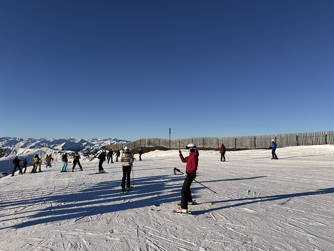
Kirchberg - Pengelstein · Panorama/video

Provider panorama/video player. Capture time is shown by the camera.
Open camera page ↗
各色は表示された値から始まります。風の色は3種類の単位で対応しています。降水のないセルは中立色です。色は表示値を示すもので、公的な気象警報ではありません。
予報グラフを準備中…
時刻と値は詳細予報と一致します。値をタップするかカーソルを合わせると詳細が表示されます。先の日付を見るには各グラフを横にスクロールしてください。雨・降水量は雪を含む各予報時間帯の水換算量です。降雪量は各時間帯の新雪量であり、積雪深ではありません。
GFSとECMWFのモデル比較です。各モデル固有の予報時刻と予報期間を維持しています。降水量と降雪量はそれぞれの予報時間帯の合計であり、時間帯はモデル間で異なる場合があります。
ECMWF · モデル計算時刻: 次回更新予定:
日 時刻(UTC) 気温(°C) 湿度(%) 風速(km/h) 風速(ノット) 風(ビューフォート) 風向 降水量(mm) 降雪量(cm) 気圧(hPa) 0°C高度(m) 天気 | 水曜日, 04/11 06:00 1.7 81 4 2 1B SE — — 1026 < 1244 Overcast 88% cloud  09:00 6.1 67 2 1 1B SE 0.01 0 1026 1958 Overcast 87% cloud 12:00 10.1 55 3 2 1B E 0 0 1024 2343 Clear 9% cloud  15:00 8.5 66 1 1 1B NE 0 0 1023 2307 Clear 7% cloud 18:00 3.6 77 2 1 1B SE 0.01 0 1025 1680 Clear 3% cloud 21:00 1.7 79 5 3 1B S 0 0 1026 < 1244 Clear 19% cloud 木曜日, 05/11 00:00 1.1 78 7 4 2B SE 0 0 1026 < 1244 Partly cloudy 36% cloud  03:00 0.3 78 6 3 2B SE 0 0 1025 < 1244 Partly cloudy 29% cloud 06:00 0.1 75 6 3 1B SE 0 0 1025 < 1244 Clear 19% cloud 09:00 8.7 55 3 2 1B SE 0 0 1024 2935 Clear 6% cloud 12:00 13.4 41 1 1 1B E 0 0 1022 3047 Clear 1% cloud 15:00 10.9 56 1 1 0B N 0 0 1022 3083 Clear 1% cloud 18:00 5.2 66 2 1 1B S 0 0 1023 3128 Clear 3% cloud 21:00 2.9 67 3 2 1B S 0 0 1023 3126 Clear 4% cloud 金曜日, 06/11 00:00 1.6 66 4 2 1B SE 0 0 1022 2581 Clear 6% cloud 03:00 1.1 63 4 2 1B SE 0 0 1021 2635 Clear 3% cloud 06:00 0.7 61 4 2 1B SE 0 0 1020 2543 Clear 2% cloud 09:00 10.5 46 3 2 1B SE 0 0 1019 3104 Clear 1% cloud 12:00 14.5 36 2 1 1B N 0 0 1017 3097 Clear 0% cloud 15:00 9.4 62 3 2 1B N 0 0 1019 3064 Clear 4% cloud 18:00 3.6 79 2 1 1B NW 0 0 1022 2489 Cloudy 77% cloud  21:00 3.1 79 2 1 1B S 0 0 1023 1911 Cloudy 78% cloud 土曜日, 07/11 00:00 2.3 81 2 1 1B S 0 0 1023 < 1244 Cloudy 78% cloud 03:00 1.7 80 2 1 1B S 0 0 1023 < 1244 Overcast 97% cloud 06:00 1.7 79 2 1 1B S 0 0 1024 < 1244 Overcast 83% cloud 09:00 6.2 67 0 0 0B W 0 0 1025 2127 Cloudy 53% cloud 12:00 9.2 57 2 1 1B N 0 0 1022 2339 Cloudy 76% cloud 15:00 7.4 68 2 1 1B NW 0 0 1022 2153 Partly cloudy 37% cloud 18:00 3 79 1 0 0B S 0 0 1024 1403 Partly cloudy 28% cloud 21:00 1.5 81 2 1 1B S 0 0 1024 < 1244 Cloudy 51% cloud 日曜日, 08/11 00:00 1.1 77 3 2 1B S 0 0 1024 < 1244 Cloudy 51% cloud 03:00 0.6 74 2 1 1B S 0 0 1023 < 1244 Clear 12% cloud 06:00 0.8 73 2 1 1B S 0 0 1024 < 1244 Cloudy 62% cloud 09:00 6.3 57 2 1 1B S 0.07 0 1025 1829 Overcast 82% cloud 12:00 9.6 51 1 1 1B N 0.15 0 1023 2095 Partly cloudy 25% cloud 15:00 8 62 1 0 0B NW 0 0 1022 1982 Clear 17% cloud 18:00 3.1 71 3 2 1B S 0 0 1023 1365 Clear 0% cloud 21:00 0.5 75 5 2 1B S 0 0 1022 < 1244 Clear 4% cloud 月曜日, 09/11 00:00 -1 76 6 3 2B S 0 0 1022 < 1244 Clear 6% cloud 03:00 0.9 69 6 3 1B S 0 0 1021 < 1244 Overcast 98% cloud 06:00 2.9 65 4 2 1B S 0.03 0 1020 1376 Overcast 100% cloud 09:00 7.6 53 3 2 1B SE 0.09 0 1020 2332 Cloudy 79% cloud 12:00 12.6 35 3 2 1B SE 0 0 1017 2639 Overcast 87% cloud 15:00 10.1 51 2 1 1B SE 0 0 1016 2676 Partly cloudy 39% cloud 18:00 6.7 58 5 3 1B S 0 0 1015 2452 Overcast 86% cloud 21:00 6.1 61 6 3 1B S 0 0 1015 2652 Overcast 99% cloud 火曜日, 10/11 00:00 5.8 67 6 3 1B S 0.04 0 1015 2667 Overcast 100% cloud 03:00 6.3 72 7 4 2B S 0.09 0 1013 2711 Overcast 100% cloud 06:00 5 75 5 3 1B S 0 0 1012 2685 Overcast 97% cloud |
|---|
Forecast table times: UTC.
Coordinates: 47.44295°N, 12.3891449°E · Requested elevation: 779 m. Model terrain: 1242 m. Terrain and 1000/925/850/700 hPa profiles are used for height estimates.
Outside the available profile, temperature uses an estimated 5.5°C/km height correction; wind retains the nearest available model-level value. Humidity is estimated with adjusted pressure and temperature.
These are altitude estimates, not a simulation of local mountain terrain. Precipitation, cloud and sea-level pressure use horizontal interpolation only.
Precipitation includes rain and snow water equivalent: preceding 3 hours through day 6, then 6 hours (see cell tooltip). Snow (cm) estimates fresh snowfall from precipitation and temperature using the GFS conversion; it is not snow depth on the ground. Freezing (m) uses additional 600/500 hPa temperatures when available and estimates the lowest resolved 0°C crossing above sea level. When all sampled levels are warm, the upper profile limit is shown (see tooltip). < marks an entirely cold sampled profile and its lower height limit. No extrapolation is used.
Kitzbühel is one of the starting points for KitzSki, whose ski region also includes Kirchberg and Mittersill. The official piste map is the best starting point for choosing a sector rather than assuming that every route begins in Kitzbühel itself. The operator also provides dedicated information on family skiing and practice areas.
This forecast opens at 779 m. It is a lower-elevation reference, not a summit forecast. When the freezing level is above this point, rain at the selected location can coincide with snow higher on the mountain. Check a forecast at your intended skiing elevation before interpreting a low or zero snowfall total as a lack of snow throughout the ski area.
For a useful comparison, keep the elevation and forecast hours the same when switching between GFS and ECMWF. After fresh snow, a rise in temperature can be just as relevant as another small snowfall amount. Use the weather graphs to follow that sequence, and consult the official piste and lift status for actual operation. Season dates and open terrain should not be inferred from a generic resort description.
Official sources: KitzSki piste map · KitzSki family skiing. Reviewed 18 October 2026.
Provider panorama/video player. Capture time is shown by the camera.
Open camera page ↗
Provider panorama/video player. Capture time is shown by the camera.
Open camera page ↗
Provider panorama/video player. Capture time is shown by the camera.
Open camera page ↗予報グラフを準備中…
時刻と値は詳細予報と一致します。値をタップするかカーソルを合わせると詳細が表示されます。先の日付を見るには各グラフを横にスクロールしてください。雨・降水量は雪を含む各予報時間帯の水換算量です。降雪量は各時間帯の新雪量であり、積雪深ではありません。
GFSとECMWFのモデル比較です。各モデル固有の予報時刻と予報期間を維持しています。降水量と降雪量はそれぞれの予報時間帯の合計であり、時間帯はモデル間で異なる場合があります。
ECMWF · モデル計算時刻: 次回更新予定:
日 時刻(UTC) 気温(°C) 湿度(%) 風速(km/h) 風速(ノット) 風(ビューフォート) 風向 降水量(mm) 降雪量(cm) 気圧(hPa) 0°C高度(m) 天気 | 水曜日, 04/11 06:00 -1.3 90 5 3 1B SE — — 1025 < 1270 Overcast 87% cloud 09:00 2.8 76 4 2 1B SE 0.01 0 1026 1962 Overcast 86% cloud 12:00 6.4 63 4 2 1B E 0 0 1024 2338 Clear 10% cloud 15:00 5 74 1 1 1B E 0 0 1023 2297 Clear 8% cloud 18:00 0.5 84 3 2 1B SE 0.01 0 1025 1617 Clear 4% cloud 21:00 -1.2 85 5 3 1B S 0 0 1026 < 1270 Partly cloudy 21% cloud 木曜日, 05/11 00:00 -1.6 83 7 4 2B SE 0 0 1026 < 1270 Partly cloudy 35% cloud 03:00 -2.3 81 6 3 2B S 0 0 1025 < 1270 Partly cloudy 26% cloud 06:00 -2.4 79 6 3 1B S 0 0 1025 < 1270 Clear 18% cloud 09:00 5.6 59 4 2 1B SE 0 0 1024 2937 Clear 5% cloud 12:00 9.9 44 1 1 1B SE 0 0 1022 3045 Clear 1% cloud 15:00 7.5 61 1 0 0B NE 0 0 1022 3081 Clear 1% cloud 18:00 2.3 70 3 1 1B S 0 0 1023 3128 Clear 3% cloud 21:00 0.2 69 4 2 1B S 0 0 1023 3126 Clear 4% cloud 金曜日, 06/11 00:00 -0.8 67 4 2 1B S 0 0 1022 2584 Clear 7% cloud 03:00 -1.3 65 4 2 1B S 0 0 1021 2630 Clear 3% cloud 06:00 -1.6 62 4 2 1B SE 0 0 1020 2545 Clear 2% cloud 09:00 7.4 48 3 2 1B SE 0 0 1019 3104 Clear 1% cloud 12:00 10.9 39 1 0 0B NE 0 0 1017 3097 Clear 0% cloud 15:00 6.2 66 2 1 1B NW 0 0 1019 3059 Clear 4% cloud 18:00 0.8 83 0 0 0B W 0 0 1022 2436 Cloudy 72% cloud 21:00 0.3 83 3 2 1B S 0 0 1023 1791 Cloudy 73% cloud 土曜日, 07/11 00:00 -0.5 85 4 2 1B S 0 0 1023 < 1270 Cloudy 75% cloud 03:00 -0.9 84 4 2 1B S 0 0 1023 < 1270 Overcast 97% cloud 06:00 -0.9 84 4 2 1B S 0 0 1024 < 1270 Overcast 84% cloud 09:00 3 73 2 1 1B SE 0 0 1024 2130 Cloudy 57% cloud 12:00 5.7 63 1 1 1B E 0 0 1022 2333 Cloudy 76% cloud 15:00 3.9 77 1 1 0B S 0 0 1022 2145 Partly cloudy 38% cloud 18:00 -0.1 88 3 2 1B S 0 0 1024 1394 Partly cloudy 30% cloud 21:00 -1.5 89 4 2 1B S 0 0 1024 < 1270 Partly cloudy 47% cloud 日曜日, 08/11 00:00 -1.7 86 3 2 1B S 0 0 1024 < 1270 Partly cloudy 49% cloud 03:00 -2.3 83 3 2 1B S 0 0 1023 < 1270 Clear 12% cloud 06:00 -2.2 82 3 2 1B S 0 0 1024 < 1270 Cloudy 62% cloud 09:00 2.8 66 3 1 1B SW 0.08 0 1025 1833 Overcast 80% cloud 12:00 5.7 59 2 1 1B NW 0.13 0 1023 2101 Partly cloudy 29% cloud 15:00 4.3 71 2 1 1B W 0 0 1022 1984 Clear 17% cloud 18:00 -0.3 78 2 1 1B SW 0 0 1023 1350 Clear 0% cloud 21:00 -2.7 81 4 2 1B S 0 0 1023 < 1270 Clear 5% cloud 月曜日, 09/11 00:00 -3.8 81 5 3 1B S 0 0 1022 < 1270 Clear 5% cloud 03:00 -2 75 4 2 1B S 0 0 1021 < 1270 Overcast 98% cloud 06:00 -0.1 74 4 2 1B S 0.03 0 1020 1380 Overcast 100% cloud 09:00 4.4 59 3 2 1B S 0.09 0 1020 2347 Cloudy 77% cloud 12:00 8.9 41 3 2 1B SW 0 0 1017 2644 Overcast 87% cloud 15:00 6.6 58 3 2 1B SW 0 0 1016 2677 Partly cloudy 38% cloud 18:00 3.5 68 5 3 1B SW 0 0 1015 2450 Overcast 87% cloud 21:00 3.1 70 6 3 1B S 0 0 1015 2653 Overcast 99% cloud 火曜日, 10/11 00:00 2.8 77 5 3 1B S 0.04 0 1015 2670 Overcast 100% cloud 03:00 3.3 82 6 3 2B SW 0.09 0 1013 2720 Overcast 100% cloud 06:00 2.2 85 5 3 1B SW 0 0 1012 2698 Overcast 97% cloud |
|---|
Forecast table times: UTC.
Coordinates: 47.42959695°N, 12.37541199°E · Requested elevation: 1408 m. Model terrain: 1268 m. Terrain and 1000/925/850/700 hPa profiles are used for height estimates.
These are altitude estimates, not a simulation of local mountain terrain. Precipitation, cloud and sea-level pressure use horizontal interpolation only.
Precipitation includes rain and snow water equivalent: preceding 3 hours through day 6, then 6 hours (see cell tooltip). Snow (cm) estimates fresh snowfall from precipitation and temperature using the GFS conversion; it is not snow depth on the ground. Freezing (m) uses additional 600/500 hPa temperatures when available and estimates the lowest resolved 0°C crossing above sea level. When all sampled levels are warm, the upper profile limit is shown (see tooltip). < marks an entirely cold sampled profile and its lower height limit. No extrapolation is used.
予報グラフを準備中…
時刻と値は詳細予報と一致します。値をタップするかカーソルを合わせると詳細が表示されます。先の日付を見るには各グラフを横にスクロールしてください。雨・降水量は雪を含む各予報時間帯の水換算量です。降雪量は各時間帯の新雪量であり、積雪深ではありません。
GFSとECMWFのモデル比較です。各モデル固有の予報時刻と予報期間を維持しています。降水量と降雪量はそれぞれの予報時間帯の合計であり、時間帯はモデル間で異なる場合があります。
ECMWF · モデル計算時刻: 次回更新予定:
日 時刻(UTC) 気温(°C) 湿度(%) 風速(km/h) 風速(ノット) 風(ビューフォート) 風向 降水量(mm) 降雪量(cm) 気圧(hPa) 0°C高度(m) 天気 | 水曜日, 04/11 06:00 -2.9 85 9 5 2B SE — — 1025 < 1340 Overcast 87% cloud 09:00 0.1 77 11 6 2B SE 0.01 0 1025 1979 Overcast 83% cloud 12:00 2.7 67 10 5 2B SE 0 0 1023 2337 Clear 12% cloud 15:00 1.8 72 6 3 1B SE 0 0 1023 2282 Clear 10% cloud 18:00 -1 73 6 3 2B SE 0.01 0 1025 1464 Clear 4% cloud 21:00 -1.9 69 8 4 2B S 0 0 1026 < 1340 Partly cloudy 26% cloud 木曜日, 05/11 00:00 -2 64 8 4 2B S 0 0 1026 < 1340 Partly cloudy 33% cloud 03:00 -2.2 62 8 4 2B S 0 0 1025 < 1340 Partly cloudy 23% cloud 06:00 -2.1 61 7 4 2B S 0 0 1024 < 1340 Clear 15% cloud 09:00 3.8 50 6 3 2B S 0 0 1024 2942 Clear 4% cloud 12:00 6.6 41 3 2 1B S 0 0 1022 3044 Clear 1% cloud 15:00 4.9 52 2 1 1B SE 0 0 1022 3079 Clear 0% cloud 18:00 1.3 55 5 2 1B S 0 0 1023 3128 Clear 3% cloud 21:00 0.1 52 5 3 1B S 0 0 1023 1647 Clear 4% cloud 金曜日, 06/11 00:00 -0.5 49 6 3 1B S 0 0 1022 2638 Clear 6% cloud 03:00 -0.7 46 5 3 1B S 0 0 1021 2646 Clear 3% cloud 06:00 -0.9 43 5 3 1B SE 0 0 1020 2570 Clear 2% cloud 09:00 5.4 38 5 3 1B SE 0 0 1019 3104 Clear 1% cloud 12:00 7.7 35 3 2 1B S 0 0 1017 3097 Clear 0% cloud 15:00 4.2 56 1 1 1B S 0 0 1019 3056 Clear 4% cloud 18:00 0.3 64 4 2 1B SE 0 0 1021 2316 Cloudy 61% cloud 21:00 -0.3 64 9 5 2B SE 0 0 1022 1457 Cloudy 62% cloud 土曜日, 07/11 00:00 -1.2 64 11 6 2B S 0 0 1023 < 1340 Cloudy 67% cloud 03:00 -1.4 67 11 6 2B S 0 0 1022 < 1340 Overcast 96% cloud 06:00 -1.6 68 11 6 2B S 0 0 1024 < 1340 Overcast 86% cloud 09:00 0.8 66 12 6 2B SE 0 0 1024 2143 Cloudy 64% cloud 12:00 2.4 59 11 6 2B SE 0 0 1022 2330 Cloudy 76% cloud 15:00 1 77 11 6 2B S 0 0 1022 2137 Partly cloudy 40% cloud 18:00 -1.9 82 11 6 2B S 0 0 1024 1352 Partly cloudy 33% cloud 21:00 -2.9 85 9 5 2B S 0 0 1024 < 1340 Partly cloudy 42% cloud 日曜日, 08/11 00:00 -3 84 6 3 2B S 0 0 1024 < 1340 Partly cloudy 43% cloud 03:00 -3.8 82 6 3 2B S 0 0 1023 < 1340 Clear 12% cloud 06:00 -3.9 82 7 4 2B SW 0 0 1024 < 1340 Cloudy 63% cloud 09:00 -0.6 72 7 4 2B SW 0.09 0 1025 1856 Cloudy 76% cloud 12:00 1.4 66 7 4 2B W 0.11 0 1022 2115 Partly cloudy 36% cloud 15:00 0.3 76 6 3 2B W 0 0 1022 1987 Clear 18% cloud 18:00 -2.6 71 8 5 2B W 0 0 1023 < 1340 Clear 1% cloud 21:00 -4.1 66 11 6 2B W 0 0 1023 < 1340 Clear 6% cloud 月曜日, 09/11 00:00 -4.6 64 11 6 2B W 0 0 1022 < 1340 Clear 5% cloud 03:00 -3.1 67 9 5 2B W 0 0 1021 < 1340 Overcast 98% cloud 06:00 -1.5 75 11 6 2B W 0.05 0 1020 1389 Overcast 99% cloud 09:00 2.1 61 11 6 2B W 0.07 0 1020 2385 Cloudy 73% cloud 12:00 5.1 48 12 6 2B W 0 0 1017 2658 Overcast 86% cloud 15:00 3.7 59 11 6 2B SW 0 0 1016 2678 Partly cloudy 37% cloud 18:00 1.5 74 16 9 3B W 0 0 1015 2437 Overcast 87% cloud 21:00 1.6 71 13 7 3B SW 0 0 1015 2650 Overcast 99% cloud 火曜日, 10/11 00:00 1.5 79 13 7 3B SW 0.04 0 1015 2668 Overcast 100% cloud 03:00 2 86 18 10 3B W 0.07 0 1013 2734 Overcast 100% cloud 06:00 1.3 88 17 9 3B W 0 0 1012 2712 Overcast 97% cloud |
|---|
Forecast table times: UTC.
Coordinates: 47.40206738°N, 12.3673439°E · Requested elevation: 1949 m. Model terrain: 1337 m. Terrain and 1000/925/850/700 hPa profiles are used for height estimates.
These are altitude estimates, not a simulation of local mountain terrain. Precipitation, cloud and sea-level pressure use horizontal interpolation only.
Precipitation includes rain and snow water equivalent: preceding 3 hours through day 6, then 6 hours (see cell tooltip). Snow (cm) estimates fresh snowfall from precipitation and temperature using the GFS conversion; it is not snow depth on the ground. Freezing (m) uses additional 600/500 hPa temperatures when available and estimates the lowest resolved 0°C crossing above sea level. When all sampled levels are warm, the upper profile limit is shown (see tooltip). < marks an entirely cold sampled profile and its lower height limit. No extrapolation is used.