Kitzsteinhorn summit · 3,029 m · Feratel

Camera image unavailable
Camera image · refreshes every 60 seconds while visible.
Open camera page ↗

Each colour starts at the value shown. Wind colours match across all three units. Dry cells stay neutral. Colours describe the displayed values, not official weather warnings.
ECMWF · Model run: Next update expected:
Day Time (UTC) Temp. (°C) Humidity (%) Wind (km/h) Wind (knots) Wind (Bft) Direction Precip. (mm) Snow (cm) Pressure (hPa) Freezing (m) Conditions | Friday, 23/10 12:00 11.8 38 4 2 1B SW — — 1015 2503 Cloudy 53% cloud  15:00 10.1 50 3 2 1B S 0.09 0 1014 2525 Partly cloudy 30% cloud  18:00 6.6 59 4 2 1B S 0.03 0 1014 2145 Overcast 87% cloud  21:00 6.2 68 1 0 0B NW 1.9 0 1017 2015 Overcast 92% cloud Saturday, 24/10 00:00 3.9 82 1 1 0B E 3.3 0 1019 1628 Overcast 100% cloud 03:00 3.8 81 1 1 1B E 1.9 0 1019 1601 Overcast 99% cloud 06:00 2.9 82 3 1 1B W 3.3 0 1021 < 1525 Overcast 100% cloud 09:00 4 73 3 2 1B NW 0.79 0 1022 1606 Overcast 86% cloud 12:00 5 61 4 2 1B NW 0.47 0 1021 1719 Cloudy 54% cloud 15:00 3.4 68 2 1 1B NW 0.60 0 1022 1529 Partly cloudy 28% cloud 18:00 -0 72 2 1 1B SW 0.11 0 1022 < 1525 Partly cloudy 45% cloud 21:00 -1.5 63 4 2 1B S 0 0 1021 < 1525 Cloudy 77% cloud Sunday, 25/10 00:00 -0.8 61 4 2 1B S 0 0 1019 < 1525 Overcast 98% cloud 03:00 2.5 55 4 2 1B S 0.00 0 1016 < 1525 Overcast 100% cloud 06:00 3.7 62 4 2 1B S 0.38 0 1014 1755 Overcast 100% cloud 09:00 6.8 66 4 2 1B SE 1.2 0 1011 3110 Overcast 98% cloud 12:00 9.5 55 3 2 1B S 0 0 1007 3035 Overcast 99% cloud 15:00 8.4 60 3 2 1B S 0.48 0 1006 2974 Overcast 100% cloud 18:00 5.3 82 6 3 1B NW 3.9 0 1016 1951 Overcast 100% cloud 21:00 4 79 3 2 1B W 2.4 0 1018 1630 Overcast 83% cloud Monday, 26/10 00:00 3.7 76 5 3 1B W 2.4 0 1020 1586 Overcast 100% cloud 03:00 3.5 77 2 1 1B W 0.56 0 1022 1554 Cloudy 69% cloud 06:00 2 78 3 2 1B W 0.11 0 1023 < 1525 Cloudy 70% cloud 09:00 5.8 69 3 1 1B NW 0.02 0 1024 1951 Partly cloudy 46% cloud 12:00 8.7 53 2 1 1B NW 0.00 0 1022 2294 Cloudy 62% cloud 15:00 7.5 58 1 0 0B W 0.00 0 1022 2332 Overcast 90% cloud 18:00 3.3 53 3 2 1B S 0 0 1022 < 1525 Cloudy 57% cloud 21:00 4.4 36 2 1 1B SW 0 0 1022 1958 Overcast 84% cloud Tuesday, 27/10 00:00 6.5 31 3 1 1B SW 0 0 1022 2375 Overcast 100% cloud 03:00 8.3 38 2 1 1B SW 0.05 0 1021 2829 Overcast 100% cloud 06:00 8.5 44 2 1 1B SW 0 0 1022 3155 Overcast 100% cloud 09:00 11.6 46 1 1 1B W 0 0 1023 3174 Cloudy 77% cloud 12:00 14.6 54 0 0 0B W 0 0 1021 3640 Clear 2% cloud  15:00 13.5 60 1 0 0B S 0 0 1020 3782 Clear 0% cloud 18:00 9.3 55 3 1 1B SW 0 0 1020 3692 Clear 0% cloud 21:00 8.8 52 3 2 1B SW 0 0 1021 3566 Cloudy 70% cloud Wednesday, 28/10 00:00 8.1 59 4 2 1B SW 0 0 1021 3286 Partly cloudy 33% cloud 03:00 7.3 64 4 2 1B W 0 0 1022 3017 Cloudy 57% cloud 06:00 6.9 69 4 2 1B W 0 0 1024 2910 Overcast 94% cloud 09:00 10.7 67 5 2 1B W 0 0 1025 2868 Overcast 100% cloud 12:00 11.2 70 4 2 1B NW 0 0 1024 2764 Overcast 99% cloud 15:00 9.6 82 4 2 1B NW 1.0 0 1025 2599 Overcast 100% cloud 18:00 8 85 4 2 1B NW 2.3 0 1027 2401 Overcast 100% cloud 21:00 6.9 85 4 2 1B NW 1.0 0 1029 2135 Overcast 100% cloud Thursday, 29/10 00:00 6.5 84 4 2 1B NW 0.93 0 1029 2060 Overcast 100% cloud 03:00 5.7 84 4 2 1B NW 0.44 0 1029 1915 Overcast 99% cloud 06:00 4.7 82 2 1 1B W 0 0 1030 1784 Partly cloudy 29% cloud 09:00 6.9 58 2 1 1B W 0 0 1029 2072 Clear 6% cloud 12:00 9.6 42 3 1 1B N 0 0 1026 2304 Clear 5% cloud 18:00 4.3 62 1 1 1B SW 0 0 1026 1734 Partly cloudy 40% cloud Friday, 30/10 00:00 3.7 55 1 0 0B S 0 0 1026 1652 Overcast 95% cloud 06:00 3.6 48 1 1 0B S 0 0 1025 1594 Partly cloudy 24% cloud 12:00 10.8 40 3 1 1B N 0 0 1022 2449 Overcast 88% cloud 18:00 4.6 60 2 1 1B SW 0 0 1022 1796 Clear 0% cloud Saturday, 31/10 00:00 3.2 58 1 1 0B SW 0 0 1022 < 1525 Clear 2% cloud 06:00 2.2 62 1 1 1B SW 0 0 1022 < 1525 Clear 13% cloud 12:00 8.2 54 4 2 1B NW 0.05 0 1019 2060 Partly cloudy 28% cloud 18:00 3.5 65 1 1 1B SW 0 0 1020 1545 Clear 19% cloud Sunday, 01/11 00:00 2 71 2 1 1B SW 0.44 0 1021 < 1525 Cloudy 59% cloud 06:00 3.6 71 1 1 1B SW 0 0 1020 1569 Overcast 94% cloud 12:00 8.6 51 2 1 1B NE 0 0 1018 2204 Overcast 100% cloud 18:00 6 70 1 0 0B NW 0.19 0 1021 2000 Overcast 100% cloud Monday, 02/11 00:00 4.7 79 1 0 0B W 1.4 0 1024 1768 Overcast 100% cloud 06:00 3.8 81 0 0 0B N 0.00 0 1024 1614 Cloudy 77% cloud 12:00 9.6 56 2 1 1B E 0 0 1021 2359 Cloudy 78% cloud |
|---|
Forecast table times: UTC.
Coordinates: 47.27358041°N, 12.74731636°E · Requested elevation: 911 m. Model terrain: 1522 m. Terrain and 1000/925/850/700 hPa profiles are used for height estimates.
Outside the available profile, temperature uses an estimated 5.5°C/km height correction; wind retains the nearest available model-level value. Humidity is estimated with adjusted pressure and temperature.
These are altitude estimates, not a simulation of local mountain terrain. Precipitation, cloud and sea-level pressure use horizontal interpolation only.
Precipitation includes rain and snow water equivalent: preceding 3 hours through day 6, then 6 hours (see cell tooltip). Snow (cm) estimates fresh snowfall from precipitation and temperature using the GFS conversion; it is not snow depth on the ground. Freezing (m) uses additional 600/500 hPa temperatures when available and estimates the lowest resolved 0°C crossing above sea level. When all sampled levels are warm, the upper profile limit is shown (see tooltip). < marks an entirely cold sampled profile and its lower height limit. No extrapolation is used.
Source: ECMWF · CC BY 4.0 · Processed by Snow Report.
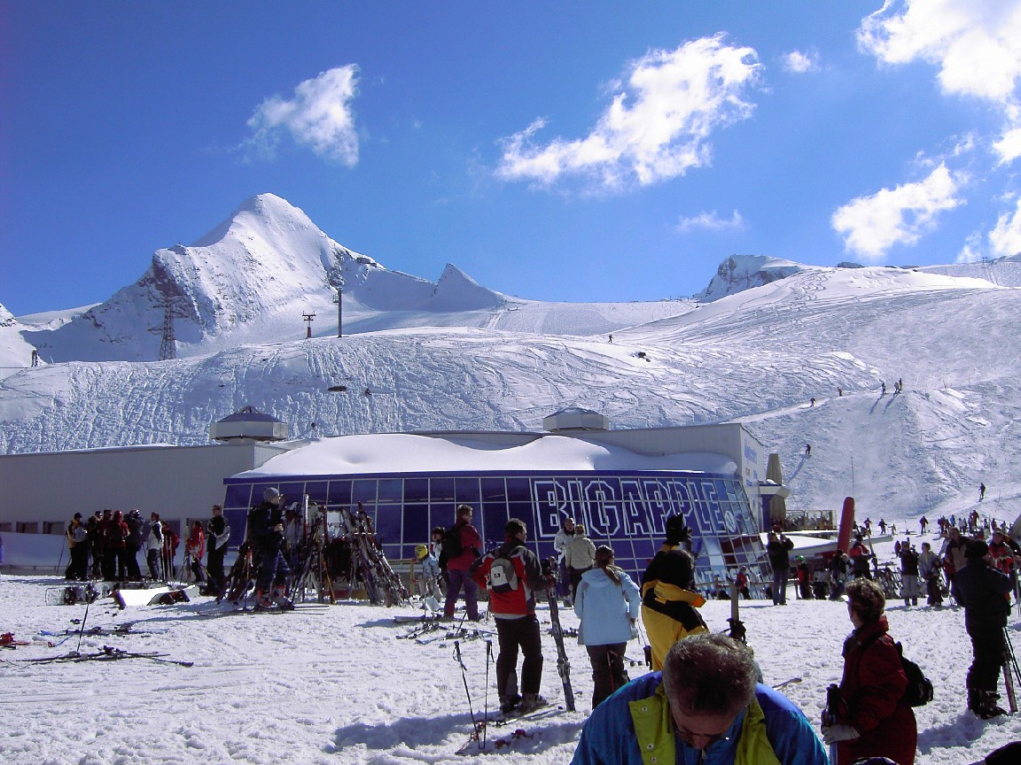
Kaprun brings together the lower Maiskogel mountain and the Kitzsteinhorn glacier area. The MK Maiskogelbahn and 3K K-onnection allow an ascent from Kaprun through Maiskogel towards the glacier, while the Gletscherjet valley station offers another starting point. It is worth identifying your departure station before choosing transport or checking the day’s lift information.
This page opens at 911 m, a lower reference in the Kaprun area. That is a very different setting from the glacier. A warm or rainy forecast at the selected point is not a report of conditions throughout Kitzsteinhorn. Choose one of the higher forecast points when planning a mountain day, and compare it with the lower point for your return.
For families or groups with different plans, Maiskogel and the glacier need not be treated as the same outing. Check the facilities you intend to use rather than relying on a single headline for the entire destination. During changing weather, follow the wind and cloud forecast as well as the amount of fresh snow. The operator’s current report confirms which parts of the lift route and pistes are actually available.
Official sources: Kitzsteinhorn — Kaprun–Maiskogel connection · Kaprun skiing. Reviewed 18 October 2026.
Camera image · refreshes every 60 seconds while visible.
Open camera page ↗
Camera image · refreshes every 60 seconds while visible.
Open camera page ↗
Camera image · refreshes every 60 seconds while visible.
Open camera page ↗ECMWF · Model run: Next update expected:
Day Time (UTC) Temp. (°C) Humidity (%) Wind (km/h) Wind (knots) Wind (Bft) Direction Precip. (mm) Snow (cm) Pressure (hPa) Freezing (m) Conditions | Friday, 23/10 12:00 4.5 52 8 4 2B SW — — 1016 2490 Cloudy 60% cloud 15:00 3.3 64 7 4 2B SW 0.10 0 1014 2481 Partly cloudy 37% cloud 18:00 0.6 75 5 3 1B SW 0.06 0 1015 2085 Overcast 83% cloud 21:00 0.1 85 4 2 1B SW 1.7 0.5 1017 1987 Overcast 93% cloud Saturday, 24/10 00:00 -1.8 98 3 2 1B N 3.2 1.3 1019 < 1645 Overcast 100% cloud 03:00 -2.1 94 7 4 2B NW 1.9 0.6 1019 < 1645 Overcast 98% cloud 06:00 -3.2 93 10 5 2B W 3.1 3.1 1021 < 1645 Overcast 99% cloud 09:00 -2.6 83 12 7 2B NW 0.74 0.2 1022 1646 Overcast 88% cloud 12:00 -1.9 72 12 6 2B NW 0.39 0.1 1021 1744 Cloudy 51% cloud 15:00 -3.1 80 11 6 2B NW 0.52 0.5 1022 < 1645 Partly cloudy 24% cloud 18:00 -6.1 82 11 6 2B W 0.09 0.1 1022 < 1645 Partly cloudy 45% cloud 21:00 -7 73 8 4 2B W 0 0 1021 < 1645 Cloudy 73% cloud Sunday, 25/10 00:00 -5.8 67 7 4 2B W 0 0 1019 < 1645 Overcast 99% cloud 03:00 -2.7 69 9 5 2B W 0.02 0 1016 < 1645 Overcast 100% cloud 06:00 -0.9 81 12 7 3B W 0.48 0.1 1015 < 1645 Overcast 100% cloud 09:00 2.2 70 12 6 2B W 1.1 0 1012 3114 Overcast 98% cloud 12:00 4.1 66 12 6 2B W 0 0 1008 3053 Overcast 97% cloud 15:00 3.3 76 13 7 3B W 0.47 0 1007 3009 Overcast 100% cloud 18:00 -0 96 13 7 3B NW 3.6 1.4 1016 1960 Overcast 100% cloud 21:00 -1.9 92 17 9 3B W 2.4 0.7 1018 1663 Overcast 83% cloud Monday, 26/10 00:00 -2.3 91 17 9 3B W 2.2 0.7 1020 < 1645 Overcast 99% cloud 03:00 -2.4 87 15 8 3B W 0.42 0.1 1022 < 1645 Cloudy 61% cloud 06:00 -3.2 80 16 8 3B W 0.09 0.1 1023 < 1645 Cloudy 68% cloud 09:00 -0 70 16 9 3B NW 0 0 1024 1972 Partly cloudy 41% cloud 12:00 2.3 56 15 8 3B NW 0 0 1022 2299 Cloudy 65% cloud 15:00 1.6 59 12 7 3B NW 0.07 0 1022 2301 Overcast 84% cloud 18:00 -1.6 51 11 6 2B NW 0 0 1022 < 1645 Cloudy 58% cloud 21:00 -0.9 36 10 5 2B NW 0 0 1022 < 1645 Overcast 83% cloud Tuesday, 27/10 00:00 1 49 11 6 2B NW 0 0 1022 2295 Overcast 100% cloud 03:00 2.9 60 14 8 3B NW 0 0 1021 2799 Overcast 100% cloud 06:00 3.5 64 11 6 2B NW 0.05 0 1022 3137 Overcast 100% cloud 09:00 5.9 59 9 5 2B N 0 0 1023 3175 Overcast 81% cloud 12:00 8.6 58 8 4 2B N 0 0 1021 3643 Clear 3% cloud 15:00 7.8 61 7 4 2B NW 0 0 1020 3790 Clear 0% cloud 18:00 4.2 54 7 4 2B NW 0 0 1020 3708 Clear 0% cloud 21:00 3.9 54 8 4 2B NW 0 0 1021 3576 Cloudy 68% cloud Wednesday, 28/10 00:00 3.2 65 10 5 2B NW 0 0 1021 3294 Partly cloudy 30% cloud 03:00 2.3 68 10 5 2B NW 0 0 1022 3006 Cloudy 56% cloud 06:00 1.9 72 8 4 2B NW 0 0 1023 2910 Overcast 93% cloud 09:00 4.9 74 8 4 2B NW 0 0 1025 2880 Overcast 100% cloud 12:00 5.1 80 9 5 2B NW 0 0 1024 2779 Overcast 98% cloud 15:00 3.7 95 8 4 2B NW 0.78 0 1025 2601 Overcast 93% cloud 18:00 2.2 99 9 5 2B NW 2.1 0 1027 2398 Overcast 99% cloud 21:00 1.1 97 10 5 2B NW 0.87 0.3 1028 2154 Overcast 98% cloud Thursday, 29/10 00:00 0.6 94 10 5 2B NW 0.78 0.2 1029 2070 Overcast 98% cloud 03:00 -0.2 92 9 5 2B NW 0.40 0.1 1029 1936 Overcast 97% cloud 06:00 -1.1 90 6 3 2B N 0 0 1030 1758 Partly cloudy 43% cloud 09:00 0.6 70 5 3 1B N 0 0 1029 2071 Clear 10% cloud 12:00 2.8 51 5 3 1B N 0 0 1026 2314 Clear 5% cloud 18:00 -1.4 68 3 2 1B N 0 0 1026 < 1645 Partly cloudy 33% cloud Friday, 30/10 00:00 -1.6 61 2 1 1B N 0 0 1026 < 1645 Overcast 95% cloud 06:00 -1.7 56 3 2 1B N 0 0 1025 < 1645 Partly cloudy 21% cloud 12:00 3.9 49 5 3 1B NW 0 0 1022 2456 Overcast 86% cloud 18:00 -1.2 68 5 3 1B NW 0 0 1022 1694 Clear 4% cloud Saturday, 31/10 00:00 -2.7 65 7 4 2B W 0 0 1022 < 1645 Clear 1% cloud 06:00 -3.7 71 7 4 2B NW 0 0 1022 < 1645 Clear 9% cloud 12:00 1.1 64 8 4 2B NW 0 0 1019 2087 Partly cloudy 27% cloud 18:00 -2.6 79 9 5 2B NW 0 0 1020 < 1645 Partly cloudy 25% cloud Sunday, 01/11 00:00 -3.7 83 10 5 2B W 0.43 0.4 1021 < 1645 Cloudy 60% cloud 06:00 -2.6 82 10 6 2B NW 0 0 1020 < 1645 Overcast 92% cloud 12:00 2 66 8 4 2B W 0 0 1018 2218 Overcast 100% cloud 18:00 0 85 10 5 2B NW 0.09 0 1021 1978 Overcast 99% cloud Monday, 02/11 00:00 -1.2 94 4 2 1B SW 1.4 0.4 1024 1754 Overcast 96% cloud 06:00 -1.7 93 5 3 1B SW 0 0 1024 < 1645 Cloudy 79% cloud 12:00 2.6 67 5 3 1B SW 0 0 1021 2328 Overcast 81% cloud |
|---|
Forecast table times: UTC.
Coordinates: 47.22090889°N, 12.69907951°E · Requested elevation: 1970 m. Model terrain: 1643 m. Terrain and 1000/925/850/700 hPa profiles are used for height estimates.
These are altitude estimates, not a simulation of local mountain terrain. Precipitation, cloud and sea-level pressure use horizontal interpolation only.
Precipitation includes rain and snow water equivalent: preceding 3 hours through day 6, then 6 hours (see cell tooltip). Snow (cm) estimates fresh snowfall from precipitation and temperature using the GFS conversion; it is not snow depth on the ground. Freezing (m) uses additional 600/500 hPa temperatures when available and estimates the lowest resolved 0°C crossing above sea level. When all sampled levels are warm, the upper profile limit is shown (see tooltip). < marks an entirely cold sampled profile and its lower height limit. No extrapolation is used.
Source: ECMWF · CC BY 4.0 · Processed by Snow Report.
ECMWF · Model run: Next update expected:
Day Time (UTC) Temp. (°C) Humidity (%) Wind (km/h) Wind (knots) Wind (Bft) Direction Precip. (mm) Snow (cm) Pressure (hPa) Freezing (m) Conditions | Friday, 23/10 12:00 -4.8 75 25 13 4B W — — 1016 2468 Cloudy 61% cloud 15:00 -3.8 72 24 13 4B W 0.10 0.1 1015 2439 Partly cloudy 42% cloud 18:00 -4.7 81 14 8 3B SW 0.08 0.1 1015 2034 Overcast 83% cloud 21:00 -5.7 96 19 10 3B SW 1.5 1.5 1017 1969 Overcast 95% cloud Saturday, 24/10 00:00 -7.4 98 11 6 2B N 2.8 2.2 1019 < 1732 Overcast 100% cloud 03:00 -8.7 82 29 16 5B NW 1.8 1.8 1019 < 1732 Overcast 98% cloud 06:00 -10 71 32 17 5B NW 2.9 2.2 1020 < 1732 Overcast 99% cloud 09:00 -10.9 64 42 22 6B W 0.69 0.7 1021 < 1732 Overcast 89% cloud 12:00 -10.7 64 34 18 5B NW 0.32 0.3 1021 1770 Partly cloudy 47% cloud 15:00 -10.7 67 36 20 5B NW 0.44 0.4 1022 < 1732 Partly cloudy 23% cloud 18:00 -10.9 71 41 22 6B NW 0.07 0.1 1022 < 1732 Partly cloudy 45% cloud 21:00 -9.3 62 32 17 5B NW 0 0 1022 < 1732 Cloudy 71% cloud Sunday, 25/10 00:00 -7.2 46 25 14 4B W 0 0 1020 < 1732 Overcast 99% cloud 03:00 -5.3 73 32 17 5B W 0.02 0 1017 < 1732 Overcast 100% cloud 06:00 -2.1 98 50 27 7B W 0.53 0.2 1016 < 1732 Overcast 100% cloud 09:00 0.5 55 52 28 7B W 1.1 0.3 1013 3107 Overcast 98% cloud 12:00 0.2 67 47 26 6B W 0 0 1009 3061 Overcast 96% cloud 15:00 -0 88 49 27 6B W 0.43 0.1 1007 3023 Overcast 100% cloud 18:00 -4.3 95 41 22 6B NW 3.4 2.6 1015 1965 Overcast 100% cloud 21:00 -8.1 79 61 33 7B W 2.1 2.1 1018 < 1732 Overcast 82% cloud Monday, 26/10 00:00 -8.9 92 56 30 7B W 2.0 2 1020 < 1732 Overcast 99% cloud 03:00 -8.4 63 59 32 7B NW 0.36 0.4 1021 < 1732 Cloudy 61% cloud 06:00 -6.6 31 58 32 7B NW 0.07 0.1 1023 < 1732 Cloudy 68% cloud 09:00 -5.9 27 58 32 7B NW 0 0 1024 1975 Partly cloudy 42% cloud 12:00 -5 24 55 30 7B NW 0 0 1022 2298 Cloudy 68% cloud 15:00 -3.4 24 50 27 6B NW 0.11 0.1 1022 2262 Cloudy 80% cloud 18:00 -2.9 17 48 26 6B NW 0 0 1022 < 1732 Cloudy 59% cloud 21:00 -2.5 14 40 22 6B NW 0 0 1022 < 1732 Overcast 83% cloud Tuesday, 27/10 00:00 -2.3 84 42 22 6B NW 0 0 1021 2241 Overcast 99% cloud 03:00 -0.8 97 57 31 7B NW 0 0 1021 2778 Overcast 100% cloud 06:00 0.3 97 47 25 6B NW 0.09 0 1022 3128 Overcast 100% cloud 09:00 0.7 65 37 20 5B N 0 0 1023 3183 Overcast 83% cloud 12:00 3.1 30 33 18 5B N 0 0 1021 3644 Clear 4% cloud 15:00 4 21 31 16 5B N 0 0 1020 3798 Clear 0% cloud 18:00 3.3 20 31 17 5B NW 0 0 1020 3723 Clear 0% cloud 21:00 2.4 31 35 19 5B NW 0 0 1021 3588 Cloudy 65% cloud Wednesday, 28/10 00:00 1 49 38 20 5B NW 0 0 1021 3315 Partly cloudy 28% cloud 03:00 0 38 37 20 5B NW 0 0 1022 3043 Cloudy 55% cloud 06:00 -0.1 40 31 17 5B N 0 0 1023 2939 Overcast 93% cloud 09:00 -0.7 48 23 13 4B NW 0 0 1025 2900 Overcast 99% cloud 12:00 -1.5 63 25 13 4B NW 0 0 1024 2793 Overcast 98% cloud 15:00 -2.4 91 24 13 4B NW 0.64 0.2 1025 2612 Overcast 89% cloud 18:00 -3.2 96 29 16 5B NW 1.8 1.8 1027 2398 Overcast 97% cloud 21:00 -5 84 31 17 5B NW 0.77 0.8 1028 2174 Overcast 96% cloud Thursday, 29/10 00:00 -5.5 73 32 17 5B NW 0.64 0.6 1029 2072 Overcast 96% cloud 03:00 -6.4 56 28 15 4B NW 0.39 0.4 1029 1951 Overcast 95% cloud 06:00 -6.4 54 24 13 4B N 0 0 1030 1731 Partly cloudy 48% cloud 09:00 -6 52 19 10 3B N 0 0 1029 2073 Clear 10% cloud 12:00 -5.7 45 13 7 3B N 0 0 1026 2320 Clear 5% cloud 18:00 -5.4 43 14 8 3B N 0 0 1026 < 1732 Partly cloudy 32% cloud Friday, 30/10 00:00 -4.1 44 13 7 3B N 0 0 1025 < 1732 Overcast 94% cloud 06:00 -5 54 14 8 3B N 0 0 1024 < 1732 Partly cloudy 22% cloud 12:00 -4.7 49 15 8 3B NW 0 0 1022 2461 Overcast 84% cloud 18:00 -5.6 51 23 12 4B NW 0 0 1022 < 1732 Clear 7% cloud Saturday, 31/10 00:00 -6.7 50 25 14 4B NW 0 0 1022 < 1732 Clear 1% cloud 06:00 -8.4 58 29 16 5B NW 0 0 1022 < 1732 Clear 9% cloud 12:00 -8.6 65 20 11 3B NW 0 0 1019 2105 Partly cloudy 27% cloud 18:00 -8.9 80 35 19 5B NW 0 0 1020 < 1732 Partly cloudy 31% cloud Sunday, 01/11 00:00 -9.2 72 38 20 5B NW 0.37 0.4 1020 < 1732 Cloudy 61% cloud 06:00 -9.1 70 39 21 6B NW 0 0 1020 < 1732 Overcast 90% cloud 12:00 -6.5 95 31 17 5B W 0 0 1018 2222 Overcast 99% cloud 18:00 -5.6 95 37 20 5B NW 0.10 0.1 1021 1947 Overcast 98% cloud Monday, 02/11 00:00 -6.8 93 16 9 3B SW 1.2 1.2 1024 1736 Overcast 93% cloud 06:00 -6.2 84 21 11 4B SW 0 0 1024 < 1732 Overcast 81% cloud 12:00 -5.3 53 23 12 4B SW 0 0 1022 2297 Overcast 84% cloud |
|---|
Forecast table times: UTC.
Coordinates: 47.18965414°N, 12.68517494°E · Requested elevation: 3028 m. Model terrain: 1729 m. Terrain and 1000/925/850/700 hPa profiles are used for height estimates.
Outside the available profile, temperature uses an estimated 5.5°C/km height correction; wind retains the nearest available model-level value. Humidity is estimated with adjusted pressure and temperature.
These are altitude estimates, not a simulation of local mountain terrain. Precipitation, cloud and sea-level pressure use horizontal interpolation only.
Precipitation includes rain and snow water equivalent: preceding 3 hours through day 6, then 6 hours (see cell tooltip). Snow (cm) estimates fresh snowfall from precipitation and temperature using the GFS conversion; it is not snow depth on the ground. Freezing (m) uses additional 600/500 hPa temperatures when available and estimates the lowest resolved 0°C crossing above sea level. When all sampled levels are warm, the upper profile limit is shown (see tooltip). < marks an entirely cold sampled profile and its lower height limit. No extrapolation is used.