Prévisions pour les stations de ski du monde entier

Plus
Guide des couleurs Température · Vent · Pluie · Neige
Chaque couleur commence à la valeur indiquée. Les couleurs du vent correspondent dans les trois unités. Les cases sans précipitations restent neutres. Les couleurs décrivent les valeurs affichées et ne sont pas des alertes officielles.
Préparation des graphiques…
Les heures et valeurs correspondent aux prévisions détaillées. Touchez une valeur pour plus de détails et faites défiler horizontalement pour les jours suivants. Les précipitations représentent l’équivalent en eau total par intervalle, neige comprise. La neige fraîche correspond à chaque intervalle, et non à l’épaisseur au sol.
Comparaison GFS et ECMWF. Chaque modèle conserve ses heures et son horizon de prévision. Les quantités de précipitations et de neige couvrent leurs propres intervalles, qui peuvent différer entre modèles.
Valeurs des prévisions et notes des modèles
Hunter Mountain - Low lift station
ECMWF · Cycle du modèle : Prochaine mise à jour attendue :
Jour Heure (UTC) Temp. (°C) Humidité (%) Vent (km/h) Vent (nœuds) Vent (Bft) Direction Précip. (mm) Neige fraîche (cm) Pression (hPa) Isotherme 0 °C (m) Conditions | Mercredi, 04/11 06:00 10.5 81 6 3 2B SW — — 1021 3162 Overcast 82% cloud  09:00 10.6 79 7 4 2B SW 0 0 1020 3157 Cloudy 53% cloud  12:00 10.3 84 7 4 2B SW 0 0 1020 3156 Clear 0% cloud  15:00 18.6 54 6 3 2B SW 0 0 1019 3150 Clear 0% cloud 18:00 21.4 46 12 6 2B SW 0 0 1017 3139 Clear 0% cloud 21:00 18.7 59 10 6 2B S 0 0 1016 3134 Clear 7% cloud Jeudi, 05/11 00:00 13.8 78 11 6 2B SW 0 0 1017 3131 Clear 2% cloud 03:00 12.5 78 12 7 2B SW 0 0 1016 3123 Partly cloudy 21% cloud  06:00 12.1 82 13 7 3B S 0 0 1015 3110 Clear 16% cloud 09:00 12.1 92 16 8 3B SW 0 0 1014 3095 Overcast 85% cloud 12:00 13.2 96 12 6 2B S 0.32 0 1013 3088 Overcast 100% cloud 15:00 14.7 96 18 10 3B S 3.3 0 1012 3081 Overcast 100% cloud 18:00 16.1 95 18 10 3B S 4.4 0 1010 3067 Overcast 96% cloud 21:00 16.7 93 15 8 3B SW 0.55 0 1010 3062 Overcast 91% cloud Vendredi, 06/11 00:00 15.9 95 12 7 3B S 0.18 0 1010 3069 Overcast 99% cloud 03:00 15.3 96 12 6 2B SW 0.71 0 1011 3064 Overcast 85% cloud 06:00 14.2 96 7 4 2B W 0.15 0 1011 3059 Overcast 100% cloud 09:00 13.7 98 3 2 1B NW 0.25 0 1012 3057 Overcast 97% cloud 12:00 11.2 96 3 2 1B SW 0.08 0 1013 3059 Overcast 98% cloud 15:00 16 66 4 2 1B SW 0 0 1013 3060 Overcast 95% cloud 18:00 18.8 51 5 2 1B SW 0.02 0 1011 3048 Overcast 94% cloud 21:00 16.2 68 1 0 0B E 0.09 0 1011 3044 Cloudy 59% cloud Samedi, 07/11 00:00 11.5 89 5 2 1B N 0 0 1012 3046 Overcast 99% cloud 03:00 11.2 85 6 3 2B N 0 0 1012 2997 Overcast 100% cloud 06:00 10.5 87 6 3 1B N 0 0 1011 2840 Overcast 100% cloud 09:00 10.2 90 4 2 1B N 0 0 1010 2745 Cloudy 63% cloud 12:00 10.4 89 4 2 1B NE 0 0 1010 2691 Overcast 92% cloud 15:00 13.4 80 4 2 1B E 0.10 0 1010 2650 Overcast 99% cloud 18:00 11 96 5 3 1B NW 4.2 0 1009 2457 Overcast 100% cloud 21:00 8.9 96 13 7 3B NW 3.9 0 1009 2241 Overcast 99% cloud Dimanche, 08/11 00:00 6 96 15 8 3B W 3.2 0 1010 2019 Overcast 100% cloud 03:00 5.9 96 14 8 3B W 7.4 0 1009 1882 Overcast 100% cloud 06:00 6 96 16 8 3B NW 7.1 0 1008 1897 Overcast 100% cloud 09:00 4.9 95 21 12 4B NW 0.84 0 1009 1802 Overcast 100% cloud 12:00 5.2 91 20 11 4B NW 0.40 0 1011 1794 Overcast 98% cloud 15:00 7.4 80 20 11 4B NW 0 0 1010 1667 Overcast 90% cloud 18:00 8.1 68 21 11 4B W 0.08 0 1009 1353 Overcast 91% cloud 21:00 7.9 59 12 7 3B W 0 0 1008 1728 Clear 7% cloud Lundi, 09/11 00:00 5.1 72 10 5 2B W 0 0 1007 1744 Clear 5% cloud 03:00 6.1 62 13 7 3B W 0 0 1006 1482 Overcast 99% cloud 06:00 5.9 77 15 8 3B W 0.08 0 1005 1340 Overcast 91% cloud 09:00 4.8 89 18 10 3B W 0.30 0 1005 1242 Overcast 98% cloud 12:00 4.1 89 22 12 4B W 0.48 0 1007 1154 Overcast 97% cloud 15:00 5.4 78 25 14 4B NW 0.10 0 1009 1178 Overcast 94% cloud 18:00 6.1 72 24 13 4B NW 0.25 0 1010 1174 Overcast 97% cloud 21:00 5.2 72 23 13 4B NW 0.08 0 1012 1095 Cloudy 71% cloud Mardi, 10/11 00:00 3.9 78 26 14 4B NW 0 0 1014 1453 Cloudy 76% cloud 03:00 4.3 78 20 11 3B NW 0 0 1014 1256 Overcast 93% cloud 06:00 4.2 81 18 10 3B NW 0 0 1015 1133 Overcast 96% cloud |
|---|
Forecast notes
Forecast table times: UTC.
Coordinates: 42.2042264°N, -74.2062122°E · Requested elevation: 502 m. Model terrain: 571 m. Terrain and 1000/925/850/700 hPa profiles are used for height estimates.
Outside the available profile, temperature uses an estimated 5.5°C/km height correction; wind retains the nearest available model-level value. Humidity is estimated with adjusted pressure and temperature.
These are altitude estimates, not a simulation of local mountain terrain. Precipitation, cloud and sea-level pressure use horizontal interpolation only.
Precipitation includes rain and snow water equivalent: preceding 3 hours through day 6, then 6 hours (see cell tooltip). Snow (cm) estimates fresh snowfall from precipitation and temperature using the GFS conversion; it is not snow depth on the ground. Freezing (m) uses additional 600/500 hPa temperatures when available and estimates the lowest resolved 0°C crossing above sea level. When all sampled levels are warm, the upper profile limit is shown (see tooltip). < marks an entirely cold sampled profile and its lower height limit. No extrapolation is used.
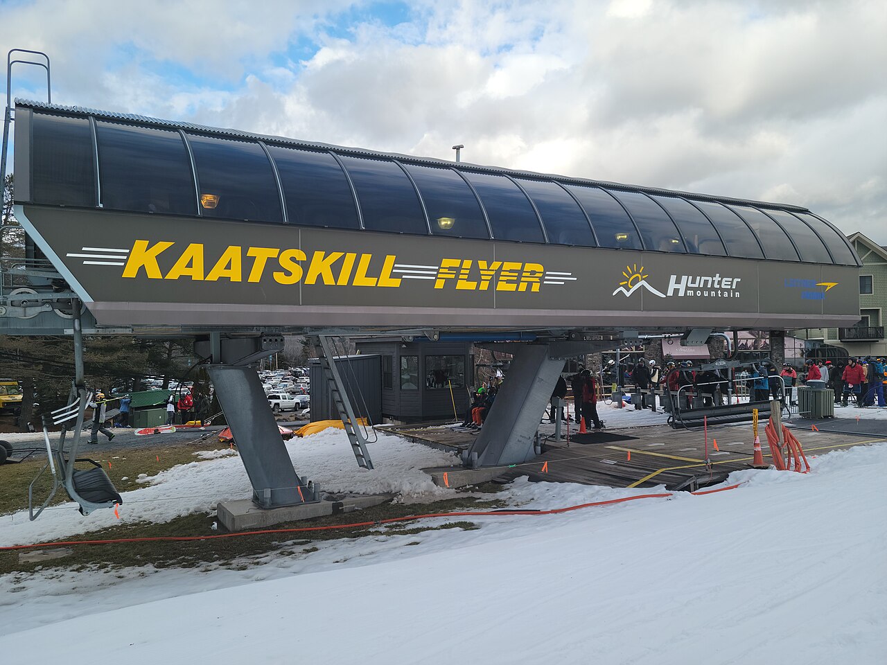
Le Hunter Mountain de cette page est la station de l’État de New York, et non Hunter Mountain Shiobara au Japon. Son guide officiel distingue quatre faces et des terrains de différents niveaux. Choisissez secteur et retour sur le plan hivernal ; le plan de randonnée estivale répond à un autre usage.
Pour une première visite, repérez les installations d’apprentissage et les rendez-vous séparément des pistes principales. Si vous revenez, consultez le plan actuel plutôt qu’une ancienne photo ou un souvenir des remontées. La station publie les horaires d’exploitation séparément des webcams et de la météo.
La prévision s’ouvre à un point bas de 502 m. Près de zéro, une petite variation de température peut changer la nature des précipitations à la base par rapport au haut. Suivez leur succession avec la température, y compris pour le retour. La neige fraîche prévue ne décrit ni neige de culture, ni damage, ni sous-couche existante ; complétez-la par le bulletin actuel des pistes.
Sources officielles: Hunter Mountain trail maps · Hunter Mountain operating hours. Informations vérifiées le 18 octobre 2026.
Préparation des graphiques…
Les heures et valeurs correspondent aux prévisions détaillées. Touchez une valeur pour plus de détails et faites défiler horizontalement pour les jours suivants. Les précipitations représentent l’équivalent en eau total par intervalle, neige comprise. La neige fraîche correspond à chaque intervalle, et non à l’épaisseur au sol.
Comparaison GFS et ECMWF. Chaque modèle conserve ses heures et son horizon de prévision. Les quantités de précipitations et de neige couvrent leurs propres intervalles, qui peuvent différer entre modèles.
Valeurs des prévisions et notes des modèles
Hunter Mountain - Base lift station
ECMWF · Cycle du modèle : Prochaine mise à jour attendue :
Jour Heure (UTC) Temp. (°C) Humidité (%) Vent (km/h) Vent (nœuds) Vent (Bft) Direction Précip. (mm) Neige fraîche (cm) Pression (hPa) Isotherme 0 °C (m) Conditions | Mercredi, 04/11 06:00 10.4 81 6 3 2B SW — — 1021 3162 Overcast 82% cloud 09:00 10.6 79 7 4 2B SW 0 0 1020 3157 Cloudy 52% cloud 12:00 10.2 85 7 4 2B SW 0 0 1020 3156 Clear 0% cloud 15:00 18.6 54 6 3 2B SW 0 0 1019 3150 Clear 0% cloud 18:00 21.4 46 12 6 2B SW 0 0 1017 3139 Clear 0% cloud 21:00 18.6 59 10 6 2B S 0 0 1016 3134 Clear 7% cloud Jeudi, 05/11 00:00 13.8 79 11 6 2B SW 0 0 1017 3131 Clear 3% cloud 03:00 12.4 78 12 7 2B SW 0 0 1016 3123 Partly cloudy 21% cloud 06:00 12 82 13 7 3B S 0 0 1015 3110 Clear 16% cloud 09:00 12 92 16 8 3B SW 0 0 1014 3095 Overcast 85% cloud 12:00 13.1 96 12 6 2B S 0.32 0 1013 3088 Overcast 100% cloud 15:00 14.6 97 18 10 3B S 3.3 0 1012 3081 Overcast 100% cloud 18:00 16.1 95 18 10 3B S 4.3 0 1010 3067 Overcast 96% cloud 21:00 16.7 93 15 8 3B SW 0.55 0 1010 3062 Overcast 91% cloud Vendredi, 06/11 00:00 15.8 95 13 7 3B S 0.18 0 1011 3069 Overcast 99% cloud 03:00 15.2 96 12 6 2B SW 0.69 0 1011 3064 Overcast 86% cloud 06:00 14.1 97 7 4 2B W 0.15 0 1011 3059 Overcast 100% cloud 09:00 13.6 98 3 2 1B NW 0.24 0 1012 3057 Overcast 97% cloud 12:00 11.1 96 3 2 1B SW 0.08 0 1013 3059 Overcast 98% cloud 15:00 15.9 65 4 2 1B SW 0 0 1013 3060 Overcast 95% cloud 18:00 18.7 50 5 3 1B SW 0.02 0 1011 3048 Overcast 94% cloud 21:00 16.1 68 1 0 0B E 0.08 0 1011 3044 Cloudy 58% cloud Samedi, 07/11 00:00 11.4 90 5 2 1B N 0 0 1012 3046 Overcast 99% cloud 03:00 11.1 86 6 3 2B N 0 0 1012 2996 Overcast 100% cloud 06:00 10.4 87 6 3 1B N 0 0 1011 2840 Overcast 100% cloud 09:00 10.1 90 4 2 1B N 0 0 1010 2744 Cloudy 63% cloud 12:00 10.3 89 4 2 1B NE 0 0 1010 2690 Overcast 93% cloud 15:00 13.3 80 4 2 1B E 0.11 0 1010 2649 Overcast 99% cloud 18:00 10.9 97 5 3 1B NW 4.2 0 1009 2455 Overcast 100% cloud 21:00 8.8 96 13 7 3B NW 3.9 0 1009 2239 Overcast 99% cloud Dimanche, 08/11 00:00 5.9 96 15 8 3B W 3.1 0 1010 2017 Overcast 100% cloud 03:00 5.8 96 14 8 3B W 7.4 0 1009 1882 Overcast 100% cloud 06:00 5.9 96 16 8 3B NW 7.1 0 1008 1898 Overcast 100% cloud 09:00 4.8 95 21 12 4B NW 0.84 0 1009 1801 Overcast 100% cloud 12:00 5.1 91 20 11 4B NW 0.40 0 1011 1794 Overcast 99% cloud 15:00 7.3 80 20 11 4B NW 0 0 1010 1667 Overcast 91% cloud 18:00 8 68 21 11 4B W 0.08 0 1009 1352 Overcast 90% cloud 21:00 7.8 59 13 7 3B W 0 0 1008 1727 Clear 7% cloud Lundi, 09/11 00:00 5 72 10 6 2B W 0 0 1007 1745 Clear 5% cloud 03:00 6.1 62 13 7 3B W 0 0 1006 1482 Overcast 99% cloud 06:00 5.8 77 15 8 3B W 0.08 0 1005 1341 Overcast 91% cloud 09:00 4.8 89 18 10 3B W 0.31 0 1005 1241 Overcast 98% cloud 12:00 4 89 23 12 4B W 0.49 0 1007 1152 Overcast 98% cloud 15:00 5.3 78 26 14 4B NW 0.10 0 1009 1177 Overcast 95% cloud 18:00 6 73 24 13 4B NW 0.25 0 1010 1173 Overcast 98% cloud 21:00 5.1 73 23 13 4B NW 0.08 0 1012 1095 Cloudy 72% cloud Mardi, 10/11 00:00 3.8 78 26 14 4B NW 0 0 1014 1448 Cloudy 77% cloud 03:00 4.2 78 20 11 4B NW 0 0 1014 1252 Overcast 93% cloud 06:00 4.1 81 18 10 3B NW 0 0 1015 1132 Overcast 97% cloud |
|---|
Forecast notes
Forecast table times: UTC.
Coordinates: 42.2038346°N, -74.2108188°E · Requested elevation: 517 m. Model terrain: 578 m. Terrain and 1000/925/850/700 hPa profiles are used for height estimates.
Outside the available profile, temperature uses an estimated 5.5°C/km height correction; wind retains the nearest available model-level value. Humidity is estimated with adjusted pressure and temperature.
These are altitude estimates, not a simulation of local mountain terrain. Precipitation, cloud and sea-level pressure use horizontal interpolation only.
Precipitation includes rain and snow water equivalent: preceding 3 hours through day 6, then 6 hours (see cell tooltip). Snow (cm) estimates fresh snowfall from precipitation and temperature using the GFS conversion; it is not snow depth on the ground. Freezing (m) uses additional 600/500 hPa temperatures when available and estimates the lowest resolved 0°C crossing above sea level. When all sampled levels are warm, the upper profile limit is shown (see tooltip). < marks an entirely cold sampled profile and its lower height limit. No extrapolation is used.
Préparation des graphiques…
Les heures et valeurs correspondent aux prévisions détaillées. Touchez une valeur pour plus de détails et faites défiler horizontalement pour les jours suivants. Les précipitations représentent l’équivalent en eau total par intervalle, neige comprise. La neige fraîche correspond à chaque intervalle, et non à l’épaisseur au sol.
Comparaison GFS et ECMWF. Chaque modèle conserve ses heures et son horizon de prévision. Les quantités de précipitations et de neige couvrent leurs propres intervalles, qui peuvent différer entre modèles.
Valeurs des prévisions et notes des modèles
Hunter Mountain - Top lift station
ECMWF · Cycle du modèle : Prochaine mise à jour attendue :
Jour Heure (UTC) Temp. (°C) Humidité (%) Vent (km/h) Vent (nœuds) Vent (Bft) Direction Précip. (mm) Neige fraîche (cm) Pression (hPa) Isotherme 0 °C (m) Conditions | Mercredi, 04/11 06:00 15.4 59 28 15 4B SW — — 1021 3162 Overcast 82% cloud 09:00 14.8 55 34 18 5B SW 0 0 1020 3157 Cloudy 51% cloud 12:00 14.5 58 33 18 5B W 0 0 1020 3156 Clear 0% cloud 15:00 15.4 54 21 11 4B SW 0 0 1019 3150 Clear 0% cloud 18:00 16.6 53 21 11 4B SW 0 0 1017 3139 Clear 0% cloud 21:00 16.4 56 26 14 4B SW 0 0 1016 3134 Clear 8% cloud Jeudi, 05/11 00:00 14.7 61 35 19 5B SW 0 0 1017 3131 Clear 3% cloud 03:00 14.5 55 40 21 6B SW 0 0 1016 3123 Partly cloudy 22% cloud 06:00 13.7 64 43 23 6B SW 0 0 1015 3109 Clear 16% cloud 09:00 12.9 79 48 26 6B SW 0 0 1014 3095 Overcast 87% cloud 12:00 12.6 96 44 24 6B SW 0.36 0 1013 3088 Overcast 100% cloud 15:00 13.4 93 54 29 7B SW 3.3 0 1012 3081 Overcast 100% cloud 18:00 13.8 95 46 25 6B SW 4.2 0 1010 3067 Overcast 95% cloud 21:00 14.4 94 38 21 5B SW 0.56 0 1010 3062 Overcast 91% cloud Vendredi, 06/11 00:00 14.4 97 40 22 6B SW 0.18 0 1011 3069 Overcast 99% cloud 03:00 13.8 91 40 22 6B SW 0.61 0 1011 3064 Overcast 89% cloud 06:00 12.3 95 25 14 4B W 0.15 0 1011 3059 Overcast 100% cloud 09:00 11.6 92 18 10 3B W 0.19 0 1012 3057 Overcast 97% cloud 12:00 10.9 85 15 8 3B SW 0.09 0 1013 3059 Overcast 98% cloud 15:00 11.5 70 12 7 2B SW 0 0 1013 3060 Overcast 96% cloud 18:00 13.4 62 10 5 2B SW 0.01 0 1011 3048 Overcast 93% cloud 21:00 13.2 61 5 3 1B SW 0.04 0 1011 3043 Cloudy 57% cloud Samedi, 07/11 00:00 11.1 82 6 3 2B N 0 0 1013 3046 Overcast 99% cloud 03:00 10.3 82 13 7 3B N 0 0 1012 2993 Overcast 100% cloud 06:00 9.8 85 12 7 3B NE 0 0 1011 2840 Overcast 100% cloud 09:00 9.9 82 11 6 2B NE 0 0 1010 2742 Cloudy 63% cloud 12:00 9.3 88 13 7 3B E 0 0 1010 2686 Overcast 95% cloud 15:00 9.4 93 6 3 1B SE 0.11 0 1010 2646 Overcast 99% cloud 18:00 8 97 7 4 2B NW 4.2 0 1009 2449 Overcast 100% cloud 21:00 6.4 95 17 9 3B NW 3.7 0 1009 2230 Overcast 99% cloud Dimanche, 08/11 00:00 4.2 94 24 13 4B NW 3.1 0 1010 2008 Overcast 100% cloud 03:00 3.9 95 30 16 5B NW 7.4 0 1009 1880 Overcast 100% cloud 06:00 4.1 96 35 19 5B NW 7.0 0 1008 1901 Overcast 100% cloud 09:00 2.8 96 56 30 7B NW 0.86 0 1009 1798 Overcast 100% cloud 12:00 3.2 92 52 28 7B NW 0.42 0 1011 1797 Overcast 99% cloud 15:00 3.7 89 46 25 6B NW 0 0 1011 1667 Overcast 94% cloud 18:00 3.4 82 39 21 6B W 0.09 0 1009 1349 Overcast 90% cloud 21:00 4.5 59 37 20 5B W 0 0 1008 1727 Clear 6% cloud Lundi, 09/11 00:00 4.1 63 41 22 6B W 0 0 1007 1753 Clear 5% cloud 03:00 3.2 72 37 20 5B W 0 0 1006 1481 Overcast 99% cloud 06:00 2.7 88 40 22 6B W 0.09 0 1006 1342 Overcast 94% cloud 09:00 1.8 94 45 24 6B W 0.31 0 1005 1239 Overcast 99% cloud 12:00 1.1 93 50 27 6B NW 0.53 0.2 1007 1143 Overcast 99% cloud 15:00 1.4 89 50 27 7B NW 0.11 0 1009 1173 Overcast 96% cloud 18:00 1.7 86 46 25 6B NW 0.27 0 1010 1172 Overcast 98% cloud 21:00 1.1 84 52 28 7B NW 0.09 0 1012 1095 Cloudy 73% cloud Mardi, 10/11 00:00 1.3 70 61 33 7B NW 0 0 1014 1431 Cloudy 78% cloud 03:00 1.4 82 54 29 7B NW 0 0 1014 1236 Overcast 94% cloud 06:00 0.9 87 46 25 6B NW 0 0 1016 1128 Overcast 97% cloud |
|---|
Forecast notes
Forecast table times: UTC.
Coordinates: 42.2005354°N, -74.2302992°E · Requested elevation: 969 m. Model terrain: 605 m. Terrain and 1000/925/850/700 hPa profiles are used for height estimates.
These are altitude estimates, not a simulation of local mountain terrain. Precipitation, cloud and sea-level pressure use horizontal interpolation only.
Precipitation includes rain and snow water equivalent: preceding 3 hours through day 6, then 6 hours (see cell tooltip). Snow (cm) estimates fresh snowfall from precipitation and temperature using the GFS conversion; it is not snow depth on the ground. Freezing (m) uses additional 600/500 hPa temperatures when available and estimates the lowest resolved 0°C crossing above sea level. When all sampled levels are warm, the upper profile limit is shown (see tooltip). < marks an entirely cold sampled profile and its lower height limit. No extrapolation is used.