Prévisions pour les stations de ski du monde entier

Plus
Guide des couleurs Température · Vent · Pluie · Neige
Chaque couleur commence à la valeur indiquée. Les couleurs du vent correspondent dans les trois unités. Les cases sans précipitations restent neutres. Les couleurs décrivent les valeurs affichées et ne sont pas des alertes officielles.
Préparation des graphiques…
Les heures et valeurs correspondent aux prévisions détaillées. Touchez une valeur pour plus de détails et faites défiler horizontalement pour les jours suivants. Les précipitations représentent l’équivalent en eau total par intervalle, neige comprise. La neige fraîche correspond à chaque intervalle, et non à l’épaisseur au sol.
Comparaison GFS et ECMWF. Chaque modèle conserve ses heures et son horizon de prévision. Les quantités de précipitations et de neige couvrent leurs propres intervalles, qui peuvent différer entre modèles.
Valeurs des prévisions et notes des modèles
Eldora - Low lift station
ECMWF · Cycle du modèle : Prochaine mise à jour attendue :
Jour Heure (UTC) Temp. (°C) Humidité (%) Vent (km/h) Vent (nœuds) Vent (Bft) Direction Précip. (mm) Neige fraîche (cm) Pression (hPa) Isotherme 0 °C (m) Conditions | Mercredi, 04/11 06:00 -4 86 4 2 1B W — — 1018 — Clear 0% cloud  09:00 -4 84 6 3 1B W 0 0 1017 — Clear 0% cloud 12:00 -3.8 78 4 2 1B W 0 0 1014 — Partly cloudy 45% cloud  15:00 1.2 52 0 0 0B S 0 0 1014 — Overcast 83% cloud  18:00 4.9 40 7 4 2B E 0.04 0 1012 — Partly cloudy 24% cloud 21:00 3.9 49 10 5 2B E 0.04 0 1011 — Cloudy 62% cloud  Jeudi, 05/11 00:00 -0.7 77 3 2 1B E 0.34 0.1 1014 — Overcast 98% cloud 03:00 -2.1 85 3 2 1B E 0.09 0 1016 — Overcast 98% cloud 06:00 -3.2 82 1 1 1B NE 0.01 0 1018 — Overcast 83% cloud 09:00 -4.1 80 2 1 1B W 0 0 1019 — Cloudy 62% cloud 12:00 -4.9 77 2 1 1B W 0 0 1020 — Clear 13% cloud 15:00 0.2 55 3 2 1B W 0 0 1021 — Clear 12% cloud 18:00 5.8 37 6 3 2B E 0 0 1019 — Clear 0% cloud 21:00 6.3 39 9 5 2B E 0 0 1017 — Clear 1% cloud Vendredi, 06/11 00:00 -0.1 69 3 2 1B SE 0 0 1020 — Clear 1% cloud 03:00 -2.2 75 2 1 1B S 0 0 1021 — Cloudy 56% cloud 06:00 -2.8 74 3 2 1B W 0 0 1021 — Cloudy 70% cloud 09:00 -2.1 63 4 2 1B W 0 0 1021 — Overcast 91% cloud 12:00 -2 60 4 2 1B W 0 0 1021 — Overcast 96% cloud 15:00 1.5 49 4 2 1B W 0 0 1023 — Overcast 95% cloud 18:00 6.7 36 3 1 1B N 0 0 1021 — Cloudy 76% cloud 21:00 6.4 41 3 1 1B N 0 0 1020 — Cloudy 74% cloud Samedi, 07/11 00:00 1.2 62 1 0 0B SW 0.01 0 1022 — Partly cloudy 49% cloud 03:00 -1.6 67 2 1 1B W 0 0 1023 — Clear 1% cloud 06:00 -2.6 75 4 2 1B W 0 0 1024 — Clear 0% cloud 09:00 -3.5 82 6 3 2B W 0 0 1024 — Clear 2% cloud 12:00 -3.8 84 7 4 2B W 0 0 1025 — Clear 1% cloud 15:00 0.5 67 7 4 2B W 0 0 1026 — Clear 0% cloud 18:00 7 31 2 1 1B NW 0 0 1024 — Clear 0% cloud 21:00 8.1 33 2 1 1B E 0 0 1021 — Clear 0% cloud Dimanche, 08/11 00:00 1.5 53 1 0 0B W 0 0 1024 — Clear 15% cloud 03:00 -1.5 52 3 1 1B W 0 0 1025 — Cloudy 61% cloud 06:00 -1.4 47 3 1 1B W 0 0 1026 — Partly cloudy 33% cloud 09:00 -1.9 48 3 2 1B W 0 0 1025 — Clear 4% cloud 12:00 -2.6 46 5 3 1B W 0 0 1024 — Clear 0% cloud 15:00 2.7 31 5 2 1B W 0 0 1024 — Clear 0% cloud 18:00 9.9 17 3 2 1B NW 0 0 1023 — Clear 0% cloud 21:00 10.7 21 5 3 1B NW 0 0 1020 — Clear 0% cloud Lundi, 09/11 00:00 2.1 41 4 2 1B W 0 0 1022 — Clear 0% cloud 03:00 0.1 48 7 4 2B W 0 0 1022 — Clear 0% cloud 06:00 -0.5 50 8 4 2B W 0 0 1022 — Clear 0% cloud 09:00 -0.8 51 8 4 2B W 0 0 1022 — Clear 0% cloud 12:00 -1 50 8 4 2B W 0 0 1022 — Clear 0% cloud 15:00 3 40 6 3 1B W 0 0 1023 — Clear 0% cloud 18:00 10.6 20 2 1 1B NW 0 0 1020 — Clear 0% cloud 21:00 11.4 20 4 2 1B NW 0 0 1018 — Clear 0% cloud Mardi, 10/11 00:00 2.9 45 3 1 1B W 0 0 1020 — Clear 0% cloud 03:00 0.6 51 3 2 1B W 0 0 1022 — Clear 0% cloud 06:00 -0.2 54 2 1 1B W 0 0 1022 — Clear 9% cloud |
|---|
Forecast notes
Forecast table times: UTC.
Coordinates: 39.9492953°N, -105.5992643°E · Requested elevation: 2821 m. Model terrain: 2934 m. Terrain and 1000/925/850/700 hPa profiles are used for height estimates.
Outside the available profile, temperature uses an estimated 5.5°C/km height correction; wind retains the nearest available model-level value. Humidity is estimated with adjusted pressure and temperature.
These are altitude estimates, not a simulation of local mountain terrain. Precipitation, cloud and sea-level pressure use horizontal interpolation only.
Precipitation includes rain and snow water equivalent: preceding 3 hours through day 6, then 6 hours (see cell tooltip). Snow (cm) estimates fresh snowfall from precipitation and temperature using the GFS conversion; it is not snow depth on the ground. Freezing (m) uses additional 600/500 hPa temperatures when available and estimates the lowest resolved 0°C crossing above sea level. When all sampled levels are warm, the upper profile limit is shown (see tooltip). < marks an entirely cold sampled profile and its lower height limit. No extrapolation is used.
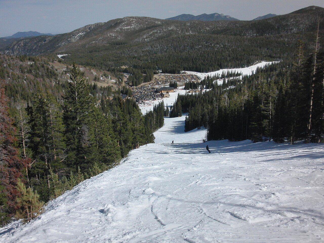
Eldora is a downhill ski area in Colorado, United States. Mapped terrain includes easy, intermediate, advanced, expert routes. Its mapped lift network extends from approximately 2821 to 3233 metres above sea level. Cross-country skiing is also mapped within the area.
Data: OpenSkiData / OpenSkiMap, OpenStreetMap contributors (ODbL), Skimap.org, Who's On First, Mapterhorn.
Préparation des graphiques…
Les heures et valeurs correspondent aux prévisions détaillées. Touchez une valeur pour plus de détails et faites défiler horizontalement pour les jours suivants. Les précipitations représentent l’équivalent en eau total par intervalle, neige comprise. La neige fraîche correspond à chaque intervalle, et non à l’épaisseur au sol.
Comparaison GFS et ECMWF. Chaque modèle conserve ses heures et son horizon de prévision. Les quantités de précipitations et de neige couvrent leurs propres intervalles, qui peuvent différer entre modèles.
Valeurs des prévisions et notes des modèles
Eldora - Base lift station
ECMWF · Cycle du modèle : Prochaine mise à jour attendue :
Jour Heure (UTC) Temp. (°C) Humidité (%) Vent (km/h) Vent (nœuds) Vent (Bft) Direction Précip. (mm) Neige fraîche (cm) Pression (hPa) Isotherme 0 °C (m) Conditions | Mercredi, 04/11 06:00 -4.3 87 4 2 1B W — — 1018 — Clear 0% cloud 09:00 -4.3 86 6 3 2B W 0 0 1017 — Clear 0% cloud 12:00 -4 79 5 3 1B W 0 0 1014 — Partly cloudy 44% cloud 15:00 1.1 52 0 0 0B S 0 0 1014 — Cloudy 80% cloud 18:00 4.6 41 8 4 2B E 0.03 0 1012 — Partly cloudy 27% cloud 21:00 3.7 50 10 5 2B E 0.04 0 1011 — Cloudy 60% cloud Jeudi, 05/11 00:00 -0.8 79 3 2 1B E 0.33 0.1 1014 — Overcast 98% cloud 03:00 -2.3 86 3 2 1B NE 0.08 0 1016 — Overcast 98% cloud 06:00 -3.3 83 1 1 1B N 0.02 0 1018 — Overcast 82% cloud 09:00 -4.2 81 3 1 1B W 0 0 1019 — Cloudy 63% cloud 12:00 -5.1 78 3 2 1B W 0 0 1020 — Clear 12% cloud 15:00 0.1 55 3 2 1B W 0 0 1021 — Clear 11% cloud 18:00 5.7 37 7 4 2B E 0 0 1019 — Clear 0% cloud 21:00 6.1 39 9 5 2B E 0 0 1017 — Clear 1% cloud Vendredi, 06/11 00:00 -0.3 70 3 2 1B SE 0 0 1020 — Clear 1% cloud 03:00 -2.4 76 2 1 1B SW 0 0 1021 — Cloudy 54% cloud 06:00 -3.1 75 4 2 1B W 0 0 1021 — Cloudy 69% cloud 09:00 -2.4 65 4 2 1B W 0 0 1021 — Overcast 90% cloud 12:00 -2.3 61 4 2 1B W 0 0 1021 — Overcast 95% cloud 15:00 1.3 50 5 2 1B W 0 0 1022 — Overcast 95% cloud 18:00 6.6 36 3 2 1B N 0 0 1021 — Cloudy 78% cloud 21:00 6.2 42 3 2 1B NE 0 0 1020 — Cloudy 76% cloud Samedi, 07/11 00:00 1.1 63 1 0 0B SW 0.01 0 1022 — Cloudy 52% cloud 03:00 -1.8 68 3 2 1B W 0 0 1023 — Clear 1% cloud 06:00 -2.9 76 4 2 1B W 0 0 1024 — Clear 0% cloud 09:00 -3.8 84 6 4 2B W 0 0 1024 — Clear 2% cloud 12:00 -4 85 8 4 2B W 0 0 1025 — Clear 1% cloud 15:00 0.4 66 7 4 2B W 0 0 1026 — Clear 0% cloud 18:00 7 30 2 1 1B NW 0 0 1023 — Clear 0% cloud 21:00 8.1 33 3 1 1B E 0 0 1021 — Clear 0% cloud Dimanche, 08/11 00:00 1.4 55 1 0 0B W 0 0 1023 — Clear 15% cloud 03:00 -1.9 54 3 2 1B W 0 0 1025 — Cloudy 59% cloud 06:00 -1.9 49 3 2 1B W 0 0 1026 — Partly cloudy 34% cloud 09:00 -2.3 50 3 2 1B W 0 0 1025 — Clear 4% cloud 12:00 -3 48 5 3 1B W 0 0 1024 — Clear 0% cloud 15:00 2.5 31 5 3 1B W 0 0 1024 — Clear 0% cloud 18:00 9.9 17 3 1 1B NW 0 0 1022 — Clear 0% cloud 21:00 10.7 21 5 3 1B NW 0 0 1020 — Clear 0% cloud Lundi, 09/11 00:00 1.9 42 5 2 1B W 0 0 1022 — Clear 0% cloud 03:00 -0.3 49 8 4 2B W 0 0 1022 — Clear 0% cloud 06:00 -0.8 52 9 5 2B W 0 0 1022 — Clear 0% cloud 09:00 -1.1 52 8 5 2B W 0 0 1022 — Clear 0% cloud 12:00 -1.3 51 9 5 2B W 0 0 1022 — Clear 0% cloud 15:00 2.8 40 7 4 2B W 0 0 1022 — Clear 0% cloud 18:00 10.6 20 2 1 1B NW 0 0 1020 — Clear 0% cloud 21:00 11.5 20 4 2 1B NW 0 0 1018 — Clear 0% cloud Mardi, 10/11 00:00 2.8 45 3 2 1B W 0 0 1020 — Clear 0% cloud 03:00 0.2 52 4 2 1B W 0 0 1022 — Clear 0% cloud 06:00 -0.6 56 3 1 1B W 0 0 1022 — Clear 9% cloud |
|---|
Forecast notes
Forecast table times: UTC.
Coordinates: 39.9376033°N, -105.5838214°E · Requested elevation: 2859 m. Model terrain: 2918 m. Terrain and 1000/925/850/700 hPa profiles are used for height estimates.
Outside the available profile, temperature uses an estimated 5.5°C/km height correction; wind retains the nearest available model-level value. Humidity is estimated with adjusted pressure and temperature.
These are altitude estimates, not a simulation of local mountain terrain. Precipitation, cloud and sea-level pressure use horizontal interpolation only.
Precipitation includes rain and snow water equivalent: preceding 3 hours through day 6, then 6 hours (see cell tooltip). Snow (cm) estimates fresh snowfall from precipitation and temperature using the GFS conversion; it is not snow depth on the ground. Freezing (m) uses additional 600/500 hPa temperatures when available and estimates the lowest resolved 0°C crossing above sea level. When all sampled levels are warm, the upper profile limit is shown (see tooltip). < marks an entirely cold sampled profile and its lower height limit. No extrapolation is used.
Préparation des graphiques…
Les heures et valeurs correspondent aux prévisions détaillées. Touchez une valeur pour plus de détails et faites défiler horizontalement pour les jours suivants. Les précipitations représentent l’équivalent en eau total par intervalle, neige comprise. La neige fraîche correspond à chaque intervalle, et non à l’épaisseur au sol.
Comparaison GFS et ECMWF. Chaque modèle conserve ses heures et son horizon de prévision. Les quantités de précipitations et de neige couvrent leurs propres intervalles, qui peuvent différer entre modèles.
Valeurs des prévisions et notes des modèles
Eldora - Top lift station
ECMWF · Cycle du modèle : Prochaine mise à jour attendue :
Jour Heure (UTC) Temp. (°C) Humidité (%) Vent (km/h) Vent (nœuds) Vent (Bft) Direction Précip. (mm) Neige fraîche (cm) Pression (hPa) Isotherme 0 °C (m) Conditions | Mercredi, 04/11 06:00 -6.2 96 4 2 1B W — — 1018 — Clear 0% cloud 09:00 -6.3 94 6 3 1B W 0 0 1017 — Clear 0% cloud 12:00 -6 87 4 2 1B W 0 0 1014 — Partly cloudy 44% cloud 15:00 -1.1 58 0 0 0B S 0 0 1014 — Overcast 81% cloud 18:00 2.7 44 7 4 2B E 0.04 0 1012 — Partly cloudy 24% cloud 21:00 1.7 55 10 5 2B E 0.05 0 1011 — Cloudy 63% cloud Jeudi, 05/11 00:00 -2.9 87 4 2 1B E 0.38 0.4 1014 — Overcast 98% cloud 03:00 -4.4 95 3 2 1B E 0.10 0.1 1016 — Overcast 98% cloud 06:00 -5.5 93 1 1 1B NE 0.02 0 1018 — Overcast 84% cloud 09:00 -6.4 90 2 1 1B W 0 0 1019 — Cloudy 64% cloud 12:00 -7.2 87 2 1 1B W 0 0 1020 — Clear 13% cloud 15:00 -2.2 62 3 2 1B W 0 0 1021 — Clear 11% cloud 18:00 3.5 41 6 3 2B E 0 0 1019 — Clear 0% cloud 21:00 4.1 43 9 5 2B E 0 0 1017 — Clear 1% cloud Vendredi, 06/11 00:00 -2.4 77 4 2 1B SE 0 0 1020 — Clear 1% cloud 03:00 -4.5 84 2 1 1B S 0 0 1021 — Cloudy 58% cloud 06:00 -5.1 83 3 2 1B W 0 0 1021 — Cloudy 70% cloud 09:00 -4.3 71 4 2 1B W 0 0 1021 — Overcast 91% cloud 12:00 -4.2 67 4 2 1B W 0 0 1021 — Overcast 95% cloud 15:00 -0.9 55 4 2 1B W 0 0 1023 — Overcast 94% cloud 18:00 4.4 40 3 1 1B N 0 0 1021 — Cloudy 76% cloud 21:00 4.1 46 3 1 1B N 0 0 1020 — Cloudy 75% cloud Samedi, 07/11 00:00 -1.1 70 1 0 0B SW 0.01 0 1022 — Partly cloudy 50% cloud 03:00 -3.9 75 2 1 1B W 0 0 1023 — Clear 1% cloud 06:00 -4.8 84 4 2 1B W 0 0 1024 — Clear 0% cloud 09:00 -5.7 92 6 3 2B W 0 0 1025 — Clear 2% cloud 12:00 -6.1 94 7 4 2B W 0 0 1025 — Clear 1% cloud 15:00 -1.8 75 6 3 2B W 0 0 1026 — Clear 0% cloud 18:00 4.7 34 2 1 1B NW 0 0 1024 — Clear 0% cloud 21:00 5.8 36 2 1 1B E 0 0 1021 — Clear 0% cloud Dimanche, 08/11 00:00 -0.8 59 1 0 0B W 0 0 1024 — Clear 15% cloud 03:00 -3.7 59 3 1 1B W 0 0 1025 — Cloudy 61% cloud 06:00 -3.7 52 3 1 1B W 0 0 1026 — Partly cloudy 33% cloud 09:00 -4.2 53 3 2 1B W 0 0 1025 — Clear 3% cloud 12:00 -4.8 51 5 3 1B W 0 0 1024 — Clear 0% cloud 15:00 0.4 34 4 2 1B W 0 0 1024 — Clear 0% cloud 18:00 7.6 19 3 2 1B NW 0 0 1023 — Clear 0% cloud 21:00 8.3 23 5 3 1B NW 0 0 1021 — Clear 0% cloud Lundi, 09/11 00:00 -0.2 46 4 2 1B W 0 0 1022 — Clear 0% cloud 03:00 -2.2 53 7 4 2B W 0 0 1022 — Clear 0% cloud 06:00 -2.7 56 7 4 2B W 0 0 1022 — Clear 0% cloud 09:00 -3.1 57 7 4 2B W 0 0 1022 — Clear 0% cloud 12:00 -3.3 56 8 4 2B W 0 0 1022 — Clear 0% cloud 15:00 0.7 44 6 3 1B W 0 0 1023 — Clear 0% cloud 18:00 8.3 22 2 1 1B NW 0 0 1020 — Clear 0% cloud 21:00 9.1 23 5 2 1B NW 0 0 1018 — Clear 0% cloud Mardi, 10/11 00:00 0.6 50 3 1 1B W 0 0 1020 — Clear 0% cloud 03:00 -1.7 57 3 2 1B W 0 0 1022 — Clear 1% cloud 06:00 -2.5 61 2 1 1B W 0 0 1022 — Clear 8% cloud |
|---|
Forecast notes
Forecast table times: UTC.
Coordinates: 39.941145°N, -105.6077021°E · Requested elevation: 3233 m. Model terrain: 2947 m. Terrain and 1000/925/850/700 hPa profiles are used for height estimates.
Outside the available profile, temperature uses an estimated 5.5°C/km height correction; wind retains the nearest available model-level value. Humidity is estimated with adjusted pressure and temperature.
These are altitude estimates, not a simulation of local mountain terrain. Precipitation, cloud and sea-level pressure use horizontal interpolation only.
Precipitation includes rain and snow water equivalent: preceding 3 hours through day 6, then 6 hours (see cell tooltip). Snow (cm) estimates fresh snowfall from precipitation and temperature using the GFS conversion; it is not snow depth on the ground. Freezing (m) uses additional 600/500 hPa temperatures when available and estimates the lowest resolved 0°C crossing above sea level. When all sampled levels are warm, the upper profile limit is shown (see tooltip). < marks an entirely cold sampled profile and its lower height limit. No extrapolation is used.