Προγνώσεις για χιονοδρομικά σε όλο τον κόσμο

Περισσότερα
Χρωματική κλίμακα Θερμοκρασία · Άνεμος · Βροχή · Χιόνι
Κάθε χρώμα ξεκινά από την τιμή που αναγράφεται. Τα χρώματα ανέμου αντιστοιχούν και στις τρεις μονάδες. Οι τιμές χωρίς υετό παραμένουν ουδέτερες. Τα χρώματα περιγράφουν τις τιμές και δεν αποτελούν επίσημες προειδοποιήσεις.
Προετοιμασία γραφημάτων…
Οι ώρες και οι τιμές αντιστοιχούν στην αναλυτική πρόγνωση. Πατήστε μια τιμή για λεπτομέρειες και μετακινήστε οριζόντια τα γραφήματα για επόμενες ημέρες. Ο υετός είναι το συνολικό ισοδύναμο νερού ανά διάστημα, μαζί με το χιόνι. Η χιονόπτωση αφορά νέο χιόνι ανά διάστημα, όχι το ύψος του χιονιού στο έδαφος.
Σύγκριση GFS και ECMWF. Κάθε μοντέλο διατηρεί τις δικές του ώρες και διάρκεια πρόγνωσης. Ο υετός και το νέο χιόνι αφορούν τα διαστήματα κάθε μοντέλου, τα οποία μπορεί να διαφέρουν.
Τιμές πρόγνωσης και σημειώσεις μοντέλων
Deer Valley Resort - Χαμηλός σταθμός
ECMWF · Εκτέλεση μοντέλου: Αναμενόμενη επόμενη ενημέρωση:
Ημέρα Ώρα (UTC) Θερμ. (°C) Υγρασία (%) Άνεμος (km/h) Άνεμος (κόμβοι) Άνεμος (Bft) Διεύθυνση Υετός (mm) Νέο χιόνι (cm) Πίεση (hPa) Σημείο παγοποίησης (m) Συνθήκες | Τετάρτη, 04/11 06:00 2.1 80 3 2 1B SE — — 1015 3065 Overcast 97% cloud  09:00 1.8 77 2 1 1B E 0 0 1014 3051 Cloudy 56% cloud  12:00 0.5 82 1 1 1B E 0 0 1014 < 2186 Overcast 91% cloud 15:00 1.9 80 2 1 1B N 0.39 0 1015 2395 Overcast 96% cloud 18:00 2.8 86 2 1 1B N 1.6 0 1016 2489 Overcast 100% cloud 21:00 2.7 88 3 2 1B N 2.4 0 1017 2459 Overcast 100% cloud Πέμπτη, 05/11 00:00 2.9 86 2 1 1B N 0.25 0 1018 2462 Cloudy 75% cloud 03:00 2.1 89 1 0 0B SW 0.06 0 1020 2355 Overcast 84% cloud 06:00 1.5 89 1 0 0B SW 0.03 0 1021 2257 Overcast 98% cloud 09:00 0.6 89 1 0 0B SW 0 0 1022 < 2186 Overcast 82% cloud 12:00 -0.6 90 1 1 0B SW 0 0 1022 < 2186 Overcast 85% cloud 15:00 0.8 87 0 0 0B SW 0 0 1023 < 2186 Cloudy 69% cloud 18:00 6.5 61 0 0 0B E 0 0 1020 2814 Cloudy 55% cloud 21:00 9.3 50 3 2 1B NW 0 0 1017 3006 Overcast 99% cloud Παρασκευή, 06/11 00:00 5.5 70 3 2 1B NW 0 0 1019 2871 Overcast 100% cloud 03:00 2.6 83 2 1 1B W 0 0 1022 2556 Overcast 100% cloud 06:00 0.2 85 1 1 1B W 0 0 1023 < 2186 Cloudy 74% cloud 09:00 -1 87 2 1 1B W 0 0 1024 < 2186 Cloudy 65% cloud 12:00 -1.1 86 0 0 0B NW 0 0 1026 < 2186 Cloudy 60% cloud 15:00 1.3 84 1 1 1B NE 0 0 1029 2219 Cloudy 65% cloud 18:00 6.3 64 3 2 1B NE 0 0 1026 2859 Clear 13% cloud  21:00 9.2 49 5 3 1B N 0 0 1023 2973 Clear 7% cloud Σάββατο, 07/11 00:00 5.6 67 3 2 1B NW 0 0 1024 2980 Clear 12% cloud 03:00 0.3 87 1 1 0B W 0 0 1026 < 2186 Cloudy 55% cloud 06:00 -1 87 2 1 1B W 0 0 1027 2936 Cloudy 51% cloud 09:00 -0.6 81 1 1 1B SW 0 0 1027 2733 Partly cloudy 41% cloud  12:00 0.2 74 0 0 0B S 0.05 0 1028 2533 Partly cloudy 34% cloud 15:00 1.9 68 0 0 0B S 0 0 1029 3161 Partly cloudy 27% cloud 18:00 8.9 43 1 0 0B NE 0 0 1026 3164 Partly cloudy 22% cloud 21:00 11.9 36 2 1 1B N 0 0 1023 3158 Partly cloudy 37% cloud Κυριακή, 08/11 00:00 7.3 56 2 1 1B NW 0 0 1024 3163 Clear 0% cloud 03:00 3.8 66 1 0 0B SE 0 0 1025 3168 Clear 0% cloud 06:00 2.8 65 1 0 0B S 0 0 1025 3169 Clear 0% cloud 09:00 2.1 65 1 0 0B S 0 0 1025 3164 Clear 0% cloud 12:00 1.7 62 1 1 1B S 0 0 1024 3160 Clear 0% cloud 15:00 3.9 58 2 1 1B S 0 0 1025 3169 Clear 0% cloud 18:00 12.2 38 3 2 1B S 0 0 1024 3174 Clear 18% cloud 21:00 14.9 29 3 2 1B SW 0 0 1021 3161 Clear 10% cloud Δευτέρα, 09/11 00:00 9.2 45 2 1 1B SW 0 0 1021 3159 Clear 0% cloud 03:00 4.9 53 1 0 0B SW 0 0 1022 3160 Clear 8% cloud 06:00 3.9 50 1 0 0B S 0 0 1023 3161 Clear 1% cloud 09:00 3.4 49 1 1 1B S 0 0 1022 3155 Clear 2% cloud 12:00 3 49 1 1 1B SW 0 0 1022 3148 Clear 0% cloud 15:00 4.6 50 2 1 1B S 0 0 1022 3152 Clear 3% cloud 18:00 13.2 33 2 1 1B S 0 0 1022 3157 Clear 0% cloud 21:00 15 29 3 2 1B W 0 0 1019 3151 Cloudy 75% cloud Τρίτη, 10/11 00:00 8.8 51 2 1 1B W 0 0 1020 3152 Partly cloudy 39% cloud 03:00 4.8 58 1 0 0B SW 0 0 1021 3152 Cloudy 66% cloud 06:00 3.8 56 1 0 0B SW 0 0 1022 3154 Partly cloudy 30% cloud |
|---|
Forecast notes
Forecast table times: UTC.
Coordinates: 40.6289317°N, -111.4468341°E · Requested elevation: 1966 m. Model terrain: 2184 m. Terrain and 1000/925/850/700 hPa profiles are used for height estimates.
Outside the available profile, temperature uses an estimated 5.5°C/km height correction; wind retains the nearest available model-level value. Humidity is estimated with adjusted pressure and temperature.
These are altitude estimates, not a simulation of local mountain terrain. Precipitation, cloud and sea-level pressure use horizontal interpolation only.
Precipitation includes rain and snow water equivalent: preceding 3 hours through day 6, then 6 hours (see cell tooltip). Snow (cm) estimates fresh snowfall from precipitation and temperature using the GFS conversion; it is not snow depth on the ground. Freezing (m) uses additional 600/500 hPa temperatures when available and estimates the lowest resolved 0°C crossing above sea level. When all sampled levels are warm, the upper profile limit is shown (see tooltip). < marks an entirely cold sampled profile and its lower height limit. No extrapolation is used.
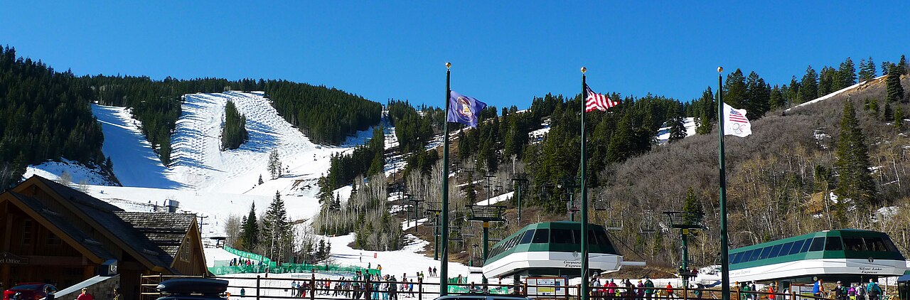
Deer Valley Resort is a downhill ski area in Utah, United States. Mapped terrain includes easy, intermediate, advanced, expert routes. Its mapped lift network extends from approximately 1966 to 2912 metres above sea level.
Data: OpenSkiData / OpenSkiMap, OpenStreetMap contributors (ODbL), Skimap.org, Who's On First, Mapterhorn.
Προετοιμασία γραφημάτων…
Οι ώρες και οι τιμές αντιστοιχούν στην αναλυτική πρόγνωση. Πατήστε μια τιμή για λεπτομέρειες και μετακινήστε οριζόντια τα γραφήματα για επόμενες ημέρες. Ο υετός είναι το συνολικό ισοδύναμο νερού ανά διάστημα, μαζί με το χιόνι. Η χιονόπτωση αφορά νέο χιόνι ανά διάστημα, όχι το ύψος του χιονιού στο έδαφος.
Σύγκριση GFS και ECMWF. Κάθε μοντέλο διατηρεί τις δικές του ώρες και διάρκεια πρόγνωσης. Ο υετός και το νέο χιόνι αφορούν τα διαστήματα κάθε μοντέλου, τα οποία μπορεί να διαφέρουν.
Τιμές πρόγνωσης και σημειώσεις μοντέλων
Deer Valley Resort - Σταθμός βάσης
ECMWF · Εκτέλεση μοντέλου: Αναμενόμενη επόμενη ενημέρωση:
Ημέρα Ώρα (UTC) Θερμ. (°C) Υγρασία (%) Άνεμος (km/h) Άνεμος (κόμβοι) Άνεμος (Bft) Διεύθυνση Υετός (mm) Νέο χιόνι (cm) Πίεση (hPa) Σημείο παγοποίησης (m) Συνθήκες | Τετάρτη, 04/11 06:00 2 80 3 2 1B SE — — 1015 3066 Overcast 97% cloud 09:00 1.7 77 2 1 1B E 0 0 1014 3051 Cloudy 56% cloud 12:00 0.4 82 1 1 1B E 0 0 1014 < 2188 Overcast 91% cloud 15:00 1.8 81 2 1 1B N 0.37 0 1015 2415 Overcast 96% cloud 18:00 2.7 87 2 1 1B N 1.6 0 1016 2492 Overcast 100% cloud 21:00 2.6 89 3 2 1B N 2.4 0 1017 2462 Overcast 100% cloud Πέμπτη, 05/11 00:00 2.8 87 1 1 1B N 0.26 0 1018 2464 Cloudy 75% cloud 03:00 1.9 90 1 0 0B SW 0.06 0 1020 2362 Overcast 85% cloud 06:00 1.4 89 1 0 0B SW 0.03 0 1021 2274 Overcast 98% cloud 09:00 0.6 89 1 0 0B SW 0 0 1022 < 2188 Overcast 81% cloud 12:00 -0.7 90 1 1 0B SW 0 0 1022 < 2188 Overcast 84% cloud 15:00 0.6 87 0 0 0B S 0 0 1023 < 2188 Cloudy 68% cloud 18:00 6.4 62 0 0 0B — 0 0 1020 2817 Cloudy 55% cloud 21:00 9.1 50 3 2 1B NW 0 0 1017 3010 Overcast 99% cloud Παρασκευή, 06/11 00:00 5.4 70 3 2 1B NW 0 0 1019 2876 Overcast 100% cloud 03:00 2.5 83 2 1 1B W 0 0 1022 2567 Overcast 100% cloud 06:00 0.1 85 1 1 1B W 0 0 1023 < 2188 Cloudy 75% cloud 09:00 -1.2 87 2 1 1B W 0 0 1024 < 2188 Cloudy 65% cloud 12:00 -1.2 87 0 0 0B NW 0 0 1026 < 2188 Cloudy 59% cloud 15:00 1.1 84 1 1 1B NE 0 0 1029 2219 Cloudy 63% cloud 18:00 6.1 65 3 2 1B NE 0 0 1026 2861 Clear 13% cloud 21:00 9.1 50 5 3 1B N 0 0 1023 2975 Clear 7% cloud Σάββατο, 07/11 00:00 5.4 67 3 1 1B NW 0 0 1024 2980 Clear 11% cloud 03:00 0.2 87 1 0 0B W 0 0 1026 < 2188 Cloudy 53% cloud 06:00 -1.1 87 2 1 1B W 0 0 1027 2933 Cloudy 50% cloud 09:00 -0.8 81 1 1 1B SW 0 0 1027 2733 Partly cloudy 40% cloud 12:00 0 75 0 0 0B S 0.05 0 1028 2532 Partly cloudy 33% cloud 15:00 1.8 68 0 0 0B — 0 0 1028 3161 Partly cloudy 26% cloud 18:00 8.7 43 1 0 0B NE 0 0 1026 3164 Partly cloudy 22% cloud 21:00 11.8 36 2 1 1B N 0 0 1023 3158 Partly cloudy 36% cloud Κυριακή, 08/11 00:00 7.2 55 2 1 1B NW 0 0 1024 3163 Clear 0% cloud 03:00 3.7 65 1 0 0B SE 0 0 1025 3168 Clear 0% cloud 06:00 2.7 65 1 0 0B S 0 0 1025 3169 Clear 0% cloud 09:00 1.9 65 1 1 0B SE 0 0 1025 3164 Clear 0% cloud 12:00 1.6 62 1 1 1B S 0 0 1024 3160 Clear 0% cloud 15:00 3.7 58 1 1 1B S 0 0 1025 3169 Clear 0% cloud 18:00 12.1 38 3 1 1B S 0 0 1024 3174 Clear 18% cloud 21:00 14.7 29 3 2 1B SW 0 0 1021 3161 Clear 10% cloud Δευτέρα, 09/11 00:00 9 45 2 1 1B SW 0 0 1021 3159 Clear 0% cloud 03:00 4.6 53 1 0 0B SW 0 0 1022 3160 Clear 9% cloud 06:00 3.7 50 1 0 0B S 0 0 1023 3161 Clear 1% cloud 09:00 3.2 49 1 1 1B S 0 0 1022 3155 Clear 2% cloud 12:00 2.8 49 1 1 1B SW 0 0 1022 3148 Clear 0% cloud 15:00 4.4 51 2 1 1B S 0 0 1022 3152 Clear 3% cloud 18:00 13.1 33 2 1 1B S 0 0 1022 3157 Clear 0% cloud 21:00 14.9 29 3 2 1B W 0 0 1019 3151 Cloudy 75% cloud Τρίτη, 10/11 00:00 8.7 51 2 1 1B W 0 0 1020 3152 Partly cloudy 38% cloud 03:00 4.6 59 0 0 0B SW 0 0 1021 3152 Cloudy 65% cloud 06:00 3.7 57 1 0 0B SW 0 0 1022 3154 Partly cloudy 30% cloud |
|---|
Forecast notes
Forecast table times: UTC.
Coordinates: 40.62008°N, -111.4431616°E · Requested elevation: 1996 m. Model terrain: 2185 m. Terrain and 1000/925/850/700 hPa profiles are used for height estimates.
Outside the available profile, temperature uses an estimated 5.5°C/km height correction; wind retains the nearest available model-level value. Humidity is estimated with adjusted pressure and temperature.
These are altitude estimates, not a simulation of local mountain terrain. Precipitation, cloud and sea-level pressure use horizontal interpolation only.
Precipitation includes rain and snow water equivalent: preceding 3 hours through day 6, then 6 hours (see cell tooltip). Snow (cm) estimates fresh snowfall from precipitation and temperature using the GFS conversion; it is not snow depth on the ground. Freezing (m) uses additional 600/500 hPa temperatures when available and estimates the lowest resolved 0°C crossing above sea level. When all sampled levels are warm, the upper profile limit is shown (see tooltip). < marks an entirely cold sampled profile and its lower height limit. No extrapolation is used.
Προετοιμασία γραφημάτων…
Οι ώρες και οι τιμές αντιστοιχούν στην αναλυτική πρόγνωση. Πατήστε μια τιμή για λεπτομέρειες και μετακινήστε οριζόντια τα γραφήματα για επόμενες ημέρες. Ο υετός είναι το συνολικό ισοδύναμο νερού ανά διάστημα, μαζί με το χιόνι. Η χιονόπτωση αφορά νέο χιόνι ανά διάστημα, όχι το ύψος του χιονιού στο έδαφος.
Σύγκριση GFS και ECMWF. Κάθε μοντέλο διατηρεί τις δικές του ώρες και διάρκεια πρόγνωσης. Ο υετός και το νέο χιόνι αφορούν τα διαστήματα κάθε μοντέλου, τα οποία μπορεί να διαφέρουν.
Τιμές πρόγνωσης και σημειώσεις μοντέλων
Deer Valley Resort - Άνω σταθμός
ECMWF · Εκτέλεση μοντέλου: Αναμενόμενη επόμενη ενημέρωση:
Ημέρα Ώρα (UTC) Θερμ. (°C) Υγρασία (%) Άνεμος (km/h) Άνεμος (κόμβοι) Άνεμος (Bft) Διεύθυνση Υετός (mm) Νέο χιόνι (cm) Πίεση (hPa) Σημείο παγοποίησης (m) Συνθήκες | Τετάρτη, 04/11 06:00 2 52 21 11 4B S — — 1015 3065 Overcast 97% cloud 09:00 0.7 66 13 7 3B S 0 0 1014 3051 Partly cloudy 46% cloud 12:00 -0.7 76 13 7 3B SW 0 0 1014 < 2140 Overcast 92% cloud 15:00 -1.7 85 6 3 1B SW 0.26 0.1 1015 2426 Overcast 95% cloud 18:00 -2.2 93 12 6 2B N 1.1 0.3 1016 2508 Overcast 100% cloud 21:00 -2.5 95 18 10 3B N 2.6 0.8 1017 2482 Overcast 100% cloud Πέμπτη, 05/11 00:00 -2.7 96 18 10 3B N 0.28 0.1 1018 2482 Cloudy 72% cloud 03:00 -2.7 87 10 5 2B N 0.07 0 1020 2406 Overcast 83% cloud 06:00 -2.9 90 8 4 2B N 0 0 1021 2281 Overcast 95% cloud 09:00 -3 84 4 2 1B NE 0 0 1021 < 2140 Overcast 81% cloud 12:00 -2.6 79 6 3 2B SE 0 0 1022 < 2140 Overcast 88% cloud 15:00 -2.4 83 13 7 3B S 0 0 1023 2176 Cloudy 74% cloud 18:00 -0.9 75 16 8 3B S 0 0 1021 2801 Cloudy 63% cloud 21:00 0.7 68 9 5 2B S 0 0 1017 2988 Overcast 99% cloud Παρασκευή, 06/11 00:00 -0.3 75 6 3 1B SW 0 0 1020 2871 Overcast 100% cloud 03:00 -1.4 82 3 2 1B SW 0 0 1021 2528 Overcast 100% cloud 06:00 -1.9 84 3 2 1B S 0 0 1023 < 2140 Cloudy 71% cloud 09:00 -2.5 84 3 2 1B W 0 0 1024 < 2140 Cloudy 68% cloud 12:00 -2.4 79 3 2 1B N 0 0 1026 < 2140 Cloudy 61% cloud 15:00 -2 75 6 3 2B N 0 0 1028 2238 Cloudy 59% cloud 18:00 -0.4 64 6 3 2B NE 0 0 1026 2858 Clear 12% cloud 21:00 0.5 66 3 2 1B N 0.01 0 1023 2959 Clear 13% cloud Σάββατο, 07/11 00:00 0.4 58 2 1 1B NE 0 0 1024 2991 Clear 20% cloud 03:00 -0.2 49 1 1 1B W 0 0 1026 < 2140 Cloudy 68% cloud 06:00 0 42 4 2 1B NW 0 0 1027 2906 Cloudy 60% cloud 09:00 0.8 34 8 4 2B NW 0 0 1027 2632 Partly cloudy 45% cloud 12:00 1.3 29 9 5 2B N 0.05 0 1028 2411 Partly cloudy 36% cloud 15:00 2 29 9 5 2B N 0 0 1029 3161 Partly cloudy 32% cloud 18:00 4.2 24 6 3 2B N 0 0 1026 3164 Partly cloudy 22% cloud 21:00 5.3 26 3 2 1B N 0 0 1023 3158 Partly cloudy 33% cloud Κυριακή, 08/11 00:00 4.3 33 3 2 1B N 0 0 1024 3163 Clear 0% cloud 03:00 3.7 46 2 1 1B N 0 0 1025 3168 Clear 0% cloud 06:00 4 44 3 2 1B SW 0 0 1025 3169 Clear 0% cloud 09:00 4.1 35 8 4 2B S 0 0 1025 3164 Clear 0% cloud 12:00 3.9 34 10 5 2B SW 0 0 1024 3160 Clear 0% cloud 15:00 4.2 35 13 7 3B SW 0 0 1025 3169 Clear 0% cloud 18:00 6.4 32 13 7 3B W 0 0 1024 3174 Clear 17% cloud 21:00 6.8 34 10 5 2B SW 0 0 1021 3161 Clear 12% cloud Δευτέρα, 09/11 00:00 6 34 8 5 2B SW 0 0 1021 3159 Clear 0% cloud 03:00 5.3 31 10 6 2B SW 0 0 1022 3160 Clear 10% cloud 06:00 4.6 32 13 7 3B SW 0 0 1023 3161 Clear 1% cloud 09:00 4.6 33 14 8 3B SW 0 0 1022 3155 Clear 2% cloud 12:00 4.3 32 14 8 3B SW 0 0 1022 3148 Clear 0% cloud 15:00 4.4 34 15 8 3B W 0 0 1022 3152 Clear 4% cloud 18:00 6.2 33 13 7 3B SW 0 0 1022 3157 Clear 0% cloud 21:00 6.4 39 8 4 2B W 0 0 1019 3151 Cloudy 76% cloud Τρίτη, 10/11 00:00 5 46 3 2 1B W 0 0 1020 3152 Partly cloudy 39% cloud 03:00 4 45 6 3 2B SW 0 0 1021 3152 Cloudy 67% cloud 06:00 3.7 39 10 6 2B W 0 0 1022 3154 Partly cloudy 30% cloud |
|---|
Forecast notes
Forecast table times: UTC.
Coordinates: 40.6123779°N, -111.5275309°E · Requested elevation: 2912 m. Model terrain: 2138 m. Terrain and 1000/925/850/700 hPa profiles are used for height estimates.
These are altitude estimates, not a simulation of local mountain terrain. Precipitation, cloud and sea-level pressure use horizontal interpolation only.
Precipitation includes rain and snow water equivalent: preceding 3 hours through day 6, then 6 hours (see cell tooltip). Snow (cm) estimates fresh snowfall from precipitation and temperature using the GFS conversion; it is not snow depth on the ground. Freezing (m) uses additional 600/500 hPa temperatures when available and estimates the lowest resolved 0°C crossing above sea level. When all sampled levels are warm, the upper profile limit is shown (see tooltip). < marks an entirely cold sampled profile and its lower height limit. No extrapolation is used.