Cervinia · Matterhorn · Panorama

Provider panorama/video player. Capture time is shown by the camera.
Open camera page ↗
各色は表示された値から始まります。風の色は3種類の単位で対応しています。降水のないセルは中立色です。色は表示値を示すもので、公的な気象警報ではありません。
予報グラフを準備中…
時刻と値は詳細予報と一致します。値をタップするかカーソルを合わせると詳細が表示されます。先の日付を見るには各グラフを横にスクロールしてください。雨・降水量は雪を含む各予報時間帯の水換算量です。降雪量は各時間帯の新雪量であり、積雪深ではありません。
GFSとECMWFのモデル比較です。各モデル固有の予報時刻と予報期間を維持しています。降水量と降雪量はそれぞれの予報時間帯の合計であり、時間帯はモデル間で異なる場合があります。
ECMWF · モデル計算時刻: 次回更新予定:
日 時刻(UTC) 気温(°C) 湿度(%) 風速(km/h) 風速(ノット) 風(ビューフォート) 風向 降水量(mm) 降雪量(cm) 気圧(hPa) 0°C高度(m) 天気 | 水曜日, 04/11 06:00 -3.1 76 3 2 1B S — — 1024 < 2651 Overcast 96% cloud  09:00 -1.7 78 6 3 2B SE 0.13 0 1025 < 2651 Overcast 100% cloud 12:00 -1.3 78 7 4 2B SE 0.33 0.1 1025 < 2651 Overcast 100% cloud 15:00 -1.5 79 7 4 2B SE 0.84 0.3 1025 < 2651 Overcast 100% cloud 18:00 -1.9 80 6 3 2B SE 0.38 0.1 1027 < 2651 Overcast 99% cloud 21:00 -2.4 77 5 3 1B SE 0.13 0 1028 < 2651 Overcast 99% cloud 木曜日, 05/11 00:00 -2.1 77 5 3 1B SE 0.10 0 1028 < 2651 Overcast 99% cloud 03:00 -2 78 6 3 1B SE 0.22 0 1027 < 2651 Overcast 99% cloud 06:00 -1.9 78 4 2 1B SE 0 0 1027 < 2651 Overcast 99% cloud 09:00 0.2 78 5 3 1B SE 0.12 0 1028 < 2651 Overcast 100% cloud 12:00 1.7 75 5 3 1B S 0 0 1027 < 2651 Overcast 99% cloud 15:00 2 74 4 2 1B S 0 0 1025 < 2651 Overcast 81% cloud 18:00 -0.8 79 2 1 1B SE 0.36 0.1 1025 < 2651 Overcast 97% cloud 21:00 -0.1 78 2 1 1B SE 1.1 0.3 1025 < 2651 Overcast 100% cloud 金曜日, 06/11 00:00 0.3 79 4 2 1B SE 0.49 0.1 1023 < 2651 Overcast 100% cloud 03:00 0.2 81 3 2 1B SE 1.7 0.5 1022 < 2651 Overcast 100% cloud 06:00 0.8 80 4 2 1B SE 0.63 0.2 1021 < 2651 Overcast 100% cloud 09:00 1.6 80 5 3 1B SE 0.24 0 1022 < 2651 Overcast 100% cloud 12:00 1.6 80 3 2 1B SE 1.1 0 1021 < 2651 Overcast 100% cloud 15:00 1.3 80 2 1 1B SE 2.6 0 1020 < 2651 Overcast 100% cloud 18:00 0.3 81 1 0 0B E 2.0 0.6 1020 < 2651 Overcast 100% cloud 21:00 -0.1 81 1 1 0B NE 1.3 0.4 1021 < 2651 Overcast 100% cloud 土曜日, 07/11 00:00 -0.5 82 1 0 0B N 1.1 0.3 1021 < 2651 Overcast 100% cloud 03:00 -0.9 81 1 1 1B N 0.23 0 1021 < 2651 Overcast 98% cloud 06:00 -1.2 80 1 0 0B NE 0.39 0.1 1022 < 2651 Overcast 100% cloud 09:00 -0.8 80 2 1 1B S 0.69 0.2 1023 < 2651 Overcast 100% cloud 12:00 -0.2 75 3 2 1B S 0.57 0.2 1022 < 2651 Overcast 100% cloud 15:00 -0.8 78 3 2 1B S 1.0 0.3 1023 < 2651 Overcast 100% cloud 18:00 -1.3 79 2 1 1B S 0.53 0.2 1024 < 2651 Overcast 88% cloud 21:00 -1.7 79 1 1 1B S 0.11 0 1025 < 2651 Overcast 85% cloud 日曜日, 08/11 00:00 -2.7 75 0 0 0B W 0 0 1025 < 2651 Cloudy 76% cloud  03:00 -6.7 72 0 0 0B N 0 0 1024 < 2651 Cloudy 73% cloud 06:00 -9.6 67 0 0 0B — 0 0 1024 < 2651 Partly cloudy 40% cloud  09:00 -3.9 49 1 0 0B W 0 0 1025 < 2651 Clear 19% cloud  12:00 -0.4 44 2 1 1B SW 0 0 1025 < 2651 Clear 9% cloud 15:00 -2.1 45 1 1 1B S 0 0 1023 < 2651 Clear 3% cloud 18:00 -4.7 46 1 0 0B SW 0 0 1023 < 2651 Partly cloudy 39% cloud 21:00 -2.6 52 2 1 1B S 0 0 1022 < 2651 Overcast 96% cloud 月曜日, 09/11 00:00 -1.3 62 1 1 1B S 0.04 0 1022 < 2651 Overcast 93% cloud 03:00 -1.5 66 1 1 1B SW 0 0 1021 < 2651 Cloudy 62% cloud 06:00 -2 70 1 1 1B S 0 0 1021 < 2651 Cloudy 75% cloud 09:00 1 64 3 2 1B S 0 0 1021 < 2651 Overcast 84% cloud 12:00 2.5 67 4 2 1B S 0.13 0 1021 < 2651 Overcast 99% cloud 15:00 2.9 72 3 2 1B S 0.19 0 1019 < 2651 Overcast 91% cloud 18:00 2 77 3 2 1B S 0.15 0 1019 < 2651 Overcast 96% cloud 21:00 2 76 3 2 1B S 0.09 0 1018 < 2651 Overcast 97% cloud 火曜日, 10/11 00:00 1.3 78 3 1 1B S 0 0 1017 < 2651 Overcast 99% cloud 03:00 2 78 3 1 1B S 0 0 1015 < 2651 Overcast 99% cloud 06:00 2.5 79 3 2 1B S 0.41 0 1014 < 2651 Overcast 100% cloud |
|---|
Forecast table times: UTC.
Coordinates: 45.93425891°N, 7.63363123°E · Requested elevation: 2023 m. Model terrain: 2648 m. Terrain and 1000/925/850/700 hPa profiles are used for height estimates.
Outside the available profile, temperature uses an estimated 5.5°C/km height correction; wind retains the nearest available model-level value. Humidity is estimated with adjusted pressure and temperature.
These are altitude estimates, not a simulation of local mountain terrain. Precipitation, cloud and sea-level pressure use horizontal interpolation only.
Precipitation includes rain and snow water equivalent: preceding 3 hours through day 6, then 6 hours (see cell tooltip). Snow (cm) estimates fresh snowfall from precipitation and temperature using the GFS conversion; it is not snow depth on the ground. Freezing (m) uses additional 600/500 hPa temperatures when available and estimates the lowest resolved 0°C crossing above sea level. When all sampled levels are warm, the upper profile limit is shown (see tooltip). < marks an entirely cold sampled profile and its lower height limit. No extrapolation is used.
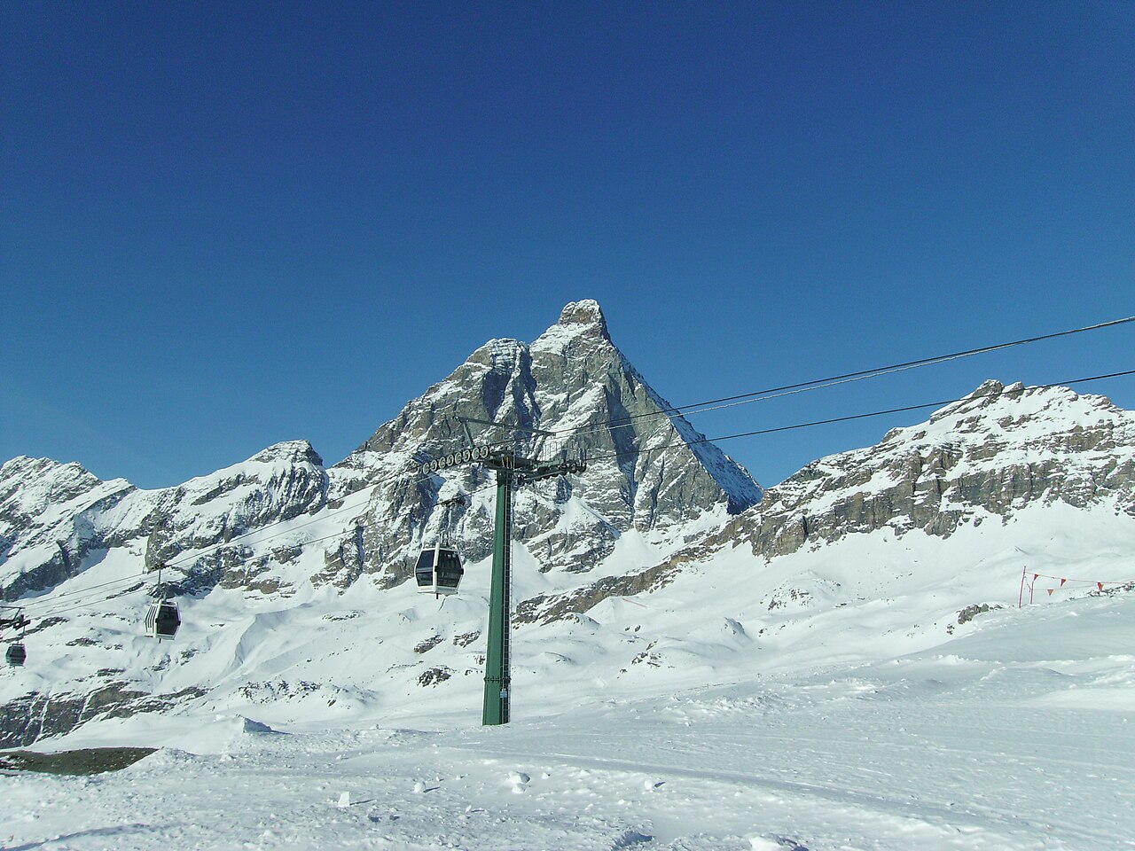
Breuil-Cervinia is the Italian starting point for skiing beneath the Matterhorn, known here as the Cervino. Its linked area includes Valtournenche and the Swiss resort of Zermatt. This is a cross-border ski area with several bases, not a descent from the summit of the Matterhorn: the mountain’s height should not be mistaken for the height of a ski lift or piste.
The forecast point on this page is at 2,023 m. That represents the lower resort rather than Plateau Rosà or the upper connections. A webcam showing snow high on the glacier can therefore be consistent with a warmer forecast here. To assess the day you intend to ski, choose the relevant mountain elevation and follow wind and temperature as well as snowfall.
The Italian operator publishes separate lift and piste information for Breuil-Cervinia, Valtournenche and Zermatt. Check the actual international connection before making it part of your itinerary, including the return. A lift marked as scheduled to open is not the same as an operating lift. For arrival and departure days, also look at the lower-elevation forecast along your route instead of relying only on the mountain outlook.
Official sources: Cervino Ski Paradise — skiing · Cervino Ski Paradise — lifts and pistes. Reviewed 18 October 2026.
Provider panorama/video player. Capture time is shown by the camera.
Open camera page ↗