Previsiones para estaciones de esquí de todo el mundo

Guía de colores Temperatura · Viento · Lluvia · Nieve
Cada color comienza en el valor indicado. Los colores del viento coinciden en las tres unidades. Las celdas sin precipitación permanecen neutras. Los colores describen los valores mostrados, no son avisos meteorológicos oficiales.
Preparando gráficos de previsión…
Las horas y los valores coinciden con la previsión detallada. Toca un valor para ver detalles y desplaza los gráficos horizontalmente para los próximos días. La precipitación es el equivalente total en agua por intervalo, incluida la nieve; la nieve nueva corresponde a cada intervalo, no al espesor de nieve en el suelo.
Comparación de GFS y ECMWF. Cada modelo conserva sus propias horas y horizonte de previsión. Las cantidades de precipitación y nieve corresponden a sus propios intervalos, que pueden diferir entre modelos.
Valores de previsión y notas de los modelos
Bodental - Base lift station
ECMWF · Ejecución del modelo: Próxima actualización prevista:
Día Hora (UTC) Temp. (°C) Humedad (%) Viento (km/h) Viento (nudos) Viento (Bft) Dirección Precip. (mm) Nieve nueva (cm) Presión (hPa) Isoterma de 0 °C (m) Condiciones | Miércoles, 04/11 06:00 1.6 99 4 2 1B NE — — 1028 1319 Overcast 100% cloud  09:00 2.2 99 5 2 1B NE 0.43 0 1029 1410 Overcast 100% cloud 12:00 3.5 94 5 2 1B NE 0.53 0 1029 1475 Overcast 100% cloud 15:00 3.9 89 5 3 1B NE 0.16 0 1028 1507 Overcast 99% cloud 18:00 2.4 98 3 2 1B E 0.00 0 1030 1425 Overcast 100% cloud 21:00 2.2 98 2 1 1B E 0 0 1032 1369 Overcast 100% cloud Jueves, 05/11 00:00 1.8 99 3 2 1B E 0.12 0 1032 1328 Overcast 100% cloud 03:00 1.7 98 2 1 1B E 0.02 0 1032 1305 Overcast 100% cloud 06:00 1.5 99 3 1 1B E 0.01 0 1032 1277 Overcast 100% cloud 09:00 2.9 90 3 2 1B E 0.12 0 1032 1358 Overcast 100% cloud 12:00 4.7 78 3 2 1B E 0.10 0 1030 1505 Overcast 100% cloud 15:00 4.7 79 3 2 1B NE 0 0 1029 2304 Partly cloudy 47% cloud  18:00 1.9 91 3 1 1B SE 0 0 1030 2581 Clear 16% cloud  21:00 0.9 91 2 1 1B SE 0 0 1030 2777 Partly cloudy 42% cloud Viernes, 06/11 00:00 -0.2 92 2 1 1B S 0 0 1029 1044 Cloudy 75% cloud  03:00 0.3 90 2 1 1B S 0 0 1028 958 Overcast 94% cloud 06:00 0.8 88 1 1 1B S 0 0 1027 2948 Overcast 80% cloud 09:00 4 79 2 1 1B E 0 0 1027 2985 Partly cloudy 37% cloud 12:00 6.6 69 2 1 1B NE 0 0 1025 2808 Clear 12% cloud 15:00 5.5 81 2 1 1B E 0 0 1024 2732 Clear 1% cloud 18:00 2.2 88 2 1 1B SE 0 0 1024 2591 Clear 6% cloud 21:00 0.8 89 3 2 1B SE 0 0 1026 2130 Partly cloudy 28% cloud Sábado, 07/11 00:00 0.3 87 3 2 1B E 0 0 1027 1739 Partly cloudy 38% cloud 03:00 -0.3 91 3 2 1B E 0 0 1027 < 888 Overcast 95% cloud 06:00 -0.3 88 4 2 1B E 0 0 1028 < 888 Overcast 99% cloud 09:00 1.6 73 2 1 1B E 0 0 1029 1342 Cloudy 69% cloud 12:00 4.1 69 3 2 1B NE 0 0 1027 1470 Overcast 100% cloud 15:00 3.3 78 2 1 1B E 0 0 1026 1538 Overcast 97% cloud 18:00 0.6 80 3 2 1B SE 0 0 1027 1450 Clear 6% cloud 21:00 -0.7 83 3 2 1B SE 0 0 1028 < 888 Clear 17% cloud Domingo, 08/11 00:00 -0.6 83 2 1 1B SE 0 0 1028 < 888 Partly cloudy 45% cloud 03:00 -0.8 78 1 1 1B SE 0 0 1028 1466 Partly cloudy 23% cloud 06:00 -0.4 73 2 1 1B S 0.02 0 1028 1254 Overcast 97% cloud 09:00 2.9 73 1 0 0B SW 0.46 0 1028 1773 Clear 15% cloud 12:00 5.6 67 2 1 1B SW 0.03 0 1026 1857 Clear 12% cloud 15:00 4.4 78 3 2 1B S 0 0 1025 1964 Clear 2% cloud 18:00 0.7 86 4 2 1B S 0 0 1026 1994 Clear 0% cloud 21:00 -0.1 88 4 2 1B SW 0 0 1026 1027 Clear 0% cloud Lunes, 09/11 00:00 0.5 84 4 2 1B SW 0 0 1026 1976 Clear 0% cloud 03:00 0.7 82 3 2 1B SW 0 0 1025 2077 Clear 3% cloud 06:00 0.8 83 4 2 1B SW 0 0 1025 2139 Cloudy 75% cloud 09:00 4.9 74 5 3 1B W 0 0 1025 2264 Cloudy 73% cloud 12:00 7.6 62 9 5 2B SW 0 0 1022 2480 Cloudy 55% cloud 15:00 5.4 77 7 4 2B SW 0 0 1021 2729 Cloudy 79% cloud 18:00 2.1 94 9 5 2B SW 0 0 1022 2879 Overcast 81% cloud 21:00 2.9 96 10 6 2B SW 0.00 0 1021 3010 Cloudy 72% cloud Martes, 10/11 00:00 3.6 96 10 6 2B SW 0.00 0 1020 3053 Overcast 94% cloud 03:00 4.6 95 10 5 2B SW 0.04 0 1018 2996 Overcast 93% cloud 06:00 4.8 94 10 6 2B SW 0.16 0 1017 3054 Overcast 94% cloud |
|---|
Forecast notes
Forecast table times: UTC.
Coordinates: 46.4783582°N, 14.2318766°E · Requested elevation: 1008 m. Model terrain: 885 m. Terrain and 1000/925/850/700 hPa profiles are used for height estimates.
These are altitude estimates, not a simulation of local mountain terrain. Precipitation, cloud and sea-level pressure use horizontal interpolation only.
Precipitation includes rain and snow water equivalent: preceding 3 hours through day 6, then 6 hours (see cell tooltip). Snow (cm) estimates fresh snowfall from precipitation and temperature using the GFS conversion; it is not snow depth on the ground. Freezing (m) uses additional 600/500 hPa temperatures when available and estimates the lowest resolved 0°C crossing above sea level. When all sampled levels are warm, the upper profile limit is shown (see tooltip). < marks an entirely cold sampled profile and its lower height limit. No extrapolation is used.
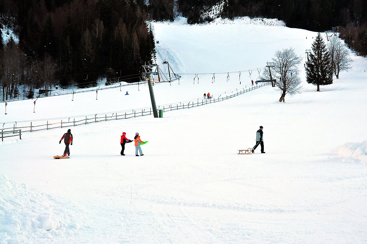
Bodental is a mapped downhill ski area in AT. Forecasts cover three real lift-station locations from approximately 1008 to 1170 metres. Elevations are terrain-model estimates.
Data: OpenSkiData / OpenSkiMap, OpenStreetMap contributors (ODbL), Skimap.org, Who's On First, Mapterhorn.
Preparando gráficos de previsión…
Las horas y los valores coinciden con la previsión detallada. Toca un valor para ver detalles y desplaza los gráficos horizontalmente para los próximos días. La precipitación es el equivalente total en agua por intervalo, incluida la nieve; la nieve nueva corresponde a cada intervalo, no al espesor de nieve en el suelo.
Comparación de GFS y ECMWF. Cada modelo conserva sus propias horas y horizonte de previsión. Las cantidades de precipitación y nieve corresponden a sus propios intervalos, que pueden diferir entre modelos.
Valores de previsión y notas de los modelos
Bodental - Middle lift station
ECMWF · Ejecución del modelo: Próxima actualización prevista:
Día Hora (UTC) Temp. (°C) Humedad (%) Viento (km/h) Viento (nudos) Viento (Bft) Dirección Precip. (mm) Nieve nueva (cm) Presión (hPa) Isoterma de 0 °C (m) Condiciones | Miércoles, 04/11 06:00 1 99 6 3 2B E — — 1028 1319 Overcast 100% cloud 09:00 1.6 99 7 4 2B E 0.42 0 1029 1410 Overcast 100% cloud 12:00 2.6 95 6 3 1B E 0.53 0 1029 1473 Overcast 100% cloud 15:00 3 91 6 3 2B NE 0.16 0 1028 1506 Overcast 99% cloud 18:00 1.7 98 5 3 1B E 0.00 0 1030 1423 Overcast 100% cloud 21:00 1.5 99 4 2 1B E 0 0 1032 1368 Overcast 100% cloud Jueves, 05/11 00:00 1.2 99 4 2 1B E 0.12 0 1032 1328 Overcast 100% cloud 03:00 1.1 98 4 2 1B E 0.02 0 1032 1306 Overcast 100% cloud 06:00 0.9 100 4 2 1B E 0.01 0 1032 1278 Overcast 100% cloud 09:00 1.9 93 4 2 1B E 0.12 0 1032 1358 Overcast 100% cloud 12:00 3.6 82 3 2 1B E 0.10 0 1030 1505 Overcast 99% cloud 15:00 3.9 81 3 2 1B E 0 0 1029 2303 Partly cloudy 47% cloud 18:00 1.7 90 4 2 1B SE 0 0 1030 2585 Clear 16% cloud 21:00 1 89 4 2 1B SE 0 0 1030 2780 Partly cloudy 41% cloud Viernes, 06/11 00:00 0.4 88 3 2 1B SE 0 0 1029 1042 Cloudy 74% cloud 03:00 0.9 84 3 2 1B S 0 0 1028 958 Overcast 93% cloud 06:00 1.4 81 3 1 1B S 0 0 1027 2948 Cloudy 80% cloud 09:00 3.8 75 3 2 1B SE 0 0 1027 2985 Partly cloudy 36% cloud 12:00 5.8 70 3 1 1B E 0 0 1025 2810 Clear 12% cloud 15:00 5.1 79 4 2 1B E 0 0 1024 2732 Clear 1% cloud 18:00 2.3 86 4 2 1B E 0 0 1024 2591 Clear 6% cloud 21:00 0.9 88 6 3 1B SE 0 0 1026 2131 Partly cloudy 28% cloud Sábado, 07/11 00:00 0.3 84 6 3 2B E 0 0 1027 1741 Partly cloudy 38% cloud 03:00 -0.3 85 6 3 2B E 0 0 1027 < 882 Overcast 94% cloud 06:00 -0.4 80 7 4 2B E 0 0 1028 < 882 Overcast 99% cloud 09:00 1.1 68 5 3 1B E 0 0 1029 1344 Cloudy 70% cloud 12:00 3 70 4 2 1B E 0 0 1027 1470 Overcast 100% cloud 15:00 2.6 78 4 2 1B E 0 0 1026 1537 Overcast 97% cloud 18:00 0.4 77 5 3 1B E 0 0 1027 1449 Clear 6% cloud 21:00 -0.6 81 5 2 1B SE 0 0 1028 < 882 Clear 17% cloud Domingo, 08/11 00:00 -0.5 81 3 2 1B SE 0 0 1028 < 882 Partly cloudy 45% cloud 03:00 -0.6 74 2 1 1B SE 0 0 1028 1457 Partly cloudy 23% cloud 06:00 -0.2 70 4 2 1B SW 0.02 0 1028 1249 Overcast 97% cloud 09:00 2.5 73 3 2 1B SW 0.46 0 1028 1775 Clear 16% cloud 12:00 4.8 69 4 2 1B SW 0.04 0 1026 1858 Clear 13% cloud 15:00 4 78 5 3 1B SW 0 0 1025 1964 Clear 2% cloud 18:00 1.1 84 5 3 1B SW 0 0 1026 1994 Clear 0% cloud 21:00 0.4 86 5 3 1B SW 0 0 1026 1019 Clear 0% cloud Lunes, 09/11 00:00 0.8 82 6 3 2B SW 0 0 1026 1976 Clear 0% cloud 03:00 1 78 6 3 2B W 0 0 1025 2078 Clear 3% cloud 06:00 1.1 78 8 4 2B W 0 0 1025 2140 Cloudy 75% cloud 09:00 4.2 72 9 5 2B SW 0 0 1025 2265 Cloudy 73% cloud 12:00 6.4 66 12 6 2B SW 0 0 1022 2478 Cloudy 55% cloud 15:00 4.6 79 11 6 2B SW 0 0 1021 2729 Cloudy 79% cloud 18:00 2.2 93 13 7 3B SW 0 0 1022 2882 Overcast 82% cloud 21:00 3 95 16 9 3B SW 0.00 0 1021 3012 Cloudy 73% cloud Martes, 10/11 00:00 3.6 96 17 9 3B SW 0.00 0 1020 3047 Overcast 94% cloud 03:00 4.5 95 16 9 3B SW 0.05 0 1018 2991 Overcast 93% cloud 06:00 4.8 94 17 9 3B SW 0.17 0 1017 3054 Overcast 95% cloud |
|---|
Forecast notes
Forecast table times: UTC.
Coordinates: 46.4734662°N, 14.2315418°E · Requested elevation: 1121 m. Model terrain: 880 m. Terrain and 1000/925/850/700 hPa profiles are used for height estimates.
These are altitude estimates, not a simulation of local mountain terrain. Precipitation, cloud and sea-level pressure use horizontal interpolation only.
Precipitation includes rain and snow water equivalent: preceding 3 hours through day 6, then 6 hours (see cell tooltip). Snow (cm) estimates fresh snowfall from precipitation and temperature using the GFS conversion; it is not snow depth on the ground. Freezing (m) uses additional 600/500 hPa temperatures when available and estimates the lowest resolved 0°C crossing above sea level. When all sampled levels are warm, the upper profile limit is shown (see tooltip). < marks an entirely cold sampled profile and its lower height limit. No extrapolation is used.
Preparando gráficos de previsión…
Las horas y los valores coinciden con la previsión detallada. Toca un valor para ver detalles y desplaza los gráficos horizontalmente para los próximos días. La precipitación es el equivalente total en agua por intervalo, incluida la nieve; la nieve nueva corresponde a cada intervalo, no al espesor de nieve en el suelo.
Comparación de GFS y ECMWF. Cada modelo conserva sus propias horas y horizonte de previsión. Las cantidades de precipitación y nieve corresponden a sus propios intervalos, que pueden diferir entre modelos.
Valores de previsión y notas de los modelos
Bodental - Top lift station
ECMWF · Ejecución del modelo: Próxima actualización prevista:
Día Hora (UTC) Temp. (°C) Humedad (%) Viento (km/h) Viento (nudos) Viento (Bft) Dirección Precip. (mm) Nieve nueva (cm) Presión (hPa) Isoterma de 0 °C (m) Condiciones | Miércoles, 04/11 06:00 0.8 99 7 4 2B E — — 1028 1319 Overcast 100% cloud 09:00 1.3 99 8 4 2B E 0.42 0 1029 1410 Overcast 100% cloud 12:00 2.3 96 6 3 2B E 0.53 0 1029 1473 Overcast 100% cloud 15:00 2.6 92 7 4 2B E 0.16 0 1028 1506 Overcast 99% cloud 18:00 1.4 98 6 3 2B E 0.00 0 1030 1423 Overcast 100% cloud 21:00 1.2 99 5 3 1B E 0 0 1032 1368 Overcast 100% cloud Jueves, 05/11 00:00 0.9 100 5 3 1B E 0.12 0 1032 1328 Overcast 100% cloud 03:00 0.8 99 5 2 1B E 0.01 0 1032 1306 Overcast 100% cloud 06:00 0.6 100 5 2 1B E 0.01 0 1032 1278 Overcast 100% cloud 09:00 1.5 93 5 3 1B SE 0.12 0 1032 1358 Overcast 100% cloud 12:00 3.2 83 4 2 1B E 0.10 0 1030 1505 Overcast 99% cloud 15:00 3.5 82 4 2 1B E 0 0 1029 2301 Partly cloudy 47% cloud 18:00 1.7 89 5 3 1B SE 0 0 1030 2584 Clear 15% cloud 21:00 1 89 4 2 1B SE 0 0 1030 2780 Partly cloudy 41% cloud Viernes, 06/11 00:00 0.6 86 3 2 1B SE 0 0 1029 1039 Cloudy 74% cloud 03:00 1.2 82 4 2 1B S 0 0 1028 957 Overcast 93% cloud 06:00 1.7 78 3 2 1B S 0 0 1027 2948 Cloudy 80% cloud 09:00 3.7 74 4 2 1B SE 0 0 1027 2985 Partly cloudy 36% cloud 12:00 5.4 71 3 2 1B SE 0 0 1025 2809 Clear 12% cloud 15:00 4.9 78 4 2 1B SE 0 0 1024 2732 Clear 1% cloud 18:00 2.4 85 5 3 1B E 0 0 1024 2592 Clear 6% cloud 21:00 1 88 7 4 2B E 0 0 1026 2131 Partly cloudy 28% cloud Sábado, 07/11 00:00 0.3 83 7 4 2B E 0 0 1027 1742 Partly cloudy 39% cloud 03:00 -0.3 82 8 4 2B E 0 0 1027 < 881 Overcast 94% cloud 06:00 -0.5 77 8 4 2B E 0 0 1028 < 881 Overcast 99% cloud 09:00 0.8 65 7 4 2B E 0 0 1029 1344 Cloudy 70% cloud 12:00 2.6 71 4 2 1B E 0 0 1027 1469 Overcast 100% cloud 15:00 2.3 78 5 3 1B E 0 0 1026 1536 Overcast 97% cloud 18:00 0.4 76 6 3 2B E 0 0 1027 1448 Clear 6% cloud 21:00 -0.6 80 5 3 1B E 0 0 1028 < 881 Clear 18% cloud Domingo, 08/11 00:00 -0.5 80 4 2 1B SE 0 0 1028 < 881 Partly cloudy 45% cloud 03:00 -0.5 73 3 1 1B SE 0 0 1028 1456 Partly cloudy 23% cloud 06:00 -0.1 68 4 2 1B SW 0.02 0 1028 1247 Overcast 97% cloud 09:00 2.4 74 4 2 1B SW 0.47 0 1028 1775 Clear 16% cloud 12:00 4.5 71 5 3 1B SW 0.04 0 1026 1857 Clear 13% cloud 15:00 3.8 78 6 3 2B SW 0 0 1025 1964 Clear 2% cloud 18:00 1.3 83 6 3 2B SW 0 0 1026 1994 Clear 0% cloud 21:00 0.6 85 6 3 2B SW 0 0 1026 1017 Clear 0% cloud Lunes, 09/11 00:00 1 81 7 4 2B W 0 0 1026 1976 Clear 0% cloud 03:00 1.1 76 7 4 2B W 0 0 1025 2078 Clear 3% cloud 06:00 1.2 77 9 5 2B W 0 0 1025 2139 Cloudy 75% cloud 09:00 4 71 10 5 2B SW 0 0 1025 2265 Cloudy 73% cloud 12:00 5.8 68 13 7 3B SW 0 0 1022 2476 Cloudy 55% cloud 15:00 4.3 80 13 7 3B SW 0 0 1021 2728 Cloudy 80% cloud 18:00 2.2 93 16 8 3B SW 0 0 1022 2881 Overcast 82% cloud 21:00 3 95 19 10 3B SW 0.00 0 1021 3013 Cloudy 73% cloud Martes, 10/11 00:00 3.6 96 19 10 3B SW 0.00 0 1020 3046 Overcast 94% cloud 03:00 4.5 95 19 10 3B SW 0.05 0 1018 2992 Overcast 93% cloud 06:00 4.9 94 20 11 3B SW 0.17 0 1017 3054 Overcast 95% cloud |
|---|
Forecast notes
Forecast table times: UTC.
Coordinates: 46.4728054°N, 14.2344202°E · Requested elevation: 1170 m. Model terrain: 878 m. Terrain and 1000/925/850/700 hPa profiles are used for height estimates.
These are altitude estimates, not a simulation of local mountain terrain. Precipitation, cloud and sea-level pressure use horizontal interpolation only.
Precipitation includes rain and snow water equivalent: preceding 3 hours through day 6, then 6 hours (see cell tooltip). Snow (cm) estimates fresh snowfall from precipitation and temperature using the GFS conversion; it is not snow depth on the ground. Freezing (m) uses additional 600/500 hPa temperatures when available and estimates the lowest resolved 0°C crossing above sea level. When all sampled levels are warm, the upper profile limit is shown (see tooltip). < marks an entirely cold sampled profile and its lower height limit. No extrapolation is used.