世界のスキー場の天気予報

色の凡例 気温 · 風 · 雨 · 雪
各色は表示された値から始まります。風の色は3種類の単位で対応しています。降水のないセルは中立色です。色は表示値を示すもので、公的な気象警報ではありません。
予報グラフを準備中…
時刻と値は詳細予報と一致します。値をタップするかカーソルを合わせると詳細が表示されます。先の日付を見るには各グラフを横にスクロールしてください。雨・降水量は雪を含む各予報時間帯の水換算量です。降雪量は各時間帯の新雪量であり、積雪深ではありません。
GFSとECMWFのモデル比較です。各モデル固有の予報時刻と予報期間を維持しています。降水量と降雪量はそれぞれの予報時間帯の合計であり、時間帯はモデル間で異なる場合があります。
予報値とモデルに関する注記
Bear Valley - Low lift station
ECMWF · モデル計算時刻: 次回更新予定:
日 時刻(UTC) 気温(°C) 湿度(%) 風速(km/h) 風速(ノット) 風(ビューフォート) 風向 降水量(mm) 降雪量(cm) 気圧(hPa) 0°C高度(m) 天気 | 水曜日, 04/11 06:00 -0.4 94 2 1 1B SE — — 1019 < 2203 Cloudy 68% cloud  09:00 -4.9 91 4 2 1B NE 0 0 1019 < 2203 Overcast 98% cloud  12:00 -7.6 84 7 4 2B NE 0 0 1018 < 2203 Cloudy 56% cloud 15:00 -6.2 85 13 7 3B NE 0 0 1017 3048 Partly cloudy 46% cloud  18:00 8.1 39 6 3 2B NE 0 0 1016 3084 Clear 0% cloud  21:00 9.9 40 6 3 2B W 0 0 1015 3085 Clear 10% cloud 木曜日, 05/11 00:00 6.3 67 4 2 1B W 0 0 1017 3088 Clear 3% cloud 03:00 -0.5 85 5 3 1B NE 0 0 1018 2715 Partly cloudy 47% cloud 06:00 -3.6 87 6 3 2B NE 0 0 1018 2849 Cloudy 51% cloud 09:00 -2.8 86 9 5 2B NE 0 0 1018 2775 Overcast 93% cloud 12:00 -3.7 83 7 4 2B NE 0 0 1018 2826 Partly cloudy 23% cloud 15:00 -4 69 3 1 1B NE 0 0 1019 2895 Clear 2% cloud 18:00 9.4 34 3 1 1B N 0 0 1019 3114 Clear 0% cloud 21:00 11.3 29 5 3 1B N 0 0 1018 3116 Clear 6% cloud 金曜日, 06/11 00:00 7.5 48 6 3 2B NE 0 0 1020 3120 Clear 1% cloud 03:00 1 76 15 8 3B NE 0 0 1021 2202 Partly cloudy 24% cloud 06:00 1.6 63 16 9 3B NE 0 0 1022 3139 Partly cloudy 21% cloud 09:00 -0 67 14 8 3B NE 0 0 1022 2404 Clear 0% cloud 12:00 -1.2 56 11 6 2B NE 0 0 1021 2552 Clear 0% cloud 15:00 -0.9 49 12 7 3B NE 0 0 1022 2504 Clear 11% cloud 18:00 11.4 26 8 4 2B NE 0 0 1023 3161 Clear 5% cloud 21:00 13.4 20 8 4 2B NE 0 0 1020 3155 Cloudy 57% cloud 土曜日, 07/11 00:00 8.9 41 10 6 2B NE 0 0 1021 3154 Overcast 92% cloud 03:00 3.9 57 15 8 3B NE 0 0 1022 3162 Clear 1% cloud 06:00 3.7 55 15 8 3B NE 0 0 1022 3168 Clear 0% cloud 09:00 2.7 57 14 8 3B NE 0 0 1021 3163 Clear 0% cloud 12:00 2.3 55 13 7 3B NE 0 0 1020 3160 Clear 0% cloud 15:00 1.9 55 11 6 2B NE 0 0 1020 3162 Clear 0% cloud 18:00 14.3 25 2 1 1B SW 0 0 1021 3169 Clear 0% cloud 21:00 15.4 28 6 3 2B SW 0 0 1020 3165 Partly cloudy 33% cloud 日曜日, 08/11 00:00 11.1 50 2 1 1B SW 0 0 1021 3162 Partly cloudy 22% cloud 03:00 4.7 63 4 2 1B E 0 0 1021 3165 Overcast 97% cloud 06:00 4 55 2 1 1B E 0 0 1022 3170 Partly cloudy 29% cloud 09:00 5.2 48 1 1 1B E 0 0 1022 3166 Overcast 93% cloud 12:00 4.1 45 2 1 1B E 0 0 1022 3160 Partly cloudy 29% cloud 15:00 2.2 48 4 2 1B NE 0 0 1022 3166 Partly cloudy 37% cloud 18:00 13.7 27 4 2 1B S 0 0 1022 3171 Partly cloudy 20% cloud 21:00 14.7 28 8 5 2B SW 0 0 1021 3163 Clear 4% cloud 月曜日, 09/11 00:00 10.6 50 4 2 1B SW 0 0 1021 3159 Clear 3% cloud 03:00 4.7 57 2 1 1B E 0 0 1022 3159 Clear 14% cloud 06:00 3.4 54 3 2 1B E 0 0 1022 3163 Partly cloudy 31% cloud 09:00 4.7 43 2 1 1B E 0 0 1021 3153 Partly cloudy 37% cloud 12:00 4.7 42 2 1 1B E 0 0 1021 3147 Clear 8% cloud 15:00 3.8 44 2 1 1B E 0 0 1022 3155 Partly cloudy 31% cloud 18:00 13.1 20 6 3 1B S 0 0 1022 3163 Cloudy 62% cloud 21:00 14.2 21 10 6 2B SW 0 0 1021 3156 Partly cloudy 41% cloud 火曜日, 10/11 00:00 9.7 44 5 2 1B SW 0 0 1021 3154 Partly cloudy 43% cloud 03:00 4.3 49 4 2 1B E 0 0 1022 3158 Partly cloudy 45% cloud 06:00 3.3 41 3 1 1B E 0 0 1022 3163 Partly cloudy 40% cloud |
|---|
Forecast notes
Forecast table times: UTC.
Coordinates: 38.5003754°N, -120.0516611°E · Requested elevation: 2018 m. Model terrain: 2200 m. Terrain and 1000/925/850/700 hPa profiles are used for height estimates.
Outside the available profile, temperature uses an estimated 5.5°C/km height correction; wind retains the nearest available model-level value. Humidity is estimated with adjusted pressure and temperature.
These are altitude estimates, not a simulation of local mountain terrain. Precipitation, cloud and sea-level pressure use horizontal interpolation only.
Precipitation includes rain and snow water equivalent: preceding 3 hours through day 6, then 6 hours (see cell tooltip). Snow (cm) estimates fresh snowfall from precipitation and temperature using the GFS conversion; it is not snow depth on the ground. Freezing (m) uses additional 600/500 hPa temperatures when available and estimates the lowest resolved 0°C crossing above sea level. When all sampled levels are warm, the upper profile limit is shown (see tooltip). < marks an entirely cold sampled profile and its lower height limit. No extrapolation is used.
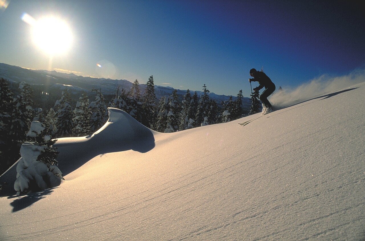
Bear Valley is a downhill ski area in California, United States. Mapped terrain includes easy, intermediate, advanced routes. Its mapped lift network extends from approximately 2018 to 2586 metres above sea level.
Data: OpenSkiData / OpenSkiMap, OpenStreetMap contributors (ODbL), Skimap.org, Who's On First, Mapterhorn.
予報グラフを準備中…
時刻と値は詳細予報と一致します。値をタップするかカーソルを合わせると詳細が表示されます。先の日付を見るには各グラフを横にスクロールしてください。雨・降水量は雪を含む各予報時間帯の水換算量です。降雪量は各時間帯の新雪量であり、積雪深ではありません。
GFSとECMWFのモデル比較です。各モデル固有の予報時刻と予報期間を維持しています。降水量と降雪量はそれぞれの予報時間帯の合計であり、時間帯はモデル間で異なる場合があります。
予報値とモデルに関する注記
Bear Valley - Base lift station
ECMWF · モデル計算時刻: 次回更新予定:
日 時刻(UTC) 気温(°C) 湿度(%) 風速(km/h) 風速(ノット) 風(ビューフォート) 風向 降水量(mm) 降雪量(cm) 気圧(hPa) 0°C高度(m) 天気 | 水曜日, 04/11 06:00 -0.4 94 2 1 1B SE — — 1019 < 2203 Cloudy 68% cloud 09:00 -4.9 91 4 2 1B NE 0 0 1019 < 2203 Overcast 98% cloud 12:00 -7.6 84 7 4 2B NE 0 0 1018 < 2203 Cloudy 56% cloud 15:00 -6.2 85 13 7 3B NE 0 0 1017 3048 Partly cloudy 46% cloud 18:00 8.1 39 6 3 2B NE 0 0 1016 3084 Clear 0% cloud 21:00 9.9 40 6 3 2B W 0 0 1015 3085 Clear 10% cloud 木曜日, 05/11 00:00 6.3 67 4 2 1B W 0 0 1017 3088 Clear 3% cloud 03:00 -0.5 85 5 3 1B NE 0 0 1018 2715 Partly cloudy 47% cloud 06:00 -3.6 87 6 3 2B NE 0 0 1018 2849 Cloudy 51% cloud 09:00 -2.8 86 9 5 2B NE 0 0 1018 2775 Overcast 93% cloud 12:00 -3.7 83 7 4 2B NE 0 0 1018 2826 Partly cloudy 23% cloud 15:00 -4 69 3 1 1B NE 0 0 1019 2895 Clear 2% cloud 18:00 9.4 34 3 1 1B N 0 0 1019 3114 Clear 0% cloud 21:00 11.3 29 5 3 1B N 0 0 1018 3116 Clear 6% cloud 金曜日, 06/11 00:00 7.5 48 6 3 2B NE 0 0 1020 3120 Clear 1% cloud 03:00 1 76 15 8 3B NE 0 0 1021 2202 Partly cloudy 24% cloud 06:00 1.6 63 16 9 3B NE 0 0 1022 3139 Partly cloudy 21% cloud 09:00 -0 67 14 8 3B NE 0 0 1022 2404 Clear 0% cloud 12:00 -1.2 56 11 6 2B NE 0 0 1021 2552 Clear 0% cloud 15:00 -0.9 49 12 7 3B NE 0 0 1022 2504 Clear 11% cloud 18:00 11.4 26 8 4 2B NE 0 0 1023 3161 Clear 5% cloud 21:00 13.4 20 8 4 2B NE 0 0 1020 3155 Cloudy 57% cloud 土曜日, 07/11 00:00 8.9 41 10 6 2B NE 0 0 1021 3154 Overcast 92% cloud 03:00 3.9 57 15 8 3B NE 0 0 1022 3162 Clear 1% cloud 06:00 3.7 55 15 8 3B NE 0 0 1022 3168 Clear 0% cloud 09:00 2.7 57 14 8 3B NE 0 0 1021 3163 Clear 0% cloud 12:00 2.3 55 13 7 3B NE 0 0 1020 3160 Clear 0% cloud 15:00 1.9 55 11 6 2B NE 0 0 1020 3162 Clear 0% cloud 18:00 14.3 25 2 1 1B SW 0 0 1021 3169 Clear 0% cloud 21:00 15.4 28 6 3 2B SW 0 0 1020 3165 Partly cloudy 33% cloud 日曜日, 08/11 00:00 11.1 50 2 1 1B SW 0 0 1021 3162 Partly cloudy 22% cloud 03:00 4.7 63 4 2 1B E 0 0 1021 3165 Overcast 97% cloud 06:00 4 55 2 1 1B E 0 0 1022 3170 Partly cloudy 29% cloud 09:00 5.2 48 1 1 1B E 0 0 1022 3166 Overcast 93% cloud 12:00 4.1 45 2 1 1B E 0 0 1022 3160 Partly cloudy 29% cloud 15:00 2.2 48 4 2 1B NE 0 0 1022 3166 Partly cloudy 37% cloud 18:00 13.7 27 4 2 1B S 0 0 1022 3171 Partly cloudy 20% cloud 21:00 14.7 28 8 5 2B SW 0 0 1021 3163 Clear 4% cloud 月曜日, 09/11 00:00 10.6 50 4 2 1B SW 0 0 1021 3159 Clear 3% cloud 03:00 4.7 57 2 1 1B E 0 0 1022 3159 Clear 14% cloud 06:00 3.4 54 3 2 1B E 0 0 1022 3163 Partly cloudy 31% cloud 09:00 4.7 43 2 1 1B E 0 0 1021 3153 Partly cloudy 37% cloud 12:00 4.7 42 2 1 1B E 0 0 1021 3147 Clear 8% cloud 15:00 3.8 44 2 1 1B E 0 0 1022 3155 Partly cloudy 31% cloud 18:00 13.1 20 6 3 1B S 0 0 1022 3163 Cloudy 62% cloud 21:00 14.2 21 10 6 2B SW 0 0 1021 3156 Partly cloudy 41% cloud 火曜日, 10/11 00:00 9.7 44 5 2 1B SW 0 0 1021 3154 Partly cloudy 43% cloud 03:00 4.3 49 4 2 1B E 0 0 1022 3158 Partly cloudy 45% cloud 06:00 3.3 41 3 1 1B E 0 0 1022 3163 Partly cloudy 40% cloud |
|---|
Forecast notes
Forecast table times: UTC.
Coordinates: 38.5003754°N, -120.0516611°E · Requested elevation: 2018 m. Model terrain: 2200 m. Terrain and 1000/925/850/700 hPa profiles are used for height estimates.
Outside the available profile, temperature uses an estimated 5.5°C/km height correction; wind retains the nearest available model-level value. Humidity is estimated with adjusted pressure and temperature.
These are altitude estimates, not a simulation of local mountain terrain. Precipitation, cloud and sea-level pressure use horizontal interpolation only.
Precipitation includes rain and snow water equivalent: preceding 3 hours through day 6, then 6 hours (see cell tooltip). Snow (cm) estimates fresh snowfall from precipitation and temperature using the GFS conversion; it is not snow depth on the ground. Freezing (m) uses additional 600/500 hPa temperatures when available and estimates the lowest resolved 0°C crossing above sea level. When all sampled levels are warm, the upper profile limit is shown (see tooltip). < marks an entirely cold sampled profile and its lower height limit. No extrapolation is used.
予報グラフを準備中…
時刻と値は詳細予報と一致します。値をタップするかカーソルを合わせると詳細が表示されます。先の日付を見るには各グラフを横にスクロールしてください。雨・降水量は雪を含む各予報時間帯の水換算量です。降雪量は各時間帯の新雪量であり、積雪深ではありません。
GFSとECMWFのモデル比較です。各モデル固有の予報時刻と予報期間を維持しています。降水量と降雪量はそれぞれの予報時間帯の合計であり、時間帯はモデル間で異なる場合があります。
予報値とモデルに関する注記
Bear Valley - Top lift station
ECMWF · モデル計算時刻: 次回更新予定:
日 時刻(UTC) 気温(°C) 湿度(%) 風速(km/h) 風速(ノット) 風(ビューフォート) 風向 降水量(mm) 降雪量(cm) 気圧(hPa) 0°C高度(m) 天気 | 水曜日, 04/11 06:00 -2.4 90 8 4 2B SW — — 1019 < 2179 Cloudy 66% cloud 09:00 -4.8 89 5 3 1B NW 0 0 1019 < 2179 Overcast 95% cloud 12:00 -5.4 63 8 4 2B N 0 0 1018 < 2179 Cloudy 56% cloud 15:00 -3.6 52 13 7 3B NE 0 0 1017 3041 Partly cloudy 44% cloud 18:00 4.8 34 4 2 1B N 0 0 1016 3084 Clear 0% cloud 21:00 5.3 44 5 2 1B W 0 0 1015 3085 Clear 10% cloud 木曜日, 05/11 00:00 3.5 57 5 3 1B W 0 0 1017 3088 Clear 4% cloud 03:00 -0.2 58 6 3 2B N 0 0 1018 2665 Partly cloudy 46% cloud 06:00 -1.6 54 5 3 1B N 0 0 1018 2827 Cloudy 51% cloud 09:00 -1 55 9 5 2B N 0 0 1018 2751 Overcast 93% cloud 12:00 -1.6 65 13 7 3B N 0 0 1018 2807 Partly cloudy 23% cloud 15:00 -1.9 49 9 5 2B NW 0 0 1019 2875 Clear 1% cloud 18:00 5.3 33 13 7 3B N 0 0 1019 3114 Clear 0% cloud 21:00 6.4 33 11 6 2B N 0 0 1018 3116 Clear 6% cloud 金曜日, 06/11 00:00 4.2 42 14 8 3B N 0 0 1019 3120 Clear 1% cloud 03:00 1.8 41 27 14 4B NE 0 0 1021 3126 Partly cloudy 24% cloud 06:00 2.1 37 21 11 4B NE 0 0 1022 3139 Partly cloudy 21% cloud 09:00 1 38 16 9 3B NE 0 0 1022 2379 Clear 0% cloud 12:00 0.4 34 15 8 3B NE 0 0 1021 2523 Clear 0% cloud 15:00 0.7 33 17 9 3B NE 0 0 1022 2470 Clear 12% cloud 18:00 8.4 24 15 8 3B NE 0 0 1022 3161 Clear 5% cloud 21:00 9.6 22 13 7 3B NE 0 0 1020 3155 Cloudy 56% cloud 土曜日, 07/11 00:00 7.5 36 14 8 3B NE 0 0 1021 3154 Overcast 93% cloud 03:00 4.8 44 17 9 3B NE 0 0 1022 3162 Clear 1% cloud 06:00 4.9 43 16 9 3B NE 0 0 1022 3167 Clear 0% cloud 09:00 4.3 44 12 6 2B NE 0 0 1020 3163 Clear 0% cloud 12:00 4 42 10 5 2B NE 0 0 1020 3160 Clear 0% cloud 15:00 3.8 42 8 4 2B NE 0 0 1020 3162 Clear 0% cloud 18:00 10.9 26 2 1 1B SW 0 0 1021 3169 Clear 0% cloud 21:00 11.4 29 7 4 2B SW 0 0 1020 3165 Partly cloudy 32% cloud 日曜日, 08/11 00:00 9 42 6 3 2B SW 0 0 1021 3162 Partly cloudy 22% cloud 03:00 5 47 3 2 1B SW 0 0 1021 3165 Overcast 97% cloud 06:00 4.4 43 8 4 2B SW 0 0 1022 3170 Partly cloudy 28% cloud 09:00 4.9 42 11 6 2B SW 0 0 1022 3166 Overcast 93% cloud 12:00 4.1 41 11 6 2B SW 0 0 1022 3160 Partly cloudy 29% cloud 15:00 3 39 7 4 2B W 0 0 1022 3166 Partly cloudy 37% cloud 18:00 9.8 25 9 5 2B SW 0 0 1022 3171 Partly cloudy 20% cloud 21:00 9.9 31 12 6 2B SW 0 0 1021 3163 Clear 4% cloud 月曜日, 09/11 00:00 7.8 41 12 7 2B SW 0 0 1021 3159 Clear 3% cloud 03:00 4.3 39 8 4 2B SW 0 0 1022 3159 Clear 13% cloud 06:00 3.5 37 8 5 2B SW 0 0 1022 3163 Partly cloudy 29% cloud 09:00 4 31 11 6 2B SW 0 0 1021 3154 Partly cloudy 35% cloud 12:00 3.9 29 12 7 3B SW 0 0 1021 3148 Clear 8% cloud 15:00 3.4 29 12 6 2B W 0 0 1022 3155 Partly cloudy 29% cloud 18:00 9 17 14 8 3B SW 0 0 1022 3163 Cloudy 60% cloud 21:00 9.5 21 16 9 3B SW 0 0 1020 3157 Partly cloudy 41% cloud 火曜日, 10/11 00:00 6.9 33 13 7 3B SW 0 0 1021 3154 Partly cloudy 43% cloud 03:00 3.6 33 9 5 2B SW 0 0 1022 3158 Partly cloudy 46% cloud 06:00 3.2 28 11 6 2B SW 0 0 1022 3163 Partly cloudy 42% cloud |
|---|
Forecast notes
Forecast table times: UTC.
Coordinates: 38.4867386°N, -120.0526434°E · Requested elevation: 2586 m. Model terrain: 2177 m. Terrain and 1000/925/850/700 hPa profiles are used for height estimates.
These are altitude estimates, not a simulation of local mountain terrain. Precipitation, cloud and sea-level pressure use horizontal interpolation only.
Precipitation includes rain and snow water equivalent: preceding 3 hours through day 6, then 6 hours (see cell tooltip). Snow (cm) estimates fresh snowfall from precipitation and temperature using the GFS conversion; it is not snow depth on the ground. Freezing (m) uses additional 600/500 hPa temperatures when available and estimates the lowest resolved 0°C crossing above sea level. When all sampled levels are warm, the upper profile limit is shown (see tooltip). < marks an entirely cold sampled profile and its lower height limit. No extrapolation is used.