Previsioni per le stazioni sciistiche di tutto il mondo

Altro
Legenda dei colori Temperatura · Vento · Pioggia · Neve
Ogni colore inizia dal valore indicato. I colori del vento corrispondono nelle tre unità di misura. Le celle senza precipitazioni restano neutre. I colori descrivono i valori visualizzati, non avvisi meteo ufficiali.
Preparazione dei grafici…
Orari e valori corrispondono alla previsione dettagliata. Tocca un valore o passaci sopra per i dettagli. Scorri orizzontalmente ogni grafico per i giorni successivi. Pioggia / precipitazioni indica l’equivalente totale in acqua per intervallo, inclusa la neve; la nevicata indica la neve fresca per intervallo, non l’altezza del manto nevoso.
Confronto dei modelli GFS ed ECMWF. Ogni modello mantiene i propri orari e il proprio orizzonte di previsione. Le quantità di precipitazioni e neve si riferiscono ai rispettivi intervalli, che possono differire tra i modelli.
Valori previsti e note sul modello
Aspen Mountain - Low lift station
ECMWF · Elaborazione del modello: Prossimo aggiornamento previsto:
Giorno Ora (UTC) Temp. (°C) Umidità (%) Vento (km/h) Vento (nodi) Vento (Bft) Direzione Precip. (mm) Neve (cm) Pressione (hPa) Zero termico (m) Condizioni | Mercoledì, 04/11 06:00 -3.9 69 4 2 1B SE — — 1018 — Clear 4% cloud  09:00 -3.3 64 4 2 1B SE 0 0 1016 — Partly cloudy 26% cloud  12:00 -2.7 62 4 2 1B SE 0 0 1013 — Partly cloudy 44% cloud 15:00 1.9 52 1 1 1B SE 0 0 1013 — Partly cloudy 27% cloud 18:00 9.2 30 2 1 1B W 0 0 1009 — Clear 4% cloud 21:00 8.2 36 5 3 1B W 0.24 0 1007 — Overcast 97% cloud  Giovedì, 05/11 00:00 1.9 75 2 1 1B W 1.0 0 1012 — Overcast 100% cloud 03:00 0.9 83 3 1 1B NW 1.9 0.6 1015 — Overcast 100% cloud 06:00 0.9 82 1 1 1B NW 3.8 1.5 1017 — Overcast 100% cloud 09:00 -0.1 81 0 0 0B — 0.95 0.3 1019 — Overcast 85% cloud 12:00 -2.8 80 3 1 1B E 0.20 0 1021 — Overcast 87% cloud 15:00 -1.1 66 3 1 1B E 0 0 1022 — Partly cloudy 38% cloud 18:00 6.3 40 0 0 0B NW 0 0 1019 — Clear 4% cloud 21:00 8.5 33 1 1 0B W 0 0 1016 — Clear 11% cloud Venerdì, 06/11 00:00 2.3 54 1 1 1B SE 0 0 1018 — Clear 7% cloud 03:00 -2.6 62 6 3 2B SE 0 0 1020 — Cloudy 57% cloud  06:00 -3.3 65 5 3 1B SE 0 0 1022 — Overcast 98% cloud 09:00 -2.9 66 5 2 1B SE 0 0 1022 — Overcast 93% cloud 12:00 -2.8 68 3 2 1B SE 0 0 1023 — Overcast 100% cloud 15:00 1.4 60 2 1 1B SE 0 0 1024 — Overcast 90% cloud 18:00 6.9 39 2 1 1B NW 0.03 0 1023 — Overcast 99% cloud 21:00 7.6 38 4 2 1B NW 0.03 0 1021 — Overcast 91% cloud Sabato, 07/11 00:00 2.8 55 1 0 0B W 0 0 1022 — Partly cloudy 42% cloud 03:00 -2.2 68 3 2 1B SE 0 0 1024 — Clear 0% cloud 06:00 -3.2 70 4 2 1B SE 0 0 1025 — Clear 0% cloud 09:00 -3.8 72 4 2 1B SE 0 0 1025 — Clear 0% cloud 12:00 -4.6 72 4 2 1B E 0 0 1026 — Clear 0% cloud 15:00 -0.1 58 3 2 1B SE 0 0 1027 — Clear 0% cloud 18:00 8.1 32 3 2 1B NW 0 0 1025 — Clear 0% cloud 21:00 9.7 31 4 2 1B NW 0 0 1022 — Clear 1% cloud Domenica, 08/11 00:00 3.2 49 0 0 0B SE 0 0 1024 — Clear 2% cloud 03:00 -1.6 61 4 2 1B SE 0 0 1026 — Cloudy 63% cloud 06:00 -1.6 57 4 2 1B SE 0 0 1026 — Partly cloudy 50% cloud 09:00 -2.5 53 3 2 1B SE 0 0 1026 — Clear 1% cloud 12:00 -2.5 49 4 2 1B SE 0 0 1025 — Clear 0% cloud 15:00 2.6 37 2 1 1B SE 0 0 1026 — Clear 0% cloud 18:00 10.9 18 2 1 1B NW 0 0 1024 — Clear 0% cloud 21:00 11.6 19 4 2 1B NW 0 0 1022 — Clear 0% cloud Lunedì, 09/11 00:00 4.5 37 1 0 0B N 0 0 1024 — Clear 0% cloud 03:00 -0.9 53 4 2 1B SE 0 0 1024 — Clear 0% cloud 06:00 -0.5 47 3 2 1B SE 0 0 1024 — Clear 0% cloud 09:00 -0.8 44 3 2 1B SE 0 0 1025 — Clear 0% cloud 12:00 -1.5 47 4 2 1B SE 0 0 1024 — Clear 0% cloud 15:00 2.8 38 3 1 1B SE 0 0 1024 — Clear 0% cloud 18:00 11.5 20 2 1 1B NW 0 0 1022 — Clear 0% cloud 21:00 12.1 22 5 3 1B NW 0 0 1020 — Clear 0% cloud Martedì, 10/11 00:00 4.9 41 1 0 0B N 0 0 1021 — Clear 0% cloud 03:00 0 55 4 2 1B SE 0 0 1023 — Clear 0% cloud 06:00 -1.1 56 4 2 1B SE 0 0 1023 — Clear 0% cloud |
|---|
Forecast notes
Forecast table times: UTC.
Coordinates: 39.1864051°N, -106.8182053°E · Requested elevation: 2425 m. Model terrain: 2985 m. Terrain and 1000/925/850/700 hPa profiles are used for height estimates.
Outside the available profile, temperature uses an estimated 5.5°C/km height correction; wind retains the nearest available model-level value. Humidity is estimated with adjusted pressure and temperature.
These are altitude estimates, not a simulation of local mountain terrain. Precipitation, cloud and sea-level pressure use horizontal interpolation only.
Precipitation includes rain and snow water equivalent: preceding 3 hours through day 6, then 6 hours (see cell tooltip). Snow (cm) estimates fresh snowfall from precipitation and temperature using the GFS conversion; it is not snow depth on the ground. Freezing (m) uses additional 600/500 hPa temperatures when available and estimates the lowest resolved 0°C crossing above sea level. When all sampled levels are warm, the upper profile limit is shown (see tooltip). < marks an entirely cold sampled profile and its lower height limit. No extrapolation is used.
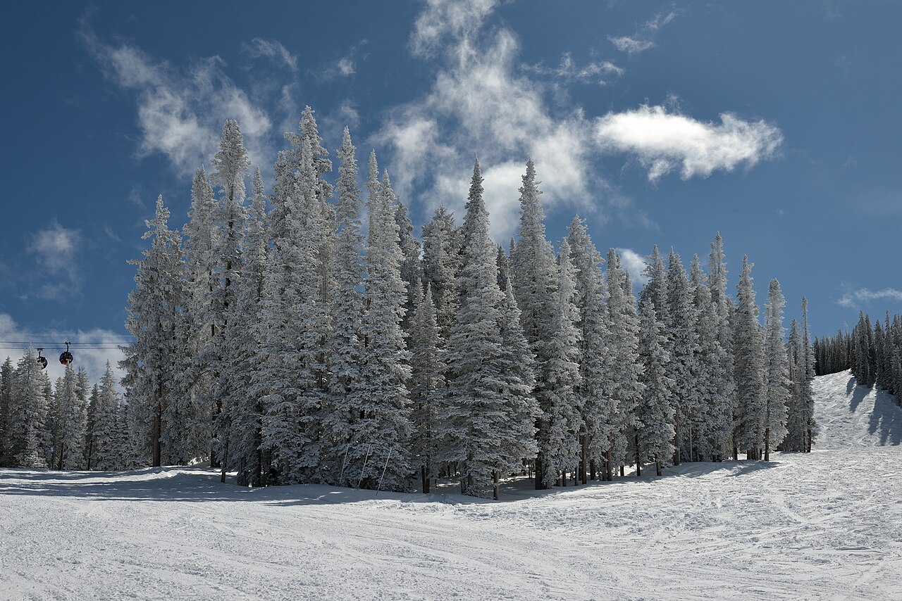
Aspen Mountain, also called Ajax, rises directly above downtown Aspen. The Silver Queen Gondola is its familiar access point. It is one of the four Aspen Snowmass mountains, but its terrain should not be confused with Snowmass or Buttermilk: the operator describes Aspen Mountain as primarily suited to intermediate and experienced skiers, with limited beginner terrain.
That distinction matters more than the shared destination name when choosing a first day. A mixed-ability group should consult the current trail map and lesson options before choosing where to meet. A ticket covering several mountains does not make their learning areas or access arrangements identical.
The default forecast is for a lower point at 2,425 m. Choose a higher station for the upper mountain, then compare the hours you intend to ski. SnowReportMeteo’s centimetres describe forecast fresh snow, while the resort’s snow and grooming report describes conditions on the mountain. Read both: a day without new snowfall can still offer open skiing, and a fresh snowfall does not by itself describe the prepared surface.
Official sources: Aspen Mountain. Reviewed 18 October 2026.
Preparazione dei grafici…
Orari e valori corrispondono alla previsione dettagliata. Tocca un valore o passaci sopra per i dettagli. Scorri orizzontalmente ogni grafico per i giorni successivi. Pioggia / precipitazioni indica l’equivalente totale in acqua per intervallo, inclusa la neve; la nevicata indica la neve fresca per intervallo, non l’altezza del manto nevoso.
Confronto dei modelli GFS ed ECMWF. Ogni modello mantiene i propri orari e il proprio orizzonte di previsione. Le quantità di precipitazioni e neve si riferiscono ai rispettivi intervalli, che possono differire tra i modelli.
Valori previsti e note sul modello
Aspen Mountain - Base lift station
ECMWF · Elaborazione del modello: Prossimo aggiornamento previsto:
Giorno Ora (UTC) Temp. (°C) Umidità (%) Vento (km/h) Vento (nodi) Vento (Bft) Direzione Precip. (mm) Neve (cm) Pressione (hPa) Zero termico (m) Condizioni | Mercoledì, 04/11 06:00 -3.9 69 4 2 1B SE — — 1018 — Clear 4% cloud 09:00 -3.3 64 4 2 1B SE 0 0 1016 — Partly cloudy 26% cloud 12:00 -2.7 62 4 2 1B SE 0 0 1013 — Partly cloudy 44% cloud 15:00 1.9 52 1 1 1B SE 0 0 1013 — Partly cloudy 27% cloud 18:00 9.2 30 2 1 1B W 0 0 1009 — Clear 4% cloud 21:00 8.2 36 5 3 1B W 0.24 0 1007 — Overcast 97% cloud Giovedì, 05/11 00:00 1.9 75 2 1 1B W 1.0 0 1012 — Overcast 100% cloud 03:00 0.9 83 3 1 1B NW 1.9 0.6 1015 — Overcast 100% cloud 06:00 0.9 82 1 1 1B NW 3.8 1.5 1017 — Overcast 100% cloud 09:00 -0.1 81 0 0 0B — 0.95 0.3 1019 — Overcast 85% cloud 12:00 -2.8 80 3 1 1B E 0.20 0 1021 — Overcast 87% cloud 15:00 -1.1 66 3 1 1B E 0 0 1022 — Partly cloudy 38% cloud 18:00 6.3 40 0 0 0B NW 0 0 1019 — Clear 4% cloud 21:00 8.5 33 1 1 0B W 0 0 1016 — Clear 11% cloud Venerdì, 06/11 00:00 2.3 54 1 1 1B SE 0 0 1018 — Clear 7% cloud 03:00 -2.6 62 6 3 2B SE 0 0 1020 — Cloudy 57% cloud 06:00 -3.3 65 5 3 1B SE 0 0 1022 — Overcast 98% cloud 09:00 -2.9 66 5 2 1B SE 0 0 1022 — Overcast 93% cloud 12:00 -2.8 68 3 2 1B SE 0 0 1023 — Overcast 100% cloud 15:00 1.4 60 2 1 1B SE 0 0 1024 — Overcast 90% cloud 18:00 6.9 39 2 1 1B NW 0.03 0 1023 — Overcast 99% cloud 21:00 7.6 38 4 2 1B NW 0.03 0 1021 — Overcast 91% cloud Sabato, 07/11 00:00 2.8 55 1 0 0B W 0 0 1022 — Partly cloudy 42% cloud 03:00 -2.2 68 3 2 1B SE 0 0 1024 — Clear 0% cloud 06:00 -3.2 70 4 2 1B SE 0 0 1025 — Clear 0% cloud 09:00 -3.8 72 4 2 1B SE 0 0 1025 — Clear 0% cloud 12:00 -4.6 72 4 2 1B E 0 0 1026 — Clear 0% cloud 15:00 -0.1 58 3 2 1B SE 0 0 1027 — Clear 0% cloud 18:00 8.1 32 3 2 1B NW 0 0 1025 — Clear 0% cloud 21:00 9.7 31 4 2 1B NW 0 0 1022 — Clear 1% cloud Domenica, 08/11 00:00 3.2 49 0 0 0B SE 0 0 1024 — Clear 2% cloud 03:00 -1.6 61 4 2 1B SE 0 0 1026 — Cloudy 63% cloud 06:00 -1.6 57 4 2 1B SE 0 0 1026 — Partly cloudy 50% cloud 09:00 -2.5 53 3 2 1B SE 0 0 1026 — Clear 1% cloud 12:00 -2.5 49 4 2 1B SE 0 0 1025 — Clear 0% cloud 15:00 2.6 37 2 1 1B SE 0 0 1026 — Clear 0% cloud 18:00 10.9 18 2 1 1B NW 0 0 1024 — Clear 0% cloud 21:00 11.6 19 4 2 1B NW 0 0 1022 — Clear 0% cloud Lunedì, 09/11 00:00 4.5 37 1 0 0B N 0 0 1024 — Clear 0% cloud 03:00 -0.9 53 4 2 1B SE 0 0 1024 — Clear 0% cloud 06:00 -0.5 47 3 2 1B SE 0 0 1024 — Clear 0% cloud 09:00 -0.8 44 3 2 1B SE 0 0 1025 — Clear 0% cloud 12:00 -1.5 47 4 2 1B SE 0 0 1024 — Clear 0% cloud 15:00 2.8 38 3 1 1B SE 0 0 1024 — Clear 0% cloud 18:00 11.5 20 2 1 1B NW 0 0 1022 — Clear 0% cloud 21:00 12.1 22 5 3 1B NW 0 0 1020 — Clear 0% cloud Martedì, 10/11 00:00 4.9 41 1 0 0B N 0 0 1021 — Clear 0% cloud 03:00 0 55 4 2 1B SE 0 0 1023 — Clear 0% cloud 06:00 -1.1 56 4 2 1B SE 0 0 1023 — Clear 0% cloud |
|---|
Forecast notes
Forecast table times: UTC.
Coordinates: 39.1864051°N, -106.8182053°E · Requested elevation: 2425 m. Model terrain: 2985 m. Terrain and 1000/925/850/700 hPa profiles are used for height estimates.
Outside the available profile, temperature uses an estimated 5.5°C/km height correction; wind retains the nearest available model-level value. Humidity is estimated with adjusted pressure and temperature.
These are altitude estimates, not a simulation of local mountain terrain. Precipitation, cloud and sea-level pressure use horizontal interpolation only.
Precipitation includes rain and snow water equivalent: preceding 3 hours through day 6, then 6 hours (see cell tooltip). Snow (cm) estimates fresh snowfall from precipitation and temperature using the GFS conversion; it is not snow depth on the ground. Freezing (m) uses additional 600/500 hPa temperatures when available and estimates the lowest resolved 0°C crossing above sea level. When all sampled levels are warm, the upper profile limit is shown (see tooltip). < marks an entirely cold sampled profile and its lower height limit. No extrapolation is used.
Preparazione dei grafici…
Orari e valori corrispondono alla previsione dettagliata. Tocca un valore o passaci sopra per i dettagli. Scorri orizzontalmente ogni grafico per i giorni successivi. Pioggia / precipitazioni indica l’equivalente totale in acqua per intervallo, inclusa la neve; la nevicata indica la neve fresca per intervallo, non l’altezza del manto nevoso.
Confronto dei modelli GFS ed ECMWF. Ogni modello mantiene i propri orari e il proprio orizzonte di previsione. Le quantità di precipitazioni e neve si riferiscono ai rispettivi intervalli, che possono differire tra i modelli.
Valori previsti e note sul modello
Aspen Mountain - Top lift station
ECMWF · Elaborazione del modello: Prossimo aggiornamento previsto:
Giorno Ora (UTC) Temp. (°C) Umidità (%) Vento (km/h) Vento (nodi) Vento (Bft) Direzione Precip. (mm) Neve (cm) Pressione (hPa) Zero termico (m) Condizioni | Mercoledì, 04/11 06:00 -9.6 89 3 2 1B E — — 1018 — Clear 4% cloud 09:00 -9.1 82 3 2 1B SE 0 0 1016 — Partly cloudy 27% cloud 12:00 -8.4 79 4 2 1B SE 0 0 1013 — Partly cloudy 45% cloud 15:00 -4.2 67 1 1 1B SE 0 0 1013 — Partly cloudy 27% cloud 18:00 3.3 40 2 1 1B SW 0 0 1009 — Clear 4% cloud 21:00 2.3 47 4 2 1B W 0.23 0 1007 — Overcast 96% cloud Giovedì, 05/11 00:00 -3.8 96 2 1 1B W 1.1 1.1 1012 — Overcast 100% cloud 03:00 -4.6 100 3 1 1B NW 1.9 1.9 1015 — Overcast 100% cloud 06:00 -4.7 100 2 1 1B N 3.6 2.8 1017 — Overcast 99% cloud 09:00 -6.1 100 1 0 0B NE 0.88 0.9 1019 — Overcast 83% cloud 12:00 -9.7 100 3 2 1B NE 0.16 0.2 1021 — Overcast 83% cloud 15:00 -7.5 83 3 1 1B E 0 0 1022 — Partly cloudy 37% cloud 18:00 0.6 50 1 0 0B S 0 0 1019 — Clear 3% cloud 21:00 2.7 42 1 0 0B SW 0 0 1016 — Clear 10% cloud Venerdì, 06/11 00:00 -3.5 69 1 1 1B SE 0 0 1019 — Clear 7% cloud 03:00 -8 79 5 3 1B SE 0 0 1021 — Cloudy 59% cloud 06:00 -8.6 81 4 2 1B SE 0 0 1022 — Overcast 98% cloud 09:00 -8.3 83 4 2 1B SE 0 0 1022 — Overcast 95% cloud 12:00 -8 86 3 1 1B SE 0 0 1023 — Overcast 100% cloud 15:00 -4.4 77 1 1 1B E 0 0 1024 — Overcast 92% cloud 18:00 1.1 52 2 1 1B NW 0.05 0 1023 — Overcast 99% cloud 21:00 1.9 50 4 2 1B NW 0.05 0 1021 — Overcast 93% cloud Sabato, 07/11 00:00 -3 72 1 1 0B NW 0 0 1023 — Partly cloudy 43% cloud 03:00 -7.9 88 3 1 1B E 0 0 1024 — Clear 0% cloud 06:00 -8.8 91 3 2 1B E 0 0 1025 — Clear 0% cloud 09:00 -9.5 95 3 2 1B E 0 0 1025 — Clear 0% cloud 12:00 -10.4 94 3 1 1B E 0 0 1026 — Clear 0% cloud 15:00 -6.2 76 2 1 1B E 0 0 1027 — Clear 0% cloud 18:00 2.5 41 3 2 1B NW 0 0 1025 — Clear 0% cloud 21:00 4 39 4 2 1B NW 0 0 1022 — Clear 1% cloud Domenica, 08/11 00:00 -2.6 64 0 0 0B N 0 0 1024 — Clear 2% cloud 03:00 -7.1 76 3 2 1B E 0 0 1026 — Cloudy 62% cloud 06:00 -7 70 3 2 1B SE 0 0 1026 — Partly cloudy 44% cloud 09:00 -7.8 64 3 1 1B SE 0 0 1026 — Clear 1% cloud 12:00 -7.9 59 3 2 1B SE 0 0 1025 — Clear 0% cloud 15:00 -3.2 45 2 1 1B SE 0 0 1026 — Clear 0% cloud 18:00 5.2 25 2 1 1B NW 0 0 1024 — Clear 0% cloud 21:00 5.9 25 4 2 1B NW 0 0 1022 — Clear 0% cloud Lunedì, 09/11 00:00 -1.4 49 1 1 1B N 0 0 1024 — Clear 0% cloud 03:00 -6.4 66 3 2 1B E 0 0 1024 — Clear 0% cloud 06:00 -6 57 3 1 1B SE 0 0 1024 — Clear 0% cloud 09:00 -6.6 55 2 1 1B E 0 0 1024 — Clear 0% cloud 12:00 -7.2 57 3 1 1B E 0 0 1024 — Clear 0% cloud 15:00 -3.1 47 2 1 1B E 0 0 1024 — Clear 0% cloud 18:00 5.8 26 3 1 1B NW 0 0 1022 — Clear 0% cloud 21:00 6.3 29 5 3 1B NW 0 0 1020 — Clear 0% cloud Martedì, 10/11 00:00 -1.1 54 2 1 1B N 0 0 1022 — Clear 0% cloud 03:00 -5.5 69 3 2 1B E 0 0 1023 — Clear 0% cloud 06:00 -6.4 69 3 2 1B SE 0 0 1023 — Clear 0% cloud |
|---|
Forecast notes
Forecast table times: UTC.
Coordinates: 39.1488394°N, -106.817805°E · Requested elevation: 3431 m. Model terrain: 3085 m. Terrain and 1000/925/850/700 hPa profiles are used for height estimates.
Outside the available profile, temperature uses an estimated 5.5°C/km height correction; wind retains the nearest available model-level value. Humidity is estimated with adjusted pressure and temperature.
These are altitude estimates, not a simulation of local mountain terrain. Precipitation, cloud and sea-level pressure use horizontal interpolation only.
Precipitation includes rain and snow water equivalent: preceding 3 hours through day 6, then 6 hours (see cell tooltip). Snow (cm) estimates fresh snowfall from precipitation and temperature using the GFS conversion; it is not snow depth on the ground. Freezing (m) uses additional 600/500 hPa temperatures when available and estimates the lowest resolved 0°C crossing above sea level. When all sampled levels are warm, the upper profile limit is shown (see tooltip). < marks an entirely cold sampled profile and its lower height limit. No extrapolation is used.