Spinale · Madonna di Campiglio · Panorama
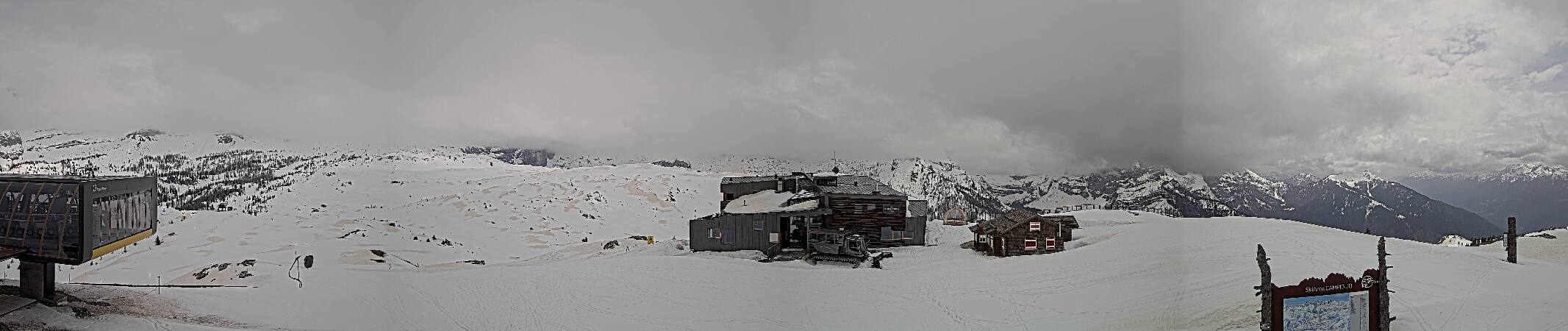
Provider panorama/video player. Capture time is shown by the camera.
Open camera page ↗

Each colour starts at the value shown. Wind colours match across all three units. Dry cells stay neutral. Colours describe the displayed values, not official weather warnings.
Preparing forecast graphs…
Times and values match the detailed forecast. Tap or point at a value for details. Scroll each chart sideways for later days. Rain / precipitation is the total water equivalent per forecast interval, including snow; snowfall is fresh snow per interval, not snow depth.
GFS and ECMWF model comparison. Each model retains its own forecast times and horizon. Precipitation and snowfall amounts cover their own forecast intervals; these can differ between models.
ECMWF · Model run: Next update expected:
Day Time (UTC) Temp. (°C) Humidity (%) Wind (km/h) Wind (knots) Wind (Bft) Direction Precip. (mm) Snow (cm) Pressure (hPa) Freezing (m) Conditions | Friday, 23/10 12:00 5.5 66 3 2 1B SW — — 1019 2294 Partly cloudy 40% cloud  15:00 4.1 88 2 1 1B S 1.1 0 1018 2197 Overcast 100% cloud  18:00 3.1 93 2 1 1B SW 2.6 0 1017 2090 Overcast 100% cloud 21:00 2.9 91 0 0 0B W 0.46 0 1017 2056 Cloudy 55% cloud  Saturday, 24/10 00:00 1.1 92 2 1 1B NW 0.04 0 1016 1727 Cloudy 71% cloud 03:00 -1.5 91 4 2 1B W 0.63 0.2 1017 < 1635 Cloudy 78% cloud 06:00 -2.8 84 4 2 1B W 0.23 0 1017 < 1635 Partly cloudy 48% cloud 09:00 4.2 51 1 1 1B N 0 0 1019 2021 Clear 4% cloud  12:00 5.9 37 1 1 1B NW 0.06 0 1017 2138 Partly cloudy 46% cloud 15:00 4.7 40 1 1 0B N 0.07 0 1018 2064 Clear 12% cloud 18:00 -0.6 59 2 1 1B W 0.01 0 1020 < 1635 Cloudy 68% cloud 21:00 -3.5 70 3 2 1B W 0.01 0 1021 < 1635 Overcast 97% cloud Sunday, 25/10 00:00 -2.6 71 3 2 1B W 0 0 1020 < 1635 Overcast 91% cloud 03:00 -0.6 72 3 2 1B W 0.16 0 1019 < 1635 Overcast 99% cloud 06:00 -0.2 75 2 1 1B SW 0.11 0 1019 < 1635 Overcast 96% cloud 09:00 3.3 68 1 0 0B S 0.04 0 1017 2970 Overcast 96% cloud 12:00 5.5 66 1 1 1B S 0 0 1014 3166 Cloudy 65% cloud 15:00 5.5 72 1 0 0B S 0 0 1012 3120 Overcast 96% cloud 18:00 3.3 81 1 1 1B W 0.11 0 1013 2650 Clear 19% cloud 21:00 -0.3 88 3 2 1B W 0 0 1015 < 1635 Partly cloudy 41% cloud Monday, 26/10 00:00 -2 78 5 2 1B W 0 0 1017 < 1635 Clear 19% cloud 03:00 -2.2 68 4 2 1B W 0 0 1017 < 1635 Clear 13% cloud 06:00 -2.2 56 2 1 1B W 0.01 0 1019 < 1635 Cloudy 70% cloud 09:00 7.1 39 2 1 1B SE 0 0 1020 2705 Cloudy 60% cloud 12:00 9.4 37 3 1 1B SE 0 0 1020 2811 Partly cloudy 28% cloud 15:00 7.7 49 2 1 1B SE 0 0 1020 2879 Cloudy 55% cloud 18:00 2.7 58 1 1 1B W 0 0 1022 2826 Partly cloudy 38% cloud 21:00 2.3 55 1 1 1B W 0 0 1022 3086 Overcast 94% cloud Tuesday, 27/10 00:00 4.4 53 1 1 1B W 0 0 1022 3315 Overcast 91% cloud 03:00 3.8 52 2 1 1B W 0 0 1021 3616 Clear 9% cloud 06:00 2.4 54 2 1 1B W 0 0 1021 3871 Clear 3% cloud 09:00 10.9 41 1 1 1B E 0 0 1022 3939 Clear 0% cloud 12:00 13.5 39 3 2 1B SE 0 0 1021 4037 Clear 0% cloud 15:00 11.5 59 2 1 1B E 0 0 1020 4041 Clear 0% cloud 18:00 5.2 70 1 1 1B W 0 0 1020 3969 Clear 0% cloud 21:00 3.2 69 2 1 1B W 0 0 1020 3886 Clear 15% cloud Wednesday, 28/10 00:00 3 60 2 1 1B W 0 0 1020 3747 Partly cloudy 45% cloud 03:00 3.1 58 2 1 1B W 0 0 1019 3589 Cloudy 70% cloud 06:00 3 60 2 1 1B W 0 0 1021 3454 Cloudy 71% cloud 09:00 11.2 44 2 1 1B NE 0 0 1022 3323 Overcast 88% cloud 12:00 12.6 43 3 2 1B E 0 0 1021 3180 Clear 19% cloud 15:00 11.5 55 2 1 1B E 0 0 1021 3028 Clear 0% cloud 18:00 5.8 67 1 0 0B W 0 0 1023 2784 Clear 5% cloud 21:00 2.1 76 2 1 1B W 0 0 1024 2253 Clear 13% cloud Thursday, 29/10 00:00 0.9 77 2 1 1B W 0 0 1024 1739 Clear 10% cloud 03:00 0.5 75 2 1 1B W 0 0 1024 < 1635 Clear 12% cloud 06:00 0.3 74 2 1 1B W 0 0 1025 < 1635 Partly cloudy 23% cloud 09:00 7.3 62 2 1 1B E 0 0 1025 2578 Clear 18% cloud 12:00 9.5 51 3 2 1B SE 0 0 1023 2652 Partly cloudy 28% cloud 18:00 3.2 78 1 0 0B W 0 0 1024 2290 Partly cloudy 39% cloud Friday, 30/10 00:00 -0.5 77 2 1 1B W 0 0 1024 < 1635 Clear 9% cloud 06:00 -0.5 75 1 1 1B W 0.03 0 1024 < 1635 Clear 10% cloud 12:00 8.9 51 4 2 1B SE 0 0 1020 2704 Cloudy 53% cloud 18:00 2.8 80 1 0 0B SW 0 0 1021 2155 Clear 14% cloud Saturday, 31/10 00:00 -0.2 73 2 1 1B W 0.06 0 1021 < 1635 Cloudy 51% cloud 06:00 0.2 72 2 1 1B W 0.04 0 1019 < 1635 Partly cloudy 39% cloud 12:00 7.6 49 3 2 1B SE 0.14 0 1017 2406 Partly cloudy 36% cloud 18:00 2 78 1 1 1B W 0.39 0 1017 1877 Partly cloudy 45% cloud Sunday, 01/11 00:00 -0.9 84 2 1 1B W 0.39 0.1 1019 < 1635 Cloudy 58% cloud 06:00 -0.3 80 1 1 1B W 0.10 0 1019 < 1635 Overcast 86% cloud 12:00 6.4 60 3 2 1B SE 0.11 0 1018 2435 Overcast 81% cloud 18:00 3 90 1 0 0B SE 0.16 0 1020 2136 Cloudy 79% cloud Monday, 02/11 00:00 2.6 92 0 0 0B NE 0.48 0 1023 2004 Overcast 91% cloud 06:00 2.2 93 0 0 0B SW 1.6 0 1023 1914 Overcast 91% cloud 12:00 4.1 89 1 1 1B SE 1.1 0 1023 2186 Overcast 100% cloud |
|---|
Forecast table times: UTC.
Coordinates: 46.22830303°N, 10.82874298°E · Requested elevation: 1508 m. Model terrain: 1632 m. Terrain and 1000/925/850/700 hPa profiles are used for height estimates.
Outside the available profile, temperature uses an estimated 5.5°C/km height correction; wind retains the nearest available model-level value. Humidity is estimated with adjusted pressure and temperature.
These are altitude estimates, not a simulation of local mountain terrain. Precipitation, cloud and sea-level pressure use horizontal interpolation only.
Precipitation includes rain and snow water equivalent: preceding 3 hours through day 6, then 6 hours (see cell tooltip). Snow (cm) estimates fresh snowfall from precipitation and temperature using the GFS conversion; it is not snow depth on the ground. Freezing (m) uses additional 600/500 hPa temperatures when available and estimates the lowest resolved 0°C crossing above sea level. When all sampled levels are warm, the upper profile limit is shown (see tooltip). < marks an entirely cold sampled profile and its lower height limit. No extrapolation is used.
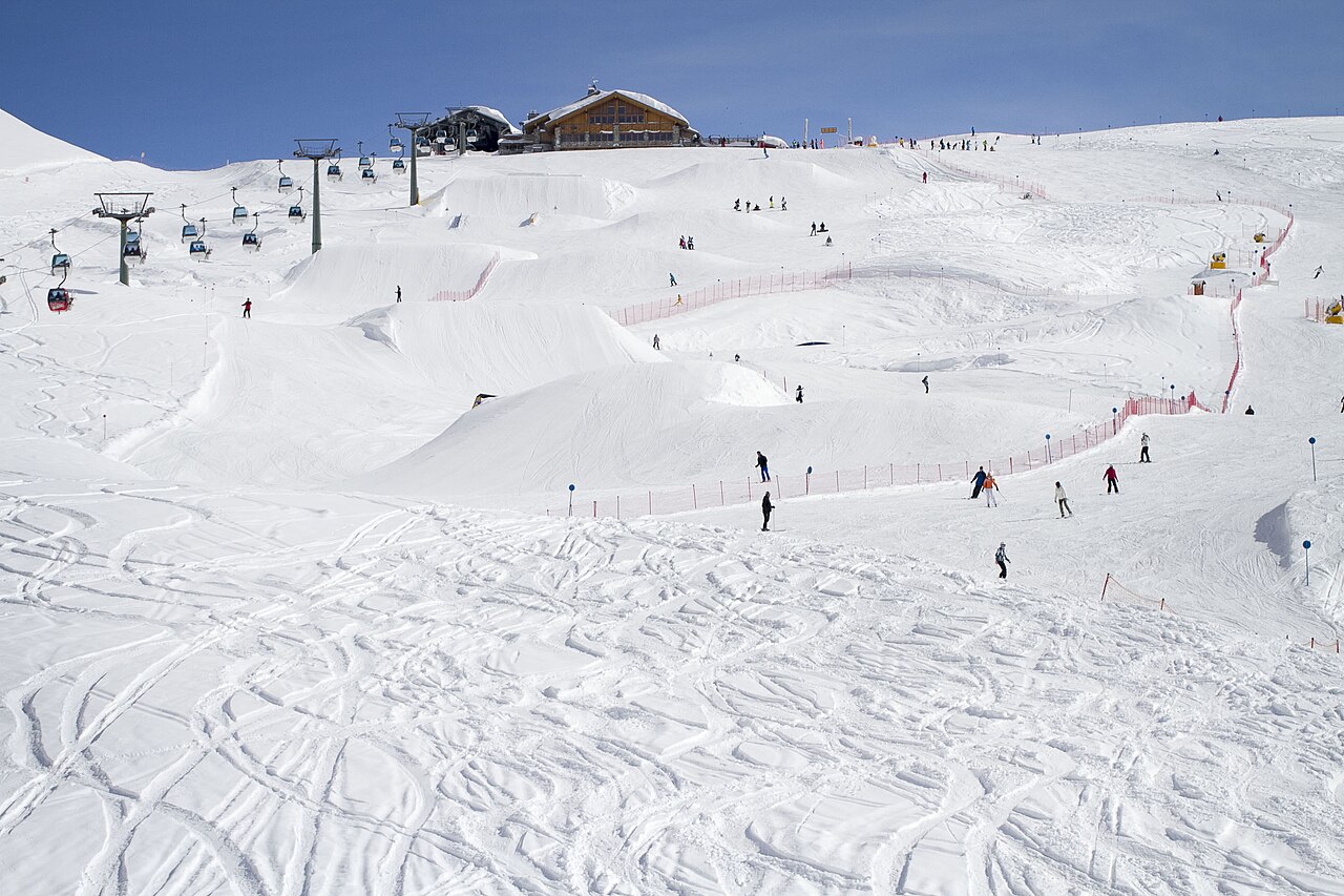
Provider panorama/video player. Capture time is shown by the camera.
Open camera page ↗Preparing forecast graphs…
Times and values match the detailed forecast. Tap or point at a value for details. Scroll each chart sideways for later days. Rain / precipitation is the total water equivalent per forecast interval, including snow; snowfall is fresh snow per interval, not snow depth.
GFS and ECMWF model comparison. Each model retains its own forecast times and horizon. Precipitation and snowfall amounts cover their own forecast intervals; these can differ between models.
ECMWF · Model run: Next update expected:
Day Time (UTC) Temp. (°C) Humidity (%) Wind (km/h) Wind (knots) Wind (Bft) Direction Precip. (mm) Snow (cm) Pressure (hPa) Freezing (m) Conditions | Friday, 23/10 12:00 2.1 74 13 7 3B SW — — 1019 2291 Partly cloudy 42% cloud 15:00 1.2 94 10 5 2B SW 1.0 0 1018 2202 Overcast 100% cloud 18:00 0.5 97 10 5 2B SW 2.5 0.7 1017 2102 Overcast 100% cloud 21:00 0.3 87 7 4 2B W 0.48 0.1 1017 2059 Cloudy 59% cloud Saturday, 24/10 00:00 -1.1 88 5 3 1B NW 0.04 0 1016 1761 Cloudy 73% cloud 03:00 -3.2 89 6 3 2B NW 0.63 0.6 1017 < 1582 Cloudy 77% cloud 06:00 -4.6 76 12 6 2B NW 0.21 0.2 1017 < 1582 Cloudy 50% cloud 09:00 0.1 56 9 5 2B NW 0 0 1019 2011 Clear 5% cloud 12:00 1.3 45 6 3 2B NW 0.07 0 1017 2132 Partly cloudy 46% cloud 15:00 0.6 48 7 4 2B NW 0.08 0 1018 2062 Clear 11% cloud 18:00 -3.2 63 6 3 2B NW 0.02 0 1020 < 1582 Cloudy 68% cloud 21:00 -4.9 70 6 3 2B W 0.01 0 1021 < 1582 Overcast 97% cloud Sunday, 25/10 00:00 -4 71 8 4 2B W 0 0 1020 < 1582 Overcast 92% cloud 03:00 -2 76 8 4 2B W 0.15 0 1019 < 1582 Overcast 99% cloud 06:00 -1 78 8 5 2B NW 0.11 0 1019 < 1582 Overcast 97% cloud 09:00 1.9 68 7 4 2B W 0.04 0 1017 2974 Overcast 96% cloud 12:00 3.7 66 9 5 2B W 0 0 1014 3171 Cloudy 68% cloud 15:00 3.7 74 12 6 2B W 0 0 1012 3129 Overcast 96% cloud 18:00 1.7 83 13 7 3B NW 0.11 0 1013 2657 Partly cloudy 20% cloud 21:00 -1.7 83 13 7 3B NW 0 0 1015 < 1582 Partly cloudy 43% cloud Monday, 26/10 00:00 -2.7 63 18 10 3B NW 0 0 1017 < 1582 Partly cloudy 21% cloud 03:00 -2.3 50 19 10 3B NW 0 0 1017 < 1582 Clear 14% cloud 06:00 -2.3 43 13 7 3B NW 0.01 0 1019 < 1582 Cloudy 70% cloud 09:00 4.1 37 8 4 2B NW 0 0 1020 2697 Cloudy 60% cloud 12:00 5.9 38 7 4 2B NW 0 0 1020 2808 Partly cloudy 28% cloud 15:00 5 47 7 4 2B NW 0 0 1020 2881 Cloudy 55% cloud 18:00 1.6 51 8 4 2B NW 0 0 1022 2856 Partly cloudy 39% cloud 21:00 1.4 55 8 4 2B NW 0 0 1022 3111 Overcast 93% cloud Tuesday, 27/10 00:00 3.1 58 7 4 2B NW 0 0 1022 3317 Overcast 90% cloud 03:00 2.9 60 9 5 2B NW 0 0 1021 3619 Clear 9% cloud 06:00 2.3 55 6 3 2B NW 0 0 1022 3868 Clear 3% cloud 09:00 8.8 40 4 2 1B N 0 0 1022 3939 Clear 0% cloud 12:00 11 37 2 1 1B N 0 0 1021 4035 Clear 0% cloud 15:00 9.6 53 3 2 1B N 0 0 1020 4041 Clear 0% cloud 18:00 5.1 58 4 2 1B NW 0 0 1020 3969 Clear 0% cloud 21:00 3.4 56 4 2 1B NW 0 0 1020 3886 Clear 16% cloud Wednesday, 28/10 00:00 2.9 51 4 2 1B NW 0 0 1020 3748 Partly cloudy 45% cloud 03:00 2.7 50 3 2 1B NW 0 0 1019 3590 Cloudy 70% cloud 06:00 2.4 54 3 2 1B NW 0 0 1021 3453 Cloudy 72% cloud 09:00 8.1 45 1 1 1B N 0 0 1022 3323 Overcast 88% cloud 12:00 9 46 1 0 0B E 0 0 1021 3183 Partly cloudy 21% cloud 15:00 7.9 61 1 1 1B NW 0 0 1021 3028 Clear 0% cloud 18:00 3.6 72 3 2 1B NW 0 0 1023 2792 Clear 5% cloud 21:00 0.8 78 4 2 1B W 0 0 1024 2315 Clear 13% cloud Thursday, 29/10 00:00 -0.3 75 5 3 1B W 0 0 1024 1863 Clear 11% cloud 03:00 -0.7 73 5 3 1B W 0 0 1024 1632 Clear 14% cloud 06:00 -1 73 5 3 1B NW 0 0 1025 < 1582 Partly cloudy 24% cloud 09:00 3.9 65 2 1 1B NW 0 0 1025 2570 Clear 19% cloud 12:00 5.5 58 2 1 1B NW 0 0 1023 2644 Partly cloudy 28% cloud 18:00 1.2 74 5 3 1B NW 0 0 1024 2310 Partly cloudy 39% cloud Friday, 30/10 00:00 -1.4 71 5 3 1B NW 0 0 1024 < 1582 Clear 10% cloud 06:00 -1.3 63 5 3 1B NW 0.03 0 1024 < 1582 Clear 11% cloud 12:00 5.2 52 1 1 1B N 0 0 1021 2699 Cloudy 51% cloud 18:00 0.7 78 4 2 1B NW 0 0 1021 2172 Clear 14% cloud Saturday, 31/10 00:00 -1.7 74 5 3 1B W 0.06 0 1021 < 1582 Cloudy 54% cloud 06:00 -1.7 71 6 3 2B NW 0.05 0 1019 < 1582 Partly cloudy 45% cloud 12:00 3.4 57 3 1 1B NW 0.16 0 1017 2392 Partly cloudy 36% cloud 18:00 -0.6 81 6 3 2B NW 0.37 0.1 1017 1884 Partly cloudy 44% cloud Sunday, 01/11 00:00 -2.8 84 7 4 2B NW 0.37 0.1 1019 < 1582 Cloudy 59% cloud 06:00 -2.2 81 6 3 2B NW 0.11 0 1019 < 1582 Overcast 86% cloud 12:00 3 68 3 2 1B W 0.13 0 1018 2426 Overcast 82% cloud 18:00 0.7 92 2 1 1B W 0.18 0 1020 2143 Cloudy 78% cloud Monday, 02/11 00:00 0 94 2 1 1B SW 0.46 0.1 1023 2006 Overcast 92% cloud 06:00 -0.5 96 5 3 1B SW 1.5 0.5 1023 1915 Overcast 92% cloud 12:00 1.1 94 8 4 2B SW 1.1 0.3 1023 2183 Overcast 100% cloud |
|---|
Forecast table times: UTC.
Coordinates: 46.2245028°N, 10.84299088°E · Requested elevation: 2001 m. Model terrain: 1580 m. Terrain and 1000/925/850/700 hPa profiles are used for height estimates.
These are altitude estimates, not a simulation of local mountain terrain. Precipitation, cloud and sea-level pressure use horizontal interpolation only.
Precipitation includes rain and snow water equivalent: preceding 3 hours through day 6, then 6 hours (see cell tooltip). Snow (cm) estimates fresh snowfall from precipitation and temperature using the GFS conversion; it is not snow depth on the ground. Freezing (m) uses additional 600/500 hPa temperatures when available and estimates the lowest resolved 0°C crossing above sea level. When all sampled levels are warm, the upper profile limit is shown (see tooltip). < marks an entirely cold sampled profile and its lower height limit. No extrapolation is used.
Preparing forecast graphs…
Times and values match the detailed forecast. Tap or point at a value for details. Scroll each chart sideways for later days. Rain / precipitation is the total water equivalent per forecast interval, including snow; snowfall is fresh snow per interval, not snow depth.
GFS and ECMWF model comparison. Each model retains its own forecast times and horizon. Precipitation and snowfall amounts cover their own forecast intervals; these can differ between models.
ECMWF · Model run: Next update expected:
Day Time (UTC) Temp. (°C) Humidity (%) Wind (km/h) Wind (knots) Wind (Bft) Direction Precip. (mm) Snow (cm) Pressure (hPa) Freezing (m) Conditions | Friday, 23/10 12:00 -1.6 83 28 15 4B W — — 1019 2285 Partly cloudy 49% cloud 15:00 -1.7 96 23 13 4B SW 0.96 0.3 1018 2220 Overcast 100% cloud 18:00 -2 96 23 13 4B SW 2.1 0.6 1017 2140 Overcast 100% cloud 21:00 -2.3 72 16 9 3B W 0.56 0.2 1017 2069 Cloudy 73% cloud Saturday, 24/10 00:00 -3.1 76 11 6 2B NW 0.06 0.1 1016 1862 Overcast 80% cloud 03:00 -4.7 80 9 5 2B NW 0.64 0.6 1017 1420 Cloudy 74% cloud 06:00 -6 58 24 13 4B NW 0.13 0.1 1017 < 1382 Cloudy 59% cloud 09:00 -4.5 59 21 11 4B NW 0 0 1019 1979 Clear 9% cloud 12:00 -3.9 58 14 8 3B NW 0.09 0.1 1017 2111 Partly cloudy 47% cloud 15:00 -4.2 57 16 9 3B NW 0.15 0.1 1017 2052 Clear 10% cloud 18:00 -5.8 66 12 6 2B NW 0.05 0 1020 1547 Cloudy 65% cloud 21:00 -5.9 66 11 6 2B W 0.01 0 1020 < 1382 Overcast 95% cloud Sunday, 25/10 00:00 -5 67 15 8 3B W 0 0 1020 < 1382 Overcast 92% cloud 03:00 -2.9 76 16 9 3B W 0.10 0.1 1019 1422 Overcast 99% cloud 06:00 -1.1 79 19 10 3B NW 0.10 0 1019 1569 Overcast 97% cloud 09:00 1 64 18 10 3B W 0.06 0 1018 2988 Overcast 97% cloud 12:00 2.3 62 21 12 4B W 0 0 1014 3192 Cloudy 76% cloud 15:00 2.3 72 28 15 4B W 0 0 1013 3163 Overcast 96% cloud 18:00 0.5 82 28 15 4B NW 0.10 0 1014 2682 Partly cloudy 23% cloud 21:00 -2.7 70 28 15 4B NW 0 0 1015 1467 Partly cloudy 50% cloud Monday, 26/10 00:00 -2.6 39 38 21 5B NW 0 0 1017 < 1382 Partly cloudy 32% cloud 03:00 -1.5 27 41 22 6B NW 0 0 1018 < 1382 Clear 19% cloud 06:00 -1.6 27 30 16 5B NW 0.02 0 1019 < 1382 Cloudy 70% cloud 09:00 0.9 31 21 11 4B NW 0 0 1021 2667 Cloudy 61% cloud 12:00 2 35 20 11 4B NW 0 0 1020 2799 Partly cloudy 30% cloud 15:00 2.2 40 19 10 3B NW 0 0 1020 2888 Cloudy 55% cloud 18:00 1 38 19 10 3B NW 0 0 1022 2928 Partly cloudy 40% cloud 21:00 1.1 54 17 9 3B NW 0 0 1022 3138 Overcast 89% cloud Tuesday, 27/10 00:00 2.2 62 16 9 3B NW 0 0 1022 3324 Overcast 88% cloud 03:00 2.6 67 20 11 3B NW 0 0 1021 3629 Clear 9% cloud 06:00 3.1 54 14 8 3B N 0 0 1022 3854 Clear 3% cloud 09:00 6.8 37 11 6 2B N 0 0 1022 3935 Clear 0% cloud 12:00 8.5 32 9 5 2B NW 0 0 1021 4029 Clear 0% cloud 15:00 7.9 40 9 5 2B NW 0 0 1020 4038 Clear 0% cloud 18:00 5.8 40 8 5 2B NW 0 0 1021 3966 Clear 0% cloud 21:00 4.6 40 8 4 2B NW 0 0 1020 3887 Clear 19% cloud Wednesday, 28/10 00:00 3.7 38 8 5 2B NW 0 0 1020 3750 Partly cloudy 42% cloud 03:00 3.1 40 7 4 2B NW 0 0 1020 3594 Cloudy 68% cloud 06:00 2.5 44 5 3 1B NW 0 0 1021 3452 Cloudy 77% cloud 09:00 4.9 43 2 1 1B N 0 0 1022 3324 Overcast 89% cloud 12:00 5 46 2 1 1B W 0 0 1021 3191 Partly cloudy 29% cloud 15:00 3.9 65 7 4 2B NW 0 0 1021 3028 Clear 0% cloud 18:00 1.5 75 8 4 2B NW 0 0 1022 2816 Clear 5% cloud 21:00 -0.1 78 8 5 2B W 0 0 1023 2461 Clear 13% cloud Thursday, 29/10 00:00 -1 71 9 5 2B W 0 0 1024 2127 Clear 15% cloud 03:00 -1.5 69 10 5 2B W 0 0 1024 1897 Partly cloudy 22% cloud 06:00 -1.8 70 10 6 2B NW 0 0 1025 1834 Partly cloudy 28% cloud 09:00 0.2 67 8 4 2B NW 0 0 1025 2537 Partly cloudy 24% cloud 12:00 0.9 66 9 5 2B NW 0 0 1023 2616 Partly cloudy 27% cloud 18:00 -0.6 65 12 6 2B NW 0 0 1023 2365 Partly cloudy 38% cloud Friday, 30/10 00:00 -1.8 60 9 5 2B NW 0 0 1024 1462 Clear 14% cloud 06:00 -1.4 45 12 7 2B NW 0.03 0 1024 < 1382 Clear 15% cloud 12:00 1.3 46 8 4 2B NW 0 0 1021 2684 Partly cloudy 45% cloud 18:00 -1.2 67 11 6 2B NW 0 0 1021 2225 Clear 12% cloud Saturday, 31/10 00:00 -2.8 71 10 5 2B W 0.06 0 1021 1590 Cloudy 65% cloud 06:00 -3.2 68 13 7 3B NW 0.08 0.1 1020 1654 Cloudy 67% cloud 12:00 -1.3 66 12 6 2B NW 0.21 0 1017 2345 Partly cloudy 37% cloud 18:00 -3.3 80 15 8 3B NW 0.25 0.3 1017 1900 Partly cloudy 40% cloud Sunday, 01/11 00:00 -4.5 78 15 8 3B NW 0.25 0.3 1019 < 1382 Cloudy 66% cloud 06:00 -3.8 78 14 7 3B NW 0.14 0.1 1019 1403 Overcast 83% cloud 12:00 -0.7 76 11 6 2B W 0.18 0 1019 2398 Overcast 83% cloud 18:00 -1.6 88 7 4 2B W 0.26 0.1 1021 2164 Cloudy 75% cloud Monday, 02/11 00:00 -2.6 89 6 3 2B SW 0.34 0.1 1023 2012 Overcast 95% cloud 06:00 -3.1 95 12 6 2B W 1.2 1.2 1023 1915 Overcast 94% cloud 12:00 -2 95 19 10 3B SW 0.83 0.2 1023 2175 Overcast 100% cloud |
|---|
Forecast table times: UTC.
Coordinates: 46.21143751°N, 10.9006691°E · Requested elevation: 2502 m. Model terrain: 1379 m. Terrain and 1000/925/850/700 hPa profiles are used for height estimates.
These are altitude estimates, not a simulation of local mountain terrain. Precipitation, cloud and sea-level pressure use horizontal interpolation only.
Precipitation includes rain and snow water equivalent: preceding 3 hours through day 6, then 6 hours (see cell tooltip). Snow (cm) estimates fresh snowfall from precipitation and temperature using the GFS conversion; it is not snow depth on the ground. Freezing (m) uses additional 600/500 hPa temperatures when available and estimates the lowest resolved 0°C crossing above sea level. When all sampled levels are warm, the upper profile limit is shown (see tooltip). < marks an entirely cold sampled profile and its lower height limit. No extrapolation is used.